Category:Beauly Firth
Jump to navigation
Jump to search
English: The Beauly Firth has several names in Scottish Gaelic including Linne Fharair, Poll an Ròid and Caolas Uisge a' Mhanachainn - the latter being a more literal version of the English.
firth in Highland, Scotland, UK  Kessock Bridge går over fjorden Beauly Firth Foto: Toby Speight | |||||
| Upload media | |||||
| Instance of | |||||
|---|---|---|---|---|---|
| Location | Highland, Scottish Highlands, Scotland | ||||
| Located in or next to body of water | |||||
| Heritage designation | |||||
 | |||||
Media in category "Beauly Firth"
The following 80 files are in this category, out of 80 total.
-
 'New Era' at North Kessock - geograph.org.uk - 3470905.jpg 3,264 × 2,448; 3.93 MB
-
 'New Era' at North Kessock - geograph.org.uk - 3518949.jpg 3,264 × 2,448; 3.35 MB
-
 'New Era' mooring at North Kessock - geograph.org.uk - 3470952.jpg 3,264 × 2,448; 3.77 MB
-

-
 Admiralty Chart No 1451 Firth of Inverness and Beauly Basin, Published 1846.jpg 9,875 × 6,795; 19.58 MB
-
 Alpha - panoramio (7).jpg 4,000 × 3,000; 6.18 MB
-
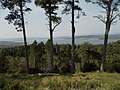
 Approaching sunset, Gallow Hill (geograph 6743482).jpg 1,024 × 576; 103 KB
-
 Beauly Firth - geograph.org.uk - 1018153.jpg 480 × 640; 59 KB
-
 Beauly Firth - geograph.org.uk - 1543560.jpg 640 × 480; 94 KB
-
 Beauly Firth - geograph.org.uk - 1636470.jpg 640 × 480; 68 KB
-
 Beauly Firth - geograph.org.uk - 6412321.jpg 800 × 533; 100 KB
-
 Beauly Firth and A9 - geograph.org.uk - 56574.jpg 640 × 480; 77 KB
-
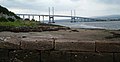
 Beauly Firth and Kessock Bridge - geograph.org.uk - 867887.jpg 640 × 480; 53 KB
-
 Beauly Firth at Charleston - geograph.org.uk - 5865524.jpg 1,024 × 640; 102 KB
-
 Beauly Firth at Milton of Redcastle - geograph.org.uk - 5207762.jpg 1,600 × 900; 342 KB
-
 Beauly Firth at Redcastle - geograph.org.uk - 5207802.jpg 1,600 × 900; 382 KB
-

-
 Beauly Firth at Tarradale - geograph.org.uk - 5555871.jpg 1,600 × 1,201; 681 KB
-
 Beauly Firth from Craig Phadrig - geograph.org.uk - 621252.jpg 640 × 499; 95 KB
-
 Beauly Firth from North Kessock - geograph.org.uk - 979627.jpg 480 × 640; 82 KB
-
 Beauly Firth near Coulmore - geograph.org.uk - 2164745.jpg 640 × 480; 141 KB
-
 Beauly Firth near Inverness - geograph.org.uk - 5015993.jpg 1,024 × 649; 82 KB
-
 Beauly Firth near Phopachy - geograph.org.uk - 1543550.jpg 640 × 480; 83 KB
-
 Beauly Firth on a windy morning - geograph.org.uk - 4404060.jpg 1,400 × 1,052; 266 KB
-
 Beauly Firth shore - geograph.org.uk - 2166993.jpg 1,024 × 768; 328 KB
-
 Beauly Firth shore at North Kessock - geograph.org.uk - 6151742.jpg 1,024 × 768; 210 KB
-
 Beauly Firth shoreline near Lettoch - geograph.org.uk - 6151718.jpg 1,024 × 768; 195 KB
-
 Beauly Firth shoreline, by Torgorm - geograph.org.uk - 4040359.jpg 2,890 × 2,000; 2.14 MB
-
 Beauly Firth Sunset - geograph.org.uk - 1024591.jpg 640 × 480; 43 KB
-
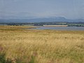
 Beauly Firth towards Ben Wyvis - geograph.org.uk - 952789.jpg 640 × 291; 43 KB
-
 Beauly Firth View - geograph.org.uk - 4403374.jpg 640 × 336; 54 KB
-
 Boat - panoramio (26).jpg 4,000 × 3,000; 2.9 MB
-
 Boathouse - geograph.org.uk - 137528.jpg 640 × 480; 103 KB
-
 Boatshed - geograph.org.uk - 171131.jpg 640 × 480; 64 KB
-
 Clachnaharry Locks - geograph.org.uk - 1344650.jpg 640 × 480; 124 KB
-
 Clachnaharry sea locks, Moray Firth. - geograph.org.uk - 1098229.jpg 426 × 640; 105 KB
-
 Coast - panoramio (11).jpg 3,808 × 2,732; 3.25 MB
-
 Corgrain Point - geograph.org.uk - 137526.jpg 640 × 480; 74 KB
-
 Crannog, Carn Dubh, Beauly Firth - geograph.org.uk - 958387.jpg 640 × 427; 139 KB
-
 Edge of the Beauly Firth - geograph.org.uk - 3474720.jpg 3,000 × 1,854; 1.62 MB
-
 Exposed sand bank, Beauly Firth - geograph.org.uk - 958359.jpg 640 × 427; 123 KB
-
 Farm Track - geograph.org.uk - 171109.jpg 640 × 480; 93 KB
-
 Hay rolls and the Beauly Firth - geograph.org.uk - 1718848.jpg 3,968 × 2,976; 5.98 MB
-
 Inner Moray Firth - geograph.org.uk - 1531359.jpg 640 × 468; 71 KB
-
 Inverness Beauly Firth and Craigphadrig Forest seen from North Kessock Pier viewpoint.jpg 6,000 × 4,000; 13.03 MB
-
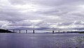 Kessock Bridge and Beauly Firth Inverness Scotland.jpg 2,544 × 1,461; 172 KB
-
 Kessockbridge.jpg 600 × 309; 20 KB
-

-
 Mudflats in the Beauly Firth - geograph.org.uk - 3474661.jpg 3,000 × 2,120; 1.3 MB
-
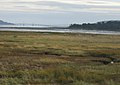
 Mudflats off Redcastle - geograph.org.uk - 3615157.jpg 3,000 × 2,091; 1.4 MB
-
 North Kessock from 'New Era' - geograph.org.uk - 3470915.jpg 3,264 × 2,448; 2.82 MB
-
 North Kessock from the Beauly Firth - geograph.org.uk - 3470920.jpg 3,264 × 2,448; 4.41 MB
-
 North Kessock Pier - geograph.org.uk - 30886.jpg 640 × 441; 75 KB
-
 Northern shore of Beauly Firth at Charleston - geograph.org.uk - 6566974.jpg 1,024 × 768; 98 KB
-
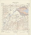
 Ordnance Survey One-Inch Sheet 28 Inverness, Published 1958.jpg 8,236 × 9,883; 9.83 MB
-
 Ordnance Survey One-Inch Sheet 37 Inverness, Published 1947.jpg 12,255 × 9,385; 14.16 MB
-
 Ordnance Survey Sheet NH 54 Beauly, Published 1950.jpg 7,652 × 8,788; 13.73 MB
-
 Ordnance Survey Sheet NH 64 Inverness, Published 1962.jpg 7,612 × 8,798; 15.12 MB
-
 Reflection - panoramio (49).jpg 4,000 × 3,000; 3.8 MB
-
 Road and railway alongside the firth - geograph.org.uk - 2899010.jpg 3,600 × 1,778; 1.81 MB
-
 Road by Beauly Firth - geograph.org.uk - 171127.jpg 640 × 480; 112 KB
-
 Shoreline on Coulmore Bay - geograph.org.uk - 171182.jpg 640 × 480; 90 KB
-
 South Kessock spit. - geograph.org.uk - 815511.jpg 640 × 480; 75 KB
-
 South Kessock's tidal bay - geograph.org.uk - 815571.jpg 640 × 480; 88 KB
-
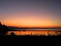
 Sunset over the Beauly Firth - geograph.org.uk - 5001274.jpg 1,024 × 768; 292 KB
-
 Sunset over the Beauly Firth - geograph.org.uk - 5650569.jpg 3,590 × 2,154; 5.31 MB
-
 The Beauly Firth - geograph.org.uk - 1439171.jpg 640 × 480; 56 KB
-
 The Beauly Firth - geograph.org.uk - 2172953.jpg 640 × 480; 38 KB
-
 The Beauly Firth and beyond from Craig Phadraig - geograph.org.uk - 6315608.jpg 1,024 × 768; 208 KB
-
 The Beauly Firth from Craig Phadraig - geograph.org.uk - 6123749.jpg 1,024 × 768; 225 KB
-
 The Beauly Firth from Ord Hill - geograph.org.uk - 6335980.jpg 1,024 × 769; 129 KB
-

-

-
 View towards the Kessock Bridge - geograph.org.uk - 1531339.jpg 640 × 480; 57 KB
-
 Welcome to Inverness. - geograph.org.uk - 253850.jpg 640 × 480; 62 KB
-
 Acharry - geograph.org.uk - 201727.jpg 640 × 480; 109 KB
-
-
-
 South Kessock pier - geograph.org.uk - 124266.jpg 640 × 427; 94 KB
-
 View of the Beauly Firth - geograph.org.uk - 175013.jpg 640 × 480; 73 KB


.jpg)
.jpg)


.jpg)


.jpg)


.jpg)


