Category:Beacon Fell Country Park
Jump to navigation
Jump to search
hill in Lancashire, United Kingdom | |||||
| Upload media | |||||
| Instance of | |||||
|---|---|---|---|---|---|
| Location | Goosnargh, Preston, Lancashire, North West England, England | ||||
| Elevation above sea level |
| ||||
 | |||||
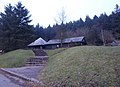
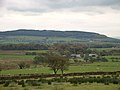
English: Beacon Fell is in the civil parish of Goosnargh in Lancashire, England. It has been a Country Park since 1970. It falls within the Forest of Bowland Area of Outstanding Natural Beauty although it is separated from the other hills in the Forest. Its summit is 266 metres (873 ft) above sea level.
(→Beacon Fell Country Park)
Media in category "Beacon Fell Country Park"
The following 51 files are in this category, out of 51 total.
-
 'Orme Sight' by Thompson Dagnall - geograph.org.uk - 2718178.jpg 480 × 640; 171 KB
-
 A path in Beacon Fell Country Park - geograph.org.uk - 4499425.jpg 4,592 × 3,056; 7.46 MB
-
 Beacon Fell - geograph.org.uk - 4435161.jpg 5,078 × 2,821; 1.77 MB
-
 Beacon Fell 235-35.jpg 1,595 × 663; 343 KB
-
 Beacon Fell Country Park - geograph.org.uk - 21208.jpg 426 × 640; 120 KB
-
 Beacon Fell Country Park - geograph.org.uk - 818723.jpg 600 × 450; 114 KB
-
 Beacon Fell Park looking South - geograph.org.uk - 1298235.jpg 640 × 480; 82 KB
-

-
 Beacon Fell trig point - geograph.org.uk - 3047361.jpg 3,072 × 2,304; 1.08 MB
-
 Beacon Fell View To Parlick - geograph.org.uk - 3294668.jpg 1,600 × 1,200; 846 KB
-
 Beacon Fell Visitor Centre - geograph.org.uk - 1050229.jpg 640 × 480; 61 KB
-
 Beacon Fell Visitor Centre - geograph.org.uk - 2901294.jpg 1,600 × 1,198; 464 KB
-
 Beaconfell.JPG 640 × 480; 54 KB
-
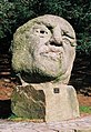
 Black Tiger and Kissing Seat by Thompson Dagnall.jpg 1,091 × 987; 292 KB
-
 Climbing up Beacon Fell - geograph.org.uk - 2718158.jpg 640 × 480; 60 KB
-
 Come and share this bench with me...... - geograph.org.uk - 1050217.jpg 640 × 480; 124 KB
-

-
 England and Scotland 053.jpg 1,024 × 768; 411 KB
-
 England and Scotland 068.jpg 1,024 × 768; 331 KB
-
 England and Scotland 077.jpg 1,024 × 768; 310 KB
-

-
 Footpath round Parlick - geograph.org.uk - 991441.jpg 640 × 444; 101 KB
-
 Grazing Land - geograph.org.uk - 1178751.jpg 640 × 426; 145 KB
-
 Hanging Bat by Thompson Dagnall.jpg 1,232 × 1,840; 673 KB
-
 Longridge Fell and Pendle Hill May 2007 229-34.jpg 1,569 × 321; 162 KB
-
 Nick's Chair - geograph.org.uk - 1081979.jpg 640 × 480; 62 KB
-
 On top of Beacon Fell (266m) - geograph.org.uk - 2719294.jpg 640 × 480; 42 KB
-
 Orme Sight by Thompson Dagnall.jpg 441 × 642; 114 KB
-
 Orme Sight, 2011.jpg 3,000 × 4,000; 3.55 MB
-
 Path in Shield Wood - geograph.org.uk - 478921.jpg 640 × 408; 413 KB
-
 Path, Beacon Fell - geograph.org.uk - 744173.jpg 427 × 640; 113 KB
-
 Pendle Hill above mist 235-0004.jpg 1,801 × 641; 350 KB
-

-
-
 Stile and Footpath North Nook Beacon Fell - geograph.org.uk - 111267.jpg 640 × 480; 107 KB
-
 Summit of Beacon Fell 1985 - geograph.org.uk - 3242113.jpg 846 × 799; 306 KB
-
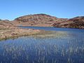
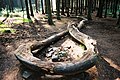
 Tarn at Beacon Fell Country Park 1985 - geograph.org.uk - 3242116.jpg 1,170 × 751; 516 KB
-
 Tarn at Beacon Fell.jpg 425 × 640; 240 KB
-
 The one way road around Beacon Fell Country Park - geograph.org.uk - 4499396.jpg 4,592 × 2,459; 7.74 MB
-
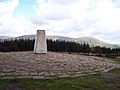 The trig point on Beacon Fell - geograph.org.uk - 2901305.jpg 1,600 × 1,198; 348 KB
-
 Track on Beacon Fell - geograph.org.uk - 3245254.jpg 640 × 425; 337 KB
-
 Visitors centre, Beacon Fell - geograph.org.uk - 3288269.jpg 640 × 462; 138 KB
-
 Walking Snake by Thompson Dagnall.jpg 1,840 × 1,232; 1.07 MB
-
 Wall Building - geograph.org.uk - 1298242.jpg 640 × 480; 118 KB
-
 Beacon Fell - geograph.org.uk - 22715.jpg 640 × 480; 80 KB
-
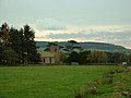
 Brooks Farm, Bleasdale - geograph.org.uk - 72071.jpg 640 × 480; 84 KB
-
 Farmland above the River Brock - geograph.org.uk - 110311.jpg 640 × 480; 74 KB
-
 Lower Rigg, Beacon Fell - geograph.org.uk - 119521.jpg 640 × 426; 162 KB
-
 Small Disused Quarry, Beacon Fell - geograph.org.uk - 111279.jpg 640 × 480; 161 KB
-
 The Trig point, Beacon Fell - geograph.org.uk - 157689.jpg 640 × 480; 64 KB
-


_-_geograph.org.uk_-_2719294.jpg)