Category:Bayersried (Ursberg)
Jump to navigation
Jump to search
human settlement in Germany | |||||
| Upload media | |||||
| Instance of | |||||
|---|---|---|---|---|---|
| Location | Ursberg, Günzburg, Swabia, Bavaria, Germany | ||||
| Elevation above sea level |
| ||||
 | |||||
Media in category "Bayersried (Ursberg)"
The following 7 files are in this category, out of 7 total.
-
 Flug -Rom-Düsseldorf-Hamburg 2013 by-RaBoe 203.jpg 3,666 × 2,436; 1.46 MB
-
 Flug -Rom-Düsseldorf-Hamburg 2013 by-RaBoe 204.jpg 3,666 × 1,690; 1.05 MB
-
 Friedhofstraße 2 Bayersried.jpg 2,273 × 1,705; 569 KB
-
 Stein-Abschnittsbefestigung-Bayersried-2.JPG 5,184 × 3,888; 6.54 MB
-
 Stein-Abschnittsbefestigung-Bayersried.JPG 5,184 × 3,888; 6.51 MB
-
 Ursberg - Bayersried - St-Georg-Str Nr 3 Amtshaus v S.JPG 4,000 × 3,000; 3.57 MB
-
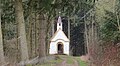 Ursberg westl - Herrgottsruh-Kapelle v NO 01.JPG 3,934 × 2,162; 1.58 MB


