Category:Barrhead
Jump to navigation
Jump to search
town in East Renfrewshire, Scotland, UK  | |||||
| Upload media | |||||
| Instance of |
| ||||
|---|---|---|---|---|---|
| Location |
| ||||
| Population |
| ||||
| Different from | |||||
 | |||||
English: Barrhead ( Scottish Gaelic: Ceann a' Bhàirr) is a town in East Renfrewshire, Scotland. 8 miles southwest of Glasgow on the edge of the Gleniffer Braes. As of the 2001 census its population was 19,813.
Gàidhlig: 'S e baile anns an t- Siorrachd Rinn Friù an Ear a tha ann an Ceann a' Bhàirr (Beurla: Barrhead). Tha e mu 8 mìltean air àirde an iar-dheas Ghlaschu. 'S e seo na co-chomharran aige: 55° 47′ 47.74″ Tuath agus 4° 23′ 10.72″ Iar.
Nederlands: Barrhead ( Schots-Gaelisch: Ceann a' Bhàirr) is een stadje in de Schotse council East Renfrewshire in het historisch graafschap Renfrewshire. Barrhead ligt ongeveer 12 kilometer van Glasgow.
Subcategories
This category has the following 16 subcategories, out of 16 total.
A
B
- Balgray Reservoir (12 F)
- Barrhead Burgh Court Hall (3 F)
- Barrhead railway station (12 F)
- Brownside Braes (7 F)
C
- Cowan Park (3 F)
D
- Dalmeny Park hotel (3 F)
F
H
- Harelaw railway bridge (2 F)
P
- Popeyes, Barrhead (3 F)
S
- Salterland viaduct (3 F)
- Springhill Road, Barrhead (3 F)
W
- Waulkmill Reservoir bridge (10 F)
Media in category "Barrhead"
The following 42 files are in this category, out of 42 total.
-
 Aurs Burn in Barrhead - geograph.org.uk - 245401.jpg 640 × 480; 210 KB
-
 Barrhead Fire Station - geograph.org.uk - 156884.jpg 640 × 480; 136 KB
-
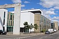
 Barrhead Health & Care Centre, Main Street, Barrhead (geograph 4088799).jpg 5,184 × 3,456; 5.59 MB
-
 Barrhead revisited.jpg 4,032 × 3,024; 5.19 MB
-
 Barrhead Royal Observer Corps Post - geograph.org.uk - 15179.jpg 640 × 480; 112 KB
-
 Barrhead, Liboside and Uplawmoor.svg 1,474 × 1,001; 88 KB
-
 Barrhead.jpg 640 × 480; 73 KB
-
 BarrheadMap1923.jpg 796 × 547; 79 KB
-
-
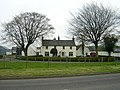 Blackbyres Farm, Barrhead - geograph.org.uk - 156867.jpg 640 × 480; 171 KB
-
 Bourock Parish Church, Barrhead - geograph.org.uk - 92332.jpg 498 × 640; 83 KB
-
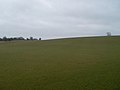
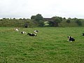
 Cattle at Craigton - geograph.org.uk - 245412.jpg 640 × 480; 200 KB
-
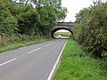
 Country Road Near Langton Bridge - geograph.org.uk - 245415.jpg 480 × 640; 187 KB
-
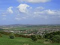
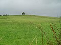
 Countryside south of Barrhead - geograph.org.uk - 1777298.jpg 640 × 480; 55 KB
-
 Cows in field and tunnels - geograph.org.uk - 1439764.jpg 640 × 480; 125 KB
-
 Cross Stubbs Inn - geograph.org.uk - 1439738.jpg 640 × 480; 113 KB
-
 Disused railway viaduct - geograph.org.uk - 685582.jpg 640 × 480; 122 KB
-
 Dyke and Trig Point - geograph.org.uk - 156773.jpg 640 × 480; 99 KB
-
 Fereneze Garden Centre - geograph.org.uk - 215018.jpg 640 × 480; 150 KB
-
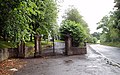 Gates to Neilston Cemetery - geograph.org.uk - 1422442.jpg 640 × 400; 99 KB
-
 Glanderston Mains - geograph.org.uk - 247120.jpg 640 × 480; 200 KB
-
 Grahamston Road housing - geograph.org.uk - 1439749.jpg 640 × 480; 112 KB
-
 Looking to trig point near Harelaw Farm - geograph.org.uk - 1439752.jpg 640 × 480; 125 KB
-
 Map of Renfrewshire Sheet 012, Ordnance Survey, 1863-1864.jpg 10,706 × 7,173; 15.2 MB
-
 Map of Renfrewshire Sheet 012, Ordnance Survey, 1863-1864.tiff 10,706 × 7,173; 219.71 MB
-
 Offices of East Renfrewshire Council, Main Street, Barrhead (geograph 4088792).jpg 5,184 × 3,456; 6.52 MB
-
 Ordnance Survey Sheet NS 55 Thornliebank, Published 1959.jpg 5,584 × 5,922; 13.56 MB
-
 Parkhouse (geograph 5259753).jpg 1,600 × 1,067; 474 KB
-
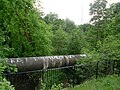 Pipeline over Levern Water - geograph.org.uk - 1319313.jpg 640 × 480; 181 KB
-
 Railway Bridge near Balgray Reservoir (geograph 5172187).jpg 4,000 × 3,000; 3.66 MB
-
 Road side well - geograph.org.uk - 139512.jpg 640 × 480; 106 KB
-
 Road signs on Caplethill Road - geograph.org.uk - 1439736.jpg 640 × 480; 104 KB
-
 Shops along Main Street - geograph.org.uk - 1651695.jpg 640 × 480; 106 KB
-
 Speed Camera Barrhead - geograph.org.uk - 1422529.jpg 640 × 452; 87 KB
-
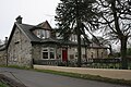
 Springhill Primary School, Barrhead - geograph.org.uk - 1651597.jpg 640 × 480; 108 KB
-
 St John's Catholic Church, Barrhead - geograph.org.uk - 92330.jpg 640 × 480; 111 KB
-
 Sunnyside Place, Barrhead - geograph.org.uk - 1651688.jpg 640 × 480; 100 KB
-
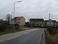
 The outskirts of Barrhead - geograph.org.uk - 1439726.jpg 640 × 480; 103 KB
-
 Tower Block UK photo cl1-09.jpg 2,594 × 1,742; 1.09 MB
-
 Track Leading to South Walton - geograph.org.uk - 247128.jpg 640 × 480; 176 KB
-
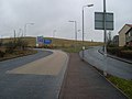
 Welcome to Barrhead - geograph.org.uk - 1777303.jpg 640 × 480; 82 KB
-
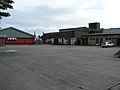 Wrong side of the Shopping Centre - geograph.org.uk - 1518439.jpg 640 × 480; 43 KB


.jpg)


.jpg)

.jpg)

.jpg)


