Category:Barns in Derbyshire
Jump to navigation
Jump to search
Ceremonial counties of England: Bedfordshire · Berkshire · Buckinghamshire · Cambridgeshire · Cheshire · Cornwall · Cumbria · Derbyshire · Devon · Dorset · Durham · East Riding of Yorkshire · East Sussex · Essex · Gloucestershire · Greater London · Greater Manchester · Hampshire · Herefordshire · Hertfordshire · Kent · Lancashire · Leicestershire · Lincolnshire · Merseyside · Norfolk · North Yorkshire · Northamptonshire · Northumberland · Nottinghamshire · Oxfordshire · Rutland · Shropshire · Somerset · South Yorkshire · Staffordshire · Suffolk · Surrey · Warwickshire · West Midlands · West Sussex · West Yorkshire · Wiltshire · Worcestershire
City-counties:
Former historic counties: Westmorland ·
Other former counties:
City-counties:
Former historic counties: Westmorland ·
Other former counties:
Subcategories
This category has the following 3 subcategories, out of 3 total.
G
Media in category "Barns in Derbyshire"
The following 33 files are in this category, out of 33 total.
-
 All fall down? - geograph.org.uk - 289776.jpg 640 × 480; 121 KB
-
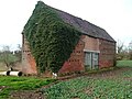
 Barn at Trent Farm, Newton Solney.jpg 1,280 × 960; 379 KB
-
 Barn at Yew Tree Farm - geograph.org.uk - 573237.jpg 640 × 480; 119 KB
-
 Barn in the Derwent Valley - geograph.org.uk - 571840.jpg 640 × 428; 90 KB
-
 Barns above Hope Station - geograph.org.uk - 1485392.jpg 640 × 479; 107 KB
-

-
 Corrugated byre with feeding cattle - geograph.org.uk - 1735652.jpg 640 × 480; 112 KB
-
 Disused barn near Tadsor Farm - geograph.org.uk - 615763.jpg 640 × 446; 125 KB
-
 Empty premises, Stanedge Road, Bakewell - geograph.org.uk - 3404035.jpg 4,608 × 3,072; 6.3 MB
-
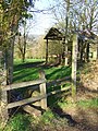 Footpath and Barn - geograph.org.uk - 362654.jpg 480 × 640; 123 KB
-
 Hall Farm - geograph.org.uk - 317052.jpg 640 × 480; 113 KB
-
 Hazlebadge - geograph.org.uk - 88377.jpg 640 × 480; 151 KB
-
 Home Farm - geograph.org.uk - 165252.jpg 640 × 495; 51 KB
-
 Kniveton Haybarn. - geograph.org.uk - 296763.jpg 480 × 640; 112 KB
-
 Ladyhole Farm Barn. - geograph.org.uk - 298236.jpg 640 × 480; 116 KB
-
 Mount Pleasant barn - geograph.org.uk - 368698.jpg 640 × 481; 153 KB
-
 Old Barn Behind Hedge - geograph.org.uk - 897883.jpg 640 × 427; 238 KB
-
 Old Barn Shardlow.JPG 3,872 × 2,592; 2.05 MB
-
 Old outbuilding at Weston Grange - geograph.org.uk - 575127.jpg 640 × 482; 136 KB
-
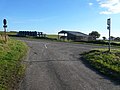
 Turning to Ambaston at Thulston - geograph.org.uk - 1703265.jpg 640 × 480; 80 KB
-
 View from Carlton Houses footpath - geograph.org.uk - 299442.jpg 640 × 480; 88 KB
-
 Westhouses - Old Barn - geograph.org.uk - 669237.jpg 640 × 480; 133 KB
-
 Barns at Summer Cross - geograph.org.uk - 88448.jpg 640 × 480; 113 KB
-
 Cattle Barn - geograph.org.uk - 363207.jpg 640 × 360; 105 KB
-
 Cows in barn at Bladon Farm - geograph.org.uk - 397623.jpg 640 × 481; 86 KB
-
 Derelict Barn next to Swiss Barn - geograph.org.uk - 736531.jpg 640 × 480; 100 KB
-
 Dewy Lane - View of Barn - geograph.org.uk - 570052.jpg 640 × 480; 111 KB
-
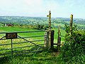
 Footpath View - Farm Buildings at Lea - geograph.org.uk - 735462.jpg 640 × 480; 74 KB
-
 High Rake - geograph.org.uk - 88374.jpg 640 × 480; 144 KB
-

-
 Slack Lane View of Barn - geograph.org.uk - 575175.jpg 640 × 480; 108 KB
-
 Stone and Timber Barn - geograph.org.uk - 460850.jpg 640 × 360; 83 KB
-
 Woodhay Baulk Barn - geograph.org.uk - 439116.jpg 640 × 480; 105 KB


