Category:Barnburgh
Jump to navigation
Jump to search
English: Barnburgh is a village and civil parish in the Metropolitan Borough of Doncaster in South Yorkshire, England. The village is adjacent to the village of Harlington - the parish contains both villages, and according to the 2001 census it had a population of 1,979. The village is located west of Doncaster itself. The local pub is the Coach & Horses on the High Street.
Nederlands: Barnburgh is een dorp (village) en civil parish in het bestuurlijke gebied Doncaster, in het Engelse graafschap South Yorkshire. De civil parish telt
village in South Yorkshire, England, UK  | |||||
| Upload media | |||||
| Instance of | |||||
|---|---|---|---|---|---|
| Location | Doncaster, South Yorkshire, Yorkshire and the Humber, England | ||||
| Population |
| ||||
 | |||||
Subcategories
This category has the following 4 subcategories, out of 4 total.
B
- St Peter's Church, Barnburgh (10 F)
C
- Coach and Horses, Barnburgh (5 F)
H
- Barnburgh Hall Dovecote (2 F)
- Harlington, South Yorkshire (15 F)
Media in category "Barnburgh"
The following 174 files are in this category, out of 174 total.
-
 A tree-lined limestone footpath - geograph.org.uk - 116897.jpg 640 × 480; 195 KB
-
 A Welcome Sight. - geograph.org.uk - 2397093.jpg 3,264 × 2,448; 1.47 MB
-
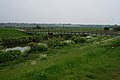
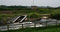
 Adwick Bridge over the River Dearne - geograph.org.uk - 4006655.jpg 1,600 × 1,064; 565 KB
-
 Adwick Bridges - geograph.org.uk - 3205552.jpg 2,048 × 1,536; 550 KB
-
 Along Barnburgh Cliff - geograph.org.uk - 2397067.jpg 3,264 × 2,448; 1.93 MB
-
 Approaching summit of Hangman Stone Road - geograph.org.uk - 6553748.jpg 3,648 × 1,744; 1.66 MB
-
 Barnburgh - farm buildings to NE of village hall - geograph.org.uk - 4202003.jpg 1,600 × 1,196; 486 KB
-
 Barnburgh - front of Church Hall - geograph.org.uk - 4202015.jpg 1,600 × 1,193; 387 KB
-
 Barnburgh - house on Hall Street - geograph.org.uk - 4202006.jpg 1,600 × 1,200; 609 KB
-
 Barnburgh - Plane Tree Farm House - geograph.org.uk - 4202012.jpg 1,600 × 1,198; 605 KB
-
 Barnburgh - St Peter's Church - chancel windows - geograph.org.uk - 4201994.jpg 1,600 × 1,246; 571 KB
-
 Barnburgh - St Peter's Church - east-facing windows - geograph.org.uk - 4201981.jpg 1,600 × 1,175; 571 KB
-
 Barnburgh - St Peter's Church - from SE - geograph.org.uk - 4201986.jpg 1,600 × 1,218; 438 KB
-
 Barnburgh - St Peter's Church - from SW - geograph.org.uk - 4201714.jpg 1,206 × 1,600; 420 KB
-
 Barnburgh - St Peter's Church - N side - from N - geograph.org.uk - 4201784.jpg 1,600 × 1,219; 563 KB
-
 Barnburgh - St Peter's Church - N side - from NW - geograph.org.uk - 4201782.jpg 1,200 × 1,600; 562 KB
-
 Barnburgh - St Peter's Church - porch - geograph.org.uk - 4202000.jpg 1,600 × 1,201; 556 KB
-
 Barnburgh - St Peter's Church - porch from W - geograph.org.uk - 4167785.jpg 1,600 × 1,185; 615 KB
-
 Barnburgh - St Peter's Church - tower - from NW - geograph.org.uk - 4201776.jpg 1,169 × 1,600; 446 KB
-
 Barnburgh - St Peter's Church - tower - from SE - geograph.org.uk - 4201997.jpg 1,158 × 1,600; 395 KB
-
 Barnburgh and Harlington play area - geograph.org.uk - 1654517.jpg 640 × 480; 45 KB
-
 Barnburgh Church - geograph.org.uk - 2372821.jpg 640 × 480; 45 KB
-
 Barnburgh Church from RSPB Adwick Washlands - geograph.org.uk - 2930129.jpg 1,024 × 762; 165 KB
-
 Barnburgh Cliff - geograph.org.uk - 6553739.jpg 3,648 × 1,744; 2.92 MB
-
 Barnburgh Hall Outhouse - geograph.org.uk - 1730667.jpg 1,280 × 959; 445 KB
-
 Barnburgh High Street - geograph.org.uk - 4863758.jpg 1,024 × 768; 130 KB
-
 Barnburgh Lane - geograph.org.uk - 4741698.jpg 4,608 × 3,456; 3.66 MB
-
 Barnburgh pinfold - geograph.org.uk - 1654483.jpg 480 × 640; 90 KB
-
 Barnburgh Pinfold on Hickleton Road - geograph.org.uk - 2991490.jpg 640 × 427; 97 KB
-
 Barnburgh to the left, Hickleton to the right - geograph.org.uk - 4862256.jpg 1,024 × 768; 362 KB
-
 Barnburgh Village Centre - geograph.org.uk - 4741597.jpg 4,608 × 3,456; 3.55 MB
-
 Barnburgh village green - geograph.org.uk - 1730671.jpg 1,280 × 959; 484 KB
-
 Barnburgh village pump - geograph.org.uk - 1730655.jpg 959 × 1,280; 741 KB
-
 Barnburgh village viewed from NE - geograph.org.uk - 131723.jpg 640 × 480; 98 KB
-
 Barns in Barnburgh - geograph.org.uk - 4863749.jpg 1,024 × 768; 189 KB
-
 Bridleway along Barnburgh Cliff - geograph.org.uk - 4863706.jpg 1,024 × 768; 360 KB
-
 Bridleway and Bales - geograph.org.uk - 197473.jpg 640 × 480; 91 KB
-
 Bridleway near Barnburgh Cliff - geograph.org.uk - 3204254.jpg 2,048 × 1,536; 736 KB
-
 Bridleway to Barnburgh Cliff - geograph.org.uk - 4862260.jpg 1,024 × 768; 199 KB
-
 Bridleway to Barnburgh from Hangman Stone Lane - geograph.org.uk - 2647907.jpg 1,024 × 660; 124 KB
-
 Bridleway towards Barnburgh Cliff - geograph.org.uk - 3204204.jpg 2,048 × 1,536; 577 KB
-
 Bridleway towards Hangman Stone Road - geograph.org.uk - 2616224.jpg 1,600 × 1,200; 277 KB
-
 Bridleway, Barnburgh Cliff - geograph.org.uk - 4862249.jpg 1,024 × 768; 350 KB
-
 Church of St Peter - geograph.org.uk - 6547442.jpg 640 × 480; 82 KB
-
 Church of St. Peter, Barnburgh - geograph.org.uk - 4863767.jpg 1,024 × 768; 147 KB
-
 Church Walk - geograph.org.uk - 926475.jpg 427 × 640; 84 KB
-
 Coach and Horses, Barnburgh - geograph.org.uk - 6553483.jpg 3,648 × 1,744; 1.84 MB
-
 Copse and Site of Chapel - geograph.org.uk - 4741629.jpg 4,608 × 3,456; 3.69 MB
-
 Copse containing the remains of St Helen's Chapel - geograph.org.uk - 2991557.jpg 4,608 × 3,072; 3.32 MB
-
 Course of the former Dearne Valley Railway - geograph.org.uk - 4862646.jpg 1,024 × 768; 203 KB
-
 Crown Inn - geograph.org.uk - 2387885.jpg 3,264 × 2,448; 1.54 MB
-
 Crown Inn, near Barnburgh - geograph.org.uk - 6552613.jpg 3,648 × 1,744; 982 KB
-
 Damaged kissing gate to River Dearne at Barnburgh, South Yorkshire.jpg 640 × 422; 125 KB
-
 Doncaster Road in Harlington - geograph.org.uk - 4741593.jpg 4,608 × 3,456; 3.43 MB
-
 Doncaster Road leaving Barnburgh - geograph.org.uk - 5762593.jpg 4,000 × 3,000; 3.35 MB
-
 Doncaster Road, Harlington - geograph.org.uk - 5835755.jpg 1,600 × 1,065; 502 KB
-
 Entering Barnburgh on Doncaster Road - geograph.org.uk - 2616217.jpg 1,600 × 1,200; 543 KB
-
 Entry to Barnburgh Fishing Lakes - geograph.org.uk - 6552617.jpg 3,648 × 1,744; 1.41 MB
-
 Evidence of St Helen's Chapel's existence - geograph.org.uk - 2991555.jpg 4,608 × 3,072; 3.45 MB
-
 Ex Miners cottages. (geograph 5301478).jpg 640 × 480; 78 KB
-
 Farm Building east of Harlington - geograph.org.uk - 2388001.jpg 3,264 × 2,448; 1.4 MB
-
 Farm Track west of Barnburgh Grange - geograph.org.uk - 2387900.jpg 3,264 × 2,448; 1.75 MB
-
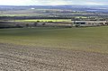
 Farmland and woodland near Barnburgh - geograph.org.uk - 2616229.jpg 1,600 × 1,200; 573 KB
-
 Farmland off St Helen's Lane - geograph.org.uk - 2616205.jpg 1,600 × 1,200; 241 KB
-
 Farmland, Sheep Walks - geograph.org.uk - 2616227.jpg 1,600 × 1,200; 465 KB
-
 Field above Stables Wood - geograph.org.uk - 6553732.jpg 3,648 × 1,744; 2.74 MB
-
 Fields near Barnburgh - geograph.org.uk - 4741603.jpg 4,608 × 3,456; 3.63 MB
-
 Fishing in the River Dearne - geograph.org.uk - 2689620.jpg 1,024 × 768; 280 KB
-
 Footbridge over the Dearne south of Harlington - geograph.org.uk - 2991547.jpg 4,608 × 3,072; 3.26 MB
-
 Footbridge over the River Dearne - geograph.org.uk - 4006574.jpg 1,600 × 1,064; 615 KB
-
 Footbridge over the River Dearne at Mill Lane - geograph.org.uk - 5836065.jpg 1,600 × 1,065; 505 KB
-
 Footpath along Barnburgh Cliff - geograph.org.uk - 4993342.jpg 640 × 480; 126 KB
-
 Footpath to Church Lane - geograph.org.uk - 4862633.jpg 1,024 × 768; 228 KB
-
 Former quarry - geograph.org.uk - 4862231.jpg 1,024 × 768; 375 KB
-
 Former rail line near Barnburgh - geograph.org.uk - 5835671.jpg 1,600 × 1,065; 900 KB
-
 Green Farmhouse - geograph.org.uk - 1730654.jpg 1,280 × 959; 493 KB
-
 Half barrier at the end of St. Helen's Lane - geograph.org.uk - 4862218.jpg 1,024 × 768; 317 KB
-
 Hall Street - geograph.org.uk - 1730669.jpg 1,280 × 959; 319 KB
-
 Hall Street - geograph.org.uk - 1730670.jpg 1,280 × 959; 334 KB
-
 Harlington - barn at road junction - geograph.org.uk - 4201697.jpg 1,600 × 1,200; 547 KB
-
 Harlington village sign east of the settlement - geograph.org.uk - 2991548.jpg 4,298 × 3,070; 3.2 MB
-
 Heavily eroded stonework - geograph.org.uk - 4863757.jpg 1,024 × 768; 180 KB
-
 Hickleton Road - geograph.org.uk - 1730661.jpg 1,280 × 959; 331 KB
-
 Hickleton Road in Barnburgh - geograph.org.uk - 4741600.jpg 3,456 × 4,608; 3.59 MB
-
 Horses at North Ings - geograph.org.uk - 5092921.jpg 4,608 × 3,456; 4.42 MB
-
 Junction of paths near Thunder Hole Spring - geograph.org.uk - 2991496.jpg 4,608 × 3,072; 3.4 MB
-
 Junction of paths north west of Stables Wood - geograph.org.uk - 2991502.jpg 3,070 × 4,298; 3.16 MB
-

-
 Looking west over the Dearne Valley - geograph.org.uk - 3223167.jpg 4,320 × 2,432; 165 KB
-
 Ludwell Hill - geograph.org.uk - 929506.jpg 640 × 427; 69 KB
-
 Manor Farm, Harlington - geograph.org.uk - 5835751.jpg 1,600 × 1,065; 447 KB
-
 Manor Farm, Harlington - geograph.org.uk - 6354368.jpg 1,600 × 1,200; 417 KB
-
 Melton View - geograph.org.uk - 1730659.jpg 1,280 × 959; 341 KB
-
 Mill Lane towards Harlington - geograph.org.uk - 3205538.jpg 2,048 × 1,536; 534 KB
-
 North End Drive, Doncaster Road, Harlington - geograph.org.uk - 5835722.jpg 1,600 × 1,065; 439 KB
-
 North Ings in the Dearne Valley - geograph.org.uk - 2991545.jpg 4,298 × 3,070; 3.11 MB
-
 Old quarry - geograph.org.uk - 4862209.jpg 1,024 × 768; 332 KB
-
 Ordnance Survey Cut Mark - geograph.org.uk - 5763092.jpg 4,000 × 3,000; 5.33 MB
-
 Path at Barnburgh Cliff - geograph.org.uk - 4741652.jpg 4,608 × 3,456; 3.45 MB
-
 Path by the churchyard - geograph.org.uk - 4862279.jpg 1,024 × 768; 289 KB
-
 Pea Field and Barnburgh Cliff - geograph.org.uk - 2397073.jpg 3,264 × 2,448; 2.11 MB
-
 Pennine sunset - geograph.org.uk - 2647908.jpg 1,024 × 768; 58 KB
-
 Pinfold, Barnburgh - geograph.org.uk - 6553487.jpg 3,648 × 1,744; 2.97 MB
-
 Plane Tree Farm - geograph.org.uk - 1730657.jpg 1,280 × 864; 335 KB
-
 Prospect of Barnburgh - geograph.org.uk - 6552648.jpg 3,286 × 1,729; 1.25 MB
-
 Public footpath off Hangman Stone Road - geograph.org.uk - 3231794.jpg 4,320 × 2,432; 390 KB
-
 Pulley across the River Dearne - geograph.org.uk - 4006649.jpg 1,600 × 1,064; 547 KB
-
 Pulley system over the River Dearne - geograph.org.uk - 2689146.jpg 1,024 × 770; 150 KB
-
 Quarry face, Barnburgh Cliff - geograph.org.uk - 4863700.jpg 1,024 × 768; 358 KB
-
 Railway cutting east of Goldthorpe - geograph.org.uk - 507642.jpg 640 × 480; 123 KB
-
 Rape Field at Barnburgh Grange - geograph.org.uk - 2387918.jpg 3,264 × 2,448; 1.98 MB
-
 Remains of cottages, Stables Wood - geograph.org.uk - 4862247.jpg 1,024 × 768; 395 KB
-
 River Dearne at Mill Lane - geograph.org.uk - 5836067.jpg 1,600 × 1,065; 501 KB
-
 Rock carving on Barnburgh Cliff - geograph.org.uk - 6546472.jpg 480 × 640; 127 KB
-
 Rock Face - geograph.org.uk - 2509926.jpg 360 × 480; 63 KB
-
 Section of Barnburgh Cliffs - geograph.org.uk - 2991518.jpg 4,608 × 3,072; 3.28 MB
-
 Site of St. Helen's Chapel - geograph.org.uk - 4741637.jpg 4,608 × 3,456; 3.51 MB
-
 Small pond alongside the River Dearne - geograph.org.uk - 4006590.jpg 1,600 × 1,064; 861 KB
-
 Smoke towards High Melton - geograph.org.uk - 3072059.jpg 640 × 480; 42 KB
-
 Splash of colour in Barnburgh - geograph.org.uk - 6552633.jpg 3,648 × 1,744; 2.33 MB
-
 St Helen's Lane (bridleway) - geograph.org.uk - 2616204.jpg 1,600 × 1,200; 534 KB
-
 St Helen's Lane - geograph.org.uk - 2397080.jpg 3,264 × 2,448; 2.3 MB
-
 St Helen's Lane - geograph.org.uk - 2397084.jpg 3,264 × 2,448; 2.18 MB
-
 St Helen's Lane - geograph.org.uk - 2870830.jpg 1,024 × 768; 163 KB
-
 St Helen's Lane - geograph.org.uk - 6354375.jpg 1,600 × 1,200; 658 KB
-
 St Helen's Lane - leading down to "The Crown Inn" - geograph.org.uk - 2991549.jpg 2,908 × 4,362; 3.19 MB
-
 St Helens lane. - geograph.org.uk - 4830118.jpg 640 × 480; 63 KB
-

-

-

-

-

-
 St Peter's Church, Barnburgh - geograph.org.uk - 2616221.jpg 1,600 × 1,200; 329 KB
-
 St Peter's parish church, Barnburgh - geograph.org.uk - 6552646.jpg 3,234 × 1,730; 1.21 MB
-
 St. Helen's Lane - geograph.org.uk - 4862132.jpg 1,024 × 768; 187 KB
-
 St. Helen's Lane - geograph.org.uk - 4862146.jpg 1,024 × 768; 198 KB
-
 St. Helen's Lane - geograph.org.uk - 4863725.jpg 1,024 × 768; 140 KB
-
 St. Helen's Lane - geograph.org.uk - 4863731.jpg 1,024 × 768; 269 KB
-
 St. Helen's Lane near Barnburgh - geograph.org.uk - 4741607.jpg 4,252 × 3,164; 2.95 MB
-
 St.Peter's Church, Barnburgh, Doncaster - geograph.org.uk - 3033951.jpg 1,024 × 768; 159 KB
-
 Stables Lane - geograph.org.uk - 4741687.jpg 4,608 × 3,456; 3.93 MB
-
 Stables Lane - geograph.org.uk - 4862266.jpg 1,024 × 768; 207 KB
-
 Stables Lane - geograph.org.uk - 6553580.jpg 1,744 × 3,648; 2.64 MB
-
 Team Lotto competing in Le Tour De Yorkshire - geograph.org.uk - 4929683.jpg 1,024 × 874; 310 KB
-
 The beginning of St. Helen's Lane - geograph.org.uk - 4863717.jpg 1,024 × 768; 242 KB
-
 The Church of St Peter in Barnburgh - geograph.org.uk - 5762587.jpg 4,000 × 3,000; 2.67 MB
-
 The Crown Inn - geograph.org.uk - 2616214.jpg 1,600 × 1,046; 246 KB
-
 The Crown Inn near Barnburgh - geograph.org.uk - 6354372.jpg 1,600 × 1,200; 469 KB
-
 The Harlington Inn, Harlington - geograph.org.uk - 5835725.jpg 1,600 × 1,065; 481 KB
-
 The Harlington Inn, Harlington - geograph.org.uk - 5835729.jpg 1,600 × 1,534; 450 KB
-
 The Marr Wind Farm - geograph.org.uk - 6547427.jpg 640 × 480; 77 KB
-
 The site of St. Helen's chapel - geograph.org.uk - 4862004.jpg 1,024 × 768; 223 KB
-
 The Trans Pennine Trail at Harlington - geograph.org.uk - 2689619.jpg 1,024 × 768; 191 KB
-
 The Trans Pennine Trail at Owler Carr - geograph.org.uk - 5092910.jpg 4,608 × 3,456; 4.45 MB
-
 Track in Bella Wood - geograph.org.uk - 6354383.jpg 1,600 × 1,200; 965 KB
-
 Track through Bella Wood - geograph.org.uk - 1802113.jpg 480 × 640; 102 KB
-
 Trans Pennine Trail at Mill Lane - geograph.org.uk - 4006579.jpg 1,600 × 1,064; 773 KB
-
 Trans Pennine Trail at Owler Carr - geograph.org.uk - 4006566.jpg 1,600 × 1,064; 516 KB
-

-
 View from Hangman Stone Road - geograph.org.uk - 1730649.jpg 1,280 × 848; 459 KB
-
 View from Hangman Stone Road - geograph.org.uk - 1730650.jpg 1,280 × 959; 639 KB
-
 View from Stables lane - geograph.org.uk - 1654485.jpg 640 × 480; 57 KB
-
 View Over Barnburgh - geograph.org.uk - 4741668.jpg 4,419 × 3,307; 3.51 MB
-
 View over fields to Barnburgh Grange - geograph.org.uk - 6547218.jpg 640 × 480; 73 KB
-
 View Towards Barnburgh - geograph.org.uk - 4741644.jpg 4,608 × 3,456; 3.69 MB
-
 View towards Barnburgh - geograph.org.uk - 4862628.jpg 1,024 × 768; 148 KB
-
 View towards buildings on Ludwell Hill - geograph.org.uk - 4863723.jpg 1,024 × 768; 166 KB
-
 View towards Doncaster Road (Harlington) - geograph.org.uk - 4863761.jpg 1,024 × 768; 139 KB
-
 View towards Melton Warren - geograph.org.uk - 4863721.jpg 1,024 × 768; 128 KB
-
 Village pump - geograph.org.uk - 926504.jpg 427 × 640; 143 KB
-
 Weir on the River Dearne - geograph.org.uk - 4006614.jpg 1,600 × 852; 621 KB
-
 Wind turbines on Barnburgh Cliff - geograph.org.uk - 3231798.jpg 4,320 × 2,432; 115 KB
-
 Woodland on Barnburgh Cliff - geograph.org.uk - 6546468.jpg 640 × 480; 143 KB
-
 The Pinfold, Barnburgh - geograph.org.uk - 621828.jpg 640 × 480; 120 KB


.jpg)


_-_geograph.org.uk_-_2616204.jpg)


_-_geograph.org.uk_-_4663092.jpg)
_-_geograph.org.uk_-_4663099.jpg)
_-_geograph.org.uk_-_4663102.jpg)
_-_geograph.org.uk_-_4663104.jpg)


_-_geograph.org.uk_-_4863761.jpg)


