Category:Baramulla district
Jump to navigation
Jump to search
district of Jammu and Kashmir, India | |||||
| Upload media | |||||
| Instance of | |||||
|---|---|---|---|---|---|
| Location |
| ||||
| Capital | |||||
| Population |
| ||||
| Area |
| ||||
| official website | |||||
 | |||||
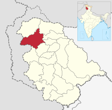
Baramulla is a district in the state of Jammu and Kashmir, India. It is divided into 8 tehsils:
Subcategories
This category has the following 12 subcategories, out of 12 total.
B
D
- Datta Temple, Bandi Uri (3 F)
G
S
- Sangrama (1 F)
V
- Vishnu temple, Buniyar (4 F)
W
- Wular Lake (23 F)
Media in category "Baramulla district"
The following 25 files are in this category, out of 25 total.
-
Baramulla District.svg 2,160 × 1,696; 146 KB
-
Baramulla map.png 668 × 532; 39 KB
-
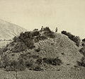
Buddhist tope baramula1868.jpg 755 × 702; 346 KB
-
Government Primary School Pethgam Wagoora.jpg 1,920 × 1,080; 615 KB
-
Govt pry school pathgam Wagoora.jpg 1,920 × 1,080; 562 KB
-
Hamre railway station.jpg 4,608 × 3,456; 3.98 MB
-
Harwan sopore.jpg 1,920 × 1,080; 305 KB
-
Hathlangoo jamia Masjid.jpg 2,340 × 4,160; 3.57 MB
-
Hathlangoo view.jpg 4,160 × 2,340; 3.05 MB
-
Hc Danger.jpg 4,160 × 2,340; 5.09 MB
-
Heritage Ruins.jpg 2,048 × 1,536; 392 KB
-
High school of seeloo- 2013-11-18 04-20.jpg 105 × 207; 4 KB
-
Houses in Doabgah village of Indian Administered Kashmir.jpg 1,836 × 3,264; 1.47 MB
-
Hundred.jpg 4,160 × 2,340; 3.55 MB
-
Hybrid Poplar.jpg 4,160 × 2,340; 2.81 MB
-
IMG 20171115 161730 nnwnn.jpg 4,160 × 2,340; 4.76 MB
-
Jamia masjid sopore.jpg 3,024 × 3,044; 2.87 MB
-
Jammu and Kashmir Baramulla district.svg 836 × 641; 164 KB
-
Purni Suder Shah View From Mazhom Railway Station Side.jpg 3,120 × 4,160; 1.87 MB
-
SHAGOO NIWAS HOME.jpg 2,592 × 1,456; 1.36 MB
-
Snow Fall in Purni Suder Shah .jpg 4,160 × 3,120; 2.88 MB
-
Sugandhesa Temple.jpg 800 × 613; 311 KB
-
Uri houses.JPG 2,592 × 1,944; 1.78 MB
-
Uri Old.JPG 2,592 × 1,944; 2.38 MB
-
Zaingair.jpg 3,840 × 2,160; 2.1 MB


