Category:Bar Hill, Cambridgeshire
Jump to navigation
Jump to search
English: Bar Hill is a purpose-built village with a population of 4,000 about 4 miles (7 km) northwest of Cambridge, England on the A14 road.
Nederlands: Bar Hill is een dorp (village en civil parish) in het Engelse graafschap Cambridgeshire. Het dorp ligt in het district South Cambridgeshire en telt ca. 4000 inwoners.
Norsk bokmål: Bar Hill er en planlagt landsby i Cambridgeshire. Den ble bestemt opprettet på slutten av 1950-årene for å lette på boligmangelen i South Cambridgeshire. De første innbyggerne flyttet inn i 1967.
Simple English: Bar Hill is a village that can be found about 4 miles (7 km) northwest of Cambridge, England. About 4,000 people live in Bar Hill.
village and civil parish in South Cambridgeshire, England, UK  | |||||
| Upload media | |||||
| Instance of | |||||
|---|---|---|---|---|---|
| Location | South Cambridgeshire, Cambridgeshire, East of England, England | ||||
| Population |
| ||||
| official website | |||||
 | |||||
Subcategories
This category has the following 3 subcategories, out of 3 total.
Media in category "Bar Hill, Cambridgeshire"
The following 132 files are in this category, out of 132 total.
-
 A14 at Bar Hill - geograph.org.uk - 4735430.jpg 2,560 × 1,920; 973 KB
-
 A14 at Bar Hill - geograph.org.uk - 4735432.jpg 2,560 × 1,920; 1.37 MB
-
 A14 junction, Bar Hill - geograph.org.uk - 4737395.jpg 2,560 × 1,920; 1.72 MB
-
 A14 near Bar Hill - geograph.org.uk - 3462479.jpg 1,542 × 897; 674 KB
-
 A14 road and farmland, Oakington, Cambs - geograph.org.uk - 89368.jpg 640 × 480; 293 KB
-
 A14 westbound - geograph.org.uk - 5464023.jpg 640 × 480; 38 KB
-
 Adder Technology, Bar Hill - geograph.org.uk - 4735368.jpg 2,560 × 1,920; 1.59 MB
-
 Allotments, Bar Hill - geograph.org.uk - 6524178.jpg 1,024 × 683; 245 KB
-
 Appletrees, Bar Hill - geograph.org.uk - 6471322.jpg 1,024 × 618; 170 KB
-
 ASD metal services - geograph.org.uk - 4600553.jpg 2,560 × 1,920; 1.38 MB
-
 B1050 Bridge, A14 - geograph.org.uk - 4811585.jpg 640 × 390; 33 KB
-
 B1050 crossing the A14 - geograph.org.uk - 4735424.jpg 2,560 × 1,920; 1.56 MB
-
 B1050 crossing the A14 - geograph.org.uk - 4735478.jpg 2,560 × 1,920; 1.17 MB
-
 B1050 entering Bar Hill - geograph.org.uk - 4735420.jpg 2,560 × 1,920; 1.48 MB
-
 B1050 leaving Bar Hill - geograph.org.uk - 4735411.jpg 2,560 × 1,920; 967 KB
-
 B1050 turn off from A14 eastbound - geograph.org.uk - 2072658.jpg 640 × 480; 52 KB
-
 Bar Hill - Residential Area (Street Sign).JPG 2,558 × 1,872; 1.49 MB
-
 Bar Hill from end of footpath from Dry Drayton - geograph.org.uk - 6471947.jpg 1,024 × 683; 302 KB
-
 Bar Hill junction, A14 - geograph.org.uk - 6671426.jpg 1,600 × 1,067; 385 KB
-
 Bar Hill Library and Post Office - geograph.org.uk - 666698.jpg 640 × 426; 55 KB
-
 Bar Hill Library.JPG 1,600 × 1,195; 459 KB
-
 Bar Hill Nature Reserve - geograph.org.uk - 2213846.jpg 1,024 × 633; 309 KB
-
 Bar Hill Nature Reserve - geograph.org.uk - 2298970.jpg 1,024 × 768; 411 KB
-
 Bar Hill Nature Reserve - geograph.org.uk - 2459799.jpg 1,400 × 1,019; 1.09 MB
-
 Bar Hill Nature Reserve - geograph.org.uk - 6739537.jpg 1,600 × 1,067; 606 KB
-
 Bar Hill skate park - geograph.org.uk - 1043241.jpg 640 × 480; 88 KB
-

-
 Bar Hill village from the Dry Drayton footpath - geograph.org.uk - 6439273.jpg 1,024 × 683; 219 KB
-
 Bar Hill Village Polling Station 2013.JPG 2,448 × 3,264; 1.87 MB
-
 Bar Hill Youth Centre - geograph.org.uk - 1074882.jpg 480 × 640; 108 KB
-
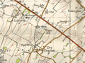 Bar hill, npe 1948.png 642 × 477; 620 KB
-
 Bridleway bridge over the A14 at Bar Hill - geograph.org.uk - 6642011.jpg 1,024 × 720; 160 KB
-
 Car and trolley park at Bar Hill - geograph.org.uk - 5680060.jpg 3,264 × 2,448; 4.02 MB
-
 Car park at Bar Hill - geograph.org.uk - 5680012.jpg 3,264 × 2,448; 3.96 MB
-
 Car wash at Bar Hill - geograph.org.uk - 5680033.jpg 3,264 × 2,448; 2.71 MB
-
 Carpet ^ Flooring, Trafalgar Way - geograph.org.uk - 4600560.jpg 2,560 × 1,920; 1.24 MB
-
 Chestnut Rise, Bar Hill - geograph.org.uk - 6637463.jpg 1,024 × 683; 181 KB
-
 Children's playground, Bar Hill - geograph.org.uk - 6497448.jpg 1,024 × 683; 202 KB
-
 Click and Collect at Bar Hill - geograph.org.uk - 5680028.jpg 3,264 × 2,448; 3.69 MB
-
 Cllr Bunty Waters, Bar Hill Parish Councillor.JPG 1,924 × 2,856; 1.53 MB
-
 Closed petrol station by A14 - geograph.org.uk - 6695973.jpg 1,600 × 1,216; 614 KB
-
 Cmglee Bar Hill Tesco Extra.jpg 2,048 × 1,024; 256 KB
-
 Cmglee Bar Hill village hall.jpg 2,048 × 1,024; 384 KB
-
 Crafts Way, Bar Hill - geograph.org.uk - 4600518.jpg 2,560 × 1,920; 1.43 MB
-
 Crafts Way, Bar Hill - geograph.org.uk - 4737409.jpg 2,560 × 1,920; 1.47 MB
-
 Crafts Way, Bar Hill - geograph.org.uk - 6471328.jpg 1,024 × 683; 190 KB
-
 Crafts Way, Bar Hill, Cambs - geograph.org.uk - 89336.jpg 640 × 480; 333 KB
-
 CTD tile showroom, Bar Hill - geograph.org.uk - 4600547.jpg 2,560 × 1,920; 1.43 MB
-
 Cycle rack at Bar Hill - geograph.org.uk - 5680020.jpg 3,264 × 2,448; 2.84 MB
-
 DHL Worldwide Express, Bar Hill - geograph.org.uk - 1043511.jpg 640 × 480; 61 KB
-
 Domino Printing Sciences, Bar Hill - geograph.org.uk - 1043516.jpg 640 × 480; 62 KB
-
 Domino, Bar Hill - geograph.org.uk - 4735369.jpg 2,560 × 1,920; 1.47 MB
-
 Field View ^ Crafts Way junction, Bar Hill - geograph.org.uk - 6471943.jpg 1,024 × 683; 129 KB
-
 Field View, Bar Hill (1) - geograph.org.uk - 6807851.jpg 1,024 × 683; 176 KB
-
 Field View, Bar Hill (2) - geograph.org.uk - 6807863.jpg 1,024 × 683; 177 KB
-
 Field View, Bar Hill (3) - geograph.org.uk - 6807875.jpg 1,024 × 683; 162 KB
-

-
 Firstan, Bar Hill - geograph.org.uk - 1043520.jpg 640 × 480; 66 KB
-
 Ford Escort MkIV 5 d Bar Hill.jpg 2,476 × 1,486; 793 KB
-
 Foxhollow, Bar Hill - geograph.org.uk - 4737424.jpg 2,560 × 1,920; 1.48 MB
-
 Foxhollow, Bar Hill - geograph.org.uk - 4737430.jpg 2,560 × 1,920; 1.09 MB
-
 Foxhollow, Bar Hill - geograph.org.uk - 4737435.jpg 2,560 × 1,920; 1.39 MB
-
 Grassy pathway, Bar Hill - geograph.org.uk - 6471317.jpg 1,024 × 683; 193 KB
-
 Hillcrest, Bar Hill - geograph.org.uk - 6471311.jpg 1,024 × 662; 136 KB
-
 Industrial building, Bar Hill - geograph.org.uk - 4735352.jpg 2,560 × 1,913; 1.22 MB
-
 Industrial unit to let - geograph.org.uk - 4600564.jpg 2,560 × 1,920; 1.48 MB
-

-

-
 Little Meadow, Bar Hill - geograph.org.uk - 6496330.jpg 1,024 × 683; 189 KB
-
 Little Meadow, Bar Hill - geograph.org.uk - 6739583.jpg 1,600 × 1,067; 494 KB
-
 Looking north from A14 - geograph.org.uk - 5464016.jpg 640 × 480; 57 KB
-
 Menzies Cambridge Hotel and Golf Club - geograph.org.uk - 4737384.jpg 2,560 × 1,920; 1.87 MB
-
 Menzies Cambridge Hotel and Golf Club - geograph.org.uk - 4737403.jpg 2,560 × 1,920; 1.26 MB
-
 Menzies Cambridge Hotel and Golf Club - geograph.org.uk - 4737406.jpg 2,560 × 1,920; 1.42 MB
-
 Modified sign, Bar Hill - geograph.org.uk - 4735403.jpg 2,560 × 1,974; 1.21 MB
-
 Motel off A14 at B1050 junction - geograph.org.uk - 2079408.jpg 640 × 480; 81 KB
-
 Multi Faith Church Bar Hill - geograph.org.uk - 1075291.jpg 640 × 480; 68 KB
-
 Munro House, Trafalgar Way - geograph.org.uk - 4600563.jpg 2,560 × 1,920; 1.14 MB
-
 Not Bar Hill Skate Park - geograph.org.uk - 4600534.jpg 2,560 × 1,920; 1.65 MB
-
 Not So Busy Roundabout Bar Hill - geograph.org.uk - 1074871.jpg 640 × 480; 85 KB
-
 Offices, Trafalgar Way - geograph.org.uk - 4600571.jpg 2,560 × 1,920; 1.49 MB
-
 Petrol Station, Bar Hill - geograph.org.uk - 5680017.jpg 3,264 × 2,448; 3.9 MB
-
 Pheasant Rise, Bar Hill - geograph.org.uk - 1043530.jpg 640 × 480; 62 KB
-
 Pheasant Rise, Bar Hill - geograph.org.uk - 6524184.jpg 1,024 × 683; 155 KB
-
 Pheasant Rise, Bar Hill - geograph.org.uk - 6739580.jpg 1,600 × 1,058; 405 KB
-
 Pheasant Rise, Bar Hill - geograph.org.uk - 6739590.jpg 1,600 × 1,067; 369 KB
-
 Roadworks adjacent A14 - geograph.org.uk - 5875047.jpg 640 × 480; 43 KB
-
 Roundabout, Bar Hill - geograph.org.uk - 4735378.jpg 2,560 × 1,920; 1.16 MB
-
 Roundabout, Bar Hill - geograph.org.uk - 4735406.jpg 2,560 × 1,920; 1.06 MB
-
 Saxon Way, Bar Hill - geograph.org.uk - 4735360.jpg 2,560 × 1,787; 1.09 MB
-
 Services on A14 - geograph.org.uk - 2641682.jpg 640 × 428; 95 KB
-
 Shopping Centre at Bar Hill - geograph.org.uk - 5679180.jpg 3,264 × 2,448; 3.79 MB
-
 Shops by Tesco, Bar Hill - geograph.org.uk - 3230402.jpg 1,600 × 1,200; 630 KB
-
 Signs of the times^ - geograph.org.uk - 1043504.jpg 640 × 480; 106 KB
-
 Small offices, Bar Hill - geograph.org.uk - 4737388.jpg 2,560 × 1,982; 1.4 MB
-
 Stonefield, Bar Hill - geograph.org.uk - 6524180.jpg 1,024 × 683; 154 KB
-
 Superstore and car park - geograph.org.uk - 5680065.jpg 3,264 × 2,448; 3.88 MB
-
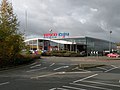
 Tesco Extra Bar Hill - geograph.org.uk - 4180867.jpg 1,280 × 851; 348 KB
-
 Tesco extra, Bar Hill - geograph.org.uk - 1043245.jpg 640 × 480; 68 KB
-
 Tesco Extra, Bar Hill - geograph.org.uk - 2789404.jpg 640 × 427; 59 KB
-
 Tesco Filling Station, Bar Hill - geograph.org.uk - 3867089.jpg 4,000 × 1,973; 3.13 MB
-
 The centre of the village, Bar Hill - geograph.org.uk - 6497597.jpg 1,024 × 683; 187 KB
-

-

-
 The Ecumenical Church, Bar Hill - geograph.org.uk - 6497569.jpg 1,024 × 711; 143 KB
-
 The Health Centre, Bar Hill - geograph.org.uk - 6638040.jpg 1,024 × 683; 217 KB
-
 The Links trading estate, Bar Hill, Cambs - geograph.org.uk - 90045.jpg 640 × 480; 276 KB
-
 The Parish Council offices, Bar Hill - geograph.org.uk - 6497584.jpg 1,024 × 683; 164 KB
-
 The Post Office ^ Library, Bar Hill - geograph.org.uk - 6497498.jpg 1,024 × 696; 146 KB
-
 The Spinney, Bar Hill - geograph.org.uk - 6471937.jpg 1,024 × 683; 161 KB
-
 The Sports Field ^ Pavilion, Bar Hill - geograph.org.uk - 6497430.jpg 1,024 × 683; 224 KB
-
 The Sports Field ^ Pavilion, Bar Hill - geograph.org.uk - 6497436.jpg 1,024 × 683; 139 KB
-
 The Village Hall ^ Sports Centre, Bar Hill - geograph.org.uk - 6496305.jpg 1,024 × 700; 137 KB
-

-
 Total Service Station near Bar Hill - geograph.org.uk - 1043261.jpg 640 × 480; 77 KB
-
 Trafalgar Way, Bar Hill - geograph.org.uk - 2789402.jpg 640 × 427; 56 KB
-
 Trafalgar Way, Bar Hill - geograph.org.uk - 4735374.jpg 2,560 × 1,920; 1.11 MB
-

-
 Village Hall Bar Hill - geograph.org.uk - 1075300.jpg 640 × 480; 53 KB
-
 Water Feature Bar Hill Golf Club - geograph.org.uk - 1074879.jpg 640 × 480; 105 KB
-
 Watermead, Bar Hill - geograph.org.uk - 6471304.jpg 1,024 × 683; 150 KB
-
 Wet day at Bar Hill - geograph.org.uk - 3867055.jpg 3,954 × 2,164; 4.18 MB
-
 Yodel distribution centre, Bar Hill - geograph.org.uk - 4600540.jpg 2,560 × 1,920; 1.64 MB
-
 Youth Centre Bar Hill - geograph.org.uk - 1074886.jpg 640 × 480; 86 KB
-
 A14 approaching bridge to Oakington - geograph.org.uk - 1043216.jpg 640 × 480; 53 KB
-
 A14 looking NW at Bar Hill - geograph.org.uk - 1043255.jpg 640 × 480; 66 KB
-
 A14 looking SE at Bar Hill - geograph.org.uk - 1043266.jpg 640 × 480; 71 KB
-

-
 Communications mast, Longstanton, Cambs - geograph.org.uk - 177115.jpg 640 × 480; 252 KB
-

-

-
 Saxon Way, Bar Hill, Cambs - geograph.org.uk - 89328.jpg 640 × 480; 276 KB


.JPG)


_Village_Sign_-_Clean_Background.png)


_-_geograph.org.uk_-_6807851.jpg)
_-_geograph.org.uk_-_6807863.jpg)
_-_geograph.org.uk_-_6807875.jpg)


