Category:Baker River, Washington State
Jump to navigation
Jump to search
river in Washington  Údolí řeky ze severovýchodu.  | |||||
| Upload media | |||||
| Instance of | |||||
|---|---|---|---|---|---|
| Located in protected area | |||||
| Location | Washington, Pacific Northwest, Washington, Pacific States Region | ||||
| Length |
| ||||
| Mouth of the watercourse | |||||
| Drainage basin |
| ||||
| Tributary |
| ||||
 | |||||
Subcategories
This category has only the following subcategory.
Media in category "Baker River, Washington State"
The following 19 files are in this category, out of 19 total.
-
 Baker River Map.jpg 632 × 542; 213 KB
-

-
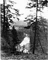
 Baker River Trail.jpg 3,072 × 2,304; 1.34 MB
-
-
 BakerRiverMap.jpg 689 × 607; 180 KB
-
 BakerRiverWashington.jpg 362 × 246; 32 KB
-
 Bakerwamap-01.png 2,831 × 2,415; 1.98 MB
-

-
-

-
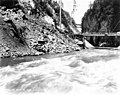
 Excavation for powerhouse foundation, March 6, 1925 (SPWS 375).jpg 768 × 609; 92 KB
-
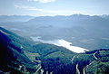
 Mount Baker from Baker Lake.jpg 2,593 × 1,762; 868 KB
-
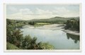 Confluence of Pemigewasset and Baker Rivers, Plymouth, N.H (NYPL b12647398-69506).tiff 2,408 × 1,569; 10.82 MB
-
 Powerhouse after dam completion, October 20, 1925 (SPWS 337).jpg 768 × 607; 71 KB
-

-
-
 Powerhouse under construction, June 29, 1925 (SPWS 370).jpg 768 × 609; 86 KB
-
 Powerhouse, nearly complete, September 16, 1925 (SPWS 332).jpg 768 × 610; 85 KB
-


.jpg)

.jpg)

.jpg)
.jpg)
.jpg)
.jpg)

.jpg)
.jpg)
.jpg)
.jpg)
.jpg)
.jpg)