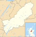
Category:Badenoch and Strathspey
Jump to navigation
Jump to search
Scottish district in Highland, Scotland, UK | |||||
| Upload media | |||||
| Instance of | |||||
|---|---|---|---|---|---|
| Location | Highland, Scottish Highlands, Scotland | ||||
 | |||||
Subcategories
This category has the following 20 subcategories, out of 20 total.
A
- Aberarder (30 F)
- Ardverikie Gate Lodge (11 F)
B
- Braeriach (56 F)
C
D
- Dunachton (4 F)
G
- Glen Banchor (11 F)
I
K
L
- Lynbreck Croft (14 F)
M
- Meall a' Chaorainn Beag (1 F)
R
S
Media in category "Badenoch and Strathspey"
The following 43 files are in this category, out of 43 total.
-
Approaching entrance to hillfort - geograph.org.uk - 916189.jpg 640 × 480; 148 KB
-
Ardverekie Wall - geograph.org.uk - 151567.jpg 500 × 362; 211 KB
-
Badenoch (district).png 368 × 456; 17 KB
-
Badenoch and Strathspey UK blank map.svg 1,385 × 1,424; 1.08 MB
-
Badenoch and Strathspey UK location map.svg 1,385 × 1,424; 1.49 MB
-
Badenoch and Strathspey UK relief location map.jpg 2,002 × 2,059; 703 KB
-
Black Wood - geograph.org.uk - 758281.jpg 640 × 480; 94 KB
-
Clan MacPherson Memorial Cairn - geograph.org.uk - 117136.jpg 640 × 480; 90 KB
-
Creag Shiaraidh - geograph.org.uk - 32763.jpg 640 × 480; 238 KB
-
Dalnavert letterboxes - geograph.org.uk - 238356.jpg 640 × 430; 120 KB
-
Dam on the River Spey - geograph.org.uk - 1347849.jpg 640 × 480; 59 KB
-
Frank Bruce Sculpture Park - The Archetype.jpg 3,256 × 2,784; 3.89 MB
-
Frank Bruce Sculpture Park - The Inner Man.jpg 2,736 × 3,888; 3.76 MB
-
Frank Bruce Sculpture Park - The Onlooker.jpg 3,248 × 2,688; 3.53 MB
-
Frank Bruce Sculpture Park - The Thinker.jpg 3,976 × 2,760; 5.31 MB
-
Glen Balloch - geograph.org.uk - 105505.jpg 640 × 480; 62 KB
-
Glen Banchor - geograph.org.uk - 105499.jpg 640 × 453; 60 KB
-
Loch behind Spey Dam - geograph.org.uk - 73547.jpg 640 × 427; 113 KB
-
Monument - geograph.org.uk - 24132.jpg 640 × 480; 128 KB
-
Monument - geograph.org.uk - 273338.jpg 480 × 640; 148 KB
-
Panorama South from Chattan Clan monument at Craig Dhu, Laggan, Scotland.jpg 7,039 × 846; 3.49 MB
-
Pylons - geograph.org.uk - 758634.jpg 640 × 480; 71 KB
-
River Spey - geograph.org.uk - 14797.jpg 640 × 480; 95 KB
-
River Spey - geograph.org.uk - 1754518.jpg 640 × 480; 86 KB
-
River Spey - geograph.org.uk - 1754522.jpg 640 × 480; 87 KB
-
River Spey - geograph.org.uk - 523441.jpg 640 × 480; 69 KB
-
River Spey downstream of Spey Dam - geograph.org.uk - 247626.jpg 640 × 480; 76 KB
-
Scot1975BadStrath.png 200 × 229; 30 KB
-
Southern shore of Spey Dam reservoir - geograph.org.uk - 1753311.jpg 640 × 480; 77 KB
-
Spey Dam Control House - geograph.org.uk - 1103793.jpg 640 × 432; 81 KB
-
Spey dam from the Glen Markie track - geograph.org.uk - 1125923.jpg 640 × 480; 85 KB
-
Spey Dam Loch - geograph.org.uk - 777540.jpg 640 × 427; 42 KB
-
Spey Dam reservoir - geograph.org.uk - 1753319.jpg 640 × 480; 76 KB
-
Strathspey near Kingussie pano.jpg 15,349 × 2,635; 14.9 MB
-
Summit of Creag Dubh. - geograph.org.uk - 26248.jpg 640 × 395; 61 KB
-
SW slopes of Spirean Beag, 596 - geograph.org.uk - 32776.jpg 640 × 480; 216 KB
-
The Laggan to Garvamore road - geograph.org.uk - 1754530.jpg 640 × 480; 76 KB
-
The Spey Dam - geograph.org.uk - 1103801.jpg 435 × 640; 76 KB
-
Upper Strathspey - geograph.org.uk - 650382.jpg 640 × 480; 67 KB
-
View of Blargie Craig from Spey Bridge - geograph.org.uk - 247636.jpg 640 × 480; 109 KB
-
Bothy and walled enclosure - geograph.org.uk - 31804.jpg 640 × 512; 252 KB


