Category:Back lanes in England
Jump to navigation
Jump to search
Subcategories
This category has the following 5 subcategories, out of 5 total.
Media in category "Back lanes in England"
The following 70 files are in this category, out of 70 total.
-
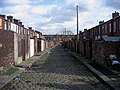
 A Back Lane in Haslingden - geograph.org.uk - 361951.jpg 640 × 480; 97 KB
-
 A back street in Skipton - geograph.org.uk - 540284.jpg 640 × 480; 212 KB
-
 Back Burnley Road Bacup - geograph.org.uk - 462772.jpg 640 × 440; 114 KB
-
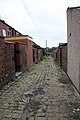
 Back Lane - geograph.org.uk - 317720.jpg 640 × 480; 114 KB
-

-
 Back Lane in Bury - geograph.org.uk - 349777.jpg 640 × 480; 94 KB
-
 Back lane off New Hey Road, Rastrick - geograph.org.uk - 5299170.jpg 2,000 × 1,500; 1.17 MB
-
-
 Back lane on washing day - geograph.org.uk - 398863.jpg 426 × 640; 88 KB
-
 Back of Kings Road - geograph.org.uk - 632612.jpg 640 × 480; 75 KB
-
 Back Street at side of Ivy House - geograph.org.uk - 400641.jpg 429 × 640; 218 KB
-
 Back Street in Fowey - geograph.org.uk - 387728.jpg 480 × 640; 108 KB
-

-

-
 Brookside, Skipton - geograph.org.uk - 1656118.jpg 640 × 480; 91 KB
-
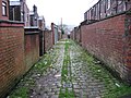
 Can Alley - geograph.org.uk - 366142.jpg 640 × 480; 104 KB
-
 Chapel Lane - geograph.org.uk - 603769.jpg 640 × 427; 113 KB
-
 Dirt road in Padiham, Lancashire, England.jpg 640 × 480; 220 KB
-
 Down the lane - geograph.org.uk - 312601.jpg 640 × 480; 121 KB
-
 Hound Hill - geograph.org.uk - 381768.jpg 640 × 480; 66 KB
-
 Kniveton Suburbia. - geograph.org.uk - 296758.jpg 640 × 480; 112 KB
-
 No through road - geograph.org.uk - 436649.jpg 640 × 480; 111 KB
-
 Oak Street, Morley - geograph.org.uk - 639916.jpg 427 × 640; 257 KB
-
 Park Lane - geograph.org.uk - 670424.jpg 640 × 480; 75 KB
-
 Passing place - geograph.org.uk - 433014.jpg 640 × 480; 99 KB
-
 Rear of Callender Street Ramsbottom - geograph.org.uk - 421762.jpg 640 × 480; 99 KB
-
 Rear of Hollinhall Street Oldham - geograph.org.uk - 305747.jpg 640 × 480; 113 KB
-
 Rear of Lamel Street - geograph.org.uk - 461905.jpg 479 × 640; 96 KB
-
 Rear of Roundthorne Road Oldham - geograph.org.uk - 305797.jpg 640 × 480; 116 KB
-
 Rear of Tynwald Street Clarksfield - geograph.org.uk - 305756.jpg 640 × 480; 109 KB
-
 Rear of Waterloo Street Oldham - geograph.org.uk - 305808.jpg 640 × 480; 100 KB
-
 Road closed - geograph.org.uk - 317728.jpg 640 × 480; 102 KB
-
 Rothbury Terrace Back Lane - geograph.org.uk - 201762.jpg 640 × 480; 89 KB
-
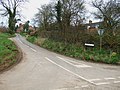
 Sandypits Lane near Etwall - geograph.org.uk - 312482.jpg 640 × 480; 117 KB
-
 Single track road - geograph.org.uk - 428989.jpg 640 × 480; 106 KB
-
 Spring Walk - geograph.org.uk - 347910.jpg 640 × 480; 115 KB
-
 Spring Walk - geograph.org.uk - 347914.jpg 640 × 480; 113 KB
-
 Stydd Lane - geograph.org.uk - 381144.jpg 640 × 480; 109 KB
-
 Tangled Wires - geograph.org.uk - 317683.jpg 640 × 480; 89 KB
-
 Taylors Lane - geograph.org.uk - 314872.jpg 640 × 480; 114 KB
-
 The old road to Elton - geograph.org.uk - 378233.jpg 640 × 480; 136 KB
-
 The road to Whitemoor Haye - geograph.org.uk - 429048.jpg 640 × 480; 60 KB
-
 To Hardwick. - geograph.org.uk - 305209.jpg 640 × 480; 117 KB
-
 Water Lane, Bishops Stortford - geograph.org.uk - 300526.jpg 483 × 640; 80 KB
-
 Wood lane footpaths - geograph.org.uk - 387669.jpg 640 × 480; 97 KB
-
 Yarra Road tenfoot - geograph.org.uk - 915439.jpg 640 × 427; 76 KB
-
 Yarra Road tenfoot - geograph.org.uk - 915442.jpg 640 × 427; 83 KB
-

-

-
 Back lane - geograph.org.uk - 436667.jpg 640 × 480; 107 KB
-
 Back Lane Austerlands - geograph.org.uk - 374354.jpg 640 × 480; 92 KB
-
 Back Lane off Salford Street Oldham - geograph.org.uk - 305799.jpg 640 × 480; 111 KB
-
 Back lane to Whitemoor Haye - geograph.org.uk - 429037.jpg 640 × 480; 63 KB
-
 Back road to Raunds - geograph.org.uk - 383044.jpg 640 × 480; 102 KB
-

-

-
 Back street view towards church - geograph.org.uk - 546798.jpg 480 × 640; 82 KB
-

-
 Beighton Road - geograph.org.uk - 346458.jpg 640 × 480; 165 KB
-
 Bullgap Lane - geograph.org.uk - 380313.jpg 640 × 480; 74 KB
-
 Deserted country lane - geograph.org.uk - 525236.jpg 640 × 480; 125 KB
-
 Ennog, Liverpool 15 - geograph.org.uk - 762149.jpg 640 × 480; 463 KB
-
 George Lane South Petherton - geograph.org.uk - 626988.jpg 640 × 480; 103 KB
-
 Moore's Lane, by Osier Gill - geograph.org.uk - 451041.jpg 640 × 480; 130 KB
-
 More Absent Terraces - geograph.org.uk - 72616.jpg 640 × 480; 58 KB
-
 Polperro, River - geograph.org.uk - 514253.jpg 640 × 480; 68 KB
-
 Reed Passage, Great Harwood - geograph.org.uk - 658710.jpg 640 × 480; 213 KB
-
 St Lukes School Shireoaks - geograph.org.uk - 463241.jpg 640 × 480; 91 KB
-
 Station Road Back Lane - geograph.org.uk - 204869.jpg 640 × 480; 79 KB
-
 Stroud - The Retreat - geograph.org.uk - 425302.jpg 426 × 640; 108 KB


