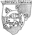
Category:Babylonian Map of the World tablet
Jump to navigation
Jump to search
6th century BCE Babylonian clay tablet written in Akkadian with a labeled depiction of the known world | |||||
| Upload media | |||||
| Instance of | |||||
|---|---|---|---|---|---|
| Depicts | Babylon, Euphrates, marsh, Assyrian Empire, Der and Urartu | ||||
| Made from material | |||||
| Location | British Museum, Bloomsbury, London Borough of Camden, Greater London, London, England | ||||
| Location of discovery | |||||
| Language of work or name | |||||
| Collection |
| ||||
| Inventory number |
| ||||
| Inception |
| ||||
| Time of discovery or invention |
| ||||
| |||||
Media in category "Babylonian Map of the World tablet"
The following 18 files are in this category, out of 18 total.
-
20180506 145606-babylon-map.jpg 2,988 × 5,312; 5.02 MB
-
BabylonianWorldMap2.jpg 585 × 480; 93 KB
-
Baylonianmaps.JPG 1,728 × 2,349; 870 KB
-
Carte babylonienne du monde, exposition Perds pas le Nord, Muséum Henri-Lecoq, 2022.jpg 2,448 × 3,264; 2.46 MB
-
Map of the World from Sippar, Iraq, 6th century BCE 1.png 756 × 821; 768 KB
-
Map of the World from Sippar, Iraq, 6th century BCE. British Museum.jpg 3,562 × 3,870; 10.73 MB
-
Map of the World from Sippar, Iraq, 6th century BCE. The British Museum.jpg 4,511 × 2,914; 9.58 MB
-
Map of the World from Sippar, Iraq. 6th century BCE. British Museum.jpg 3,556 × 3,883; 9.74 MB
-
Map of the World from Sippar, Mesopotamia, Iraq. 6th century BCE. The British Museum.jpg 2,430 × 3,494; 5.81 MB
-
Meissner Babylonien und Assyrien clay map 1925.jpg 382 × 420; 50 KB
-
The Babylonian map of the world, from Sippar, Mesopotamia..JPG 4,288 × 2,848; 9.66 MB


