Category:B1257 road (England)
Jump to navigation
Jump to search
road in England | |||||
| Upload media | |||||
| Instance of |
| ||||
|---|---|---|---|---|---|
| Location | North Yorkshire, Yorkshire and the Humber, England | ||||
| Transport network |
| ||||
| |||||
English: The B1257 is a long distance route from Malton to Stokesley via Helmsley
Subcategories
This category has the following 5 subcategories, out of 5 total.
Media in category "B1257 road (England)"
The following 38 files are in this category, out of 38 total.
-
 16 ^ Down Hill - geograph.org.uk - 1329417.jpg 640 × 480; 116 KB
-
 A country crossroads and milestone - geograph.org.uk - 167695.jpg 640 × 480; 106 KB
-
 B1257 at 569920 - geograph.org.uk - 28942.jpg 640 × 480; 109 KB
-
 B1257 at SE569880 - geograph.org.uk - 28927.jpg 640 × 480; 103 KB
-
 B1257 at SE589848 - geograph.org.uk - 28918.jpg 640 × 480; 101 KB
-
 B1257 near Hawnby Junction - geograph.org.uk - 156304.jpg 640 × 382; 37 KB
-
 B1257 roadside parking - geograph.org.uk - 1616535.jpg 640 × 480; 83 KB
-
 B1257 towards Pickering - geograph.org.uk - 2440106.jpg 1,600 × 1,200; 572 KB
-
 B1257, Appleton le Street.jpg 640 × 480; 70 KB
-
 Bilsdale Telephone Exchange - geograph.org.uk - 1500676.jpg 640 × 480; 119 KB
-
 Bilsdale, North Yorkshire.jpg 2,040 × 918; 87 KB
-
 Bridge over Ledge Beck Bilsdale - geograph.org.uk - 105050.jpg 640 × 429; 93 KB
-
 Broughton Plantation - geograph.org.uk - 341557.jpg 640 × 480; 142 KB
-
 Damaged bridge over the Rye - geograph.org.uk - 105054.jpg 640 × 427; 59 KB
-
 Entrance to Laverock Hall Farm - geograph.org.uk - 1762568.jpg 2,048 × 1,536; 1.49 MB
-
 Footpath near Cam House - geograph.org.uk - 1640560.jpg 640 × 480; 86 KB
-
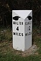
 Old Mile Post - geograph.org.uk - 1329392.jpg 480 × 640; 112 KB
-
 Stokesley 19 - geograph.org.uk - 1329390.jpg 480 × 640; 105 KB
-
 Idyllic Scene - geograph.org.uk - 1329439.jpg 640 × 480; 140 KB
-
 Low Mill, Bilsdale - geograph.org.uk - 54171.jpg 640 × 480; 70 KB
-
 Lowry's Restaurant - geograph.org.uk - 1197318.jpg 640 × 453; 71 KB
-
 Milestone- In Place (geograph 6126528).jpg 669 × 497; 54 KB
-
 New Bridge - geograph.org.uk - 28931.jpg 640 × 480; 121 KB
-
 Newgate Bank - geograph.org.uk - 28933.jpg 640 × 480; 126 KB
-
 Public Bridleway, Trennet - geograph.org.uk - 50950.jpg 640 × 480; 78 KB
-
-
 Road junction, B1257 - geograph.org.uk - 1616527.jpg 640 × 480; 73 KB
-
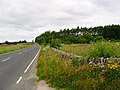
 Spring Flowers by the B1257 - geograph.org.uk - 387788.jpg 640 × 482; 135 KB
-

-
 The B1257 at Leysthorpe - geograph.org.uk - 293617.jpg 640 × 480; 148 KB
-
 The B1257 east of Oswaldkirk - geograph.org.uk - 293619.jpg 640 × 480; 157 KB
-
 The B1257 road entering Stonegrave - geograph.org.uk - 293037.jpg 640 × 480; 145 KB
-

-
 View From Hasty Bank - geograph.org.uk - 341501.jpg 640 × 480; 161 KB
-
 View from the B1257 - geograph.org.uk - 28925.jpg 640 × 480; 76 KB
-
 Village hall, Great Broughton - geograph.org.uk - 1640515.jpg 640 × 480; 65 KB
-
 Water Hydrant Sign at Maynards Corner - geograph.org.uk - 30134.jpg 640 × 480; 80 KB
-


.jpg)


.jpg)


