Category:Aviation maps of Norway
Jump to navigation
Jump to search
Media in category "Aviation maps of Norway"
The following 18 files are in this category, out of 18 total.
-
1925 Route Map of Scandinavia and the Baltic States.jpg 1,260 × 746; 338 KB
-
1944 Liberator crash at Skorve, detail map.jpg 718 × 637; 74 KB
-
Airports between Bodø and Tromsø.svg 512 × 557; 344 KB
-
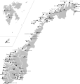
Airports in Norway map.svg 501 × 526; 166 KB
-
Akershus amt nr 105- Instrument Approach Chart ICAO, 1950.jpg 2,474 × 3,208; 1.2 MB
-
Busy Bee.png 224 × 275; 16 KB
-
DNL domestic route map.svg 501 × 526; 95 KB
-
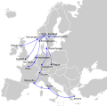
DNL international route map.svg 454 × 450; 325 KB
-
FBU domestic map.svg 501 × 526; 147 KB
-
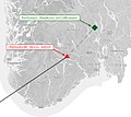
Liberator crash at Skorve, overview map.jpg 602 × 539; 62 KB
-
Map Widerøe Flight 933.png 562 × 332; 159 KB
-
Norwegian Air Shuttle routes domestic.svg 501 × 526; 104 KB
-
TRD destinations map.svg 645 × 690; 490 KB
-
TRD domestic map.svg 501 × 526; 100 KB
-
Vildanden routes.svg 221 × 274; 52 KB
-
Vnukovo-2801.jpg 1,352 × 737; 799 KB
-
Western Norway air routes.svg 223 × 277; 57 KB
-
Wideroe routes.svg 549 × 523; 115 KB


