Category:Avenue Gallieni (Courbevoie)
Jump to navigation
Jump to search
| Object location | | View all coordinates using: OpenStreetMap |
|---|
avenue in Courbevoie, France _-_2024-04-01_-_2.jpg) _-_2024-04-01_-_1.jpg) | |||||
| Upload media | |||||
| Instance of | |||||
|---|---|---|---|---|---|
| Part of | |||||
| Named after | |||||
| Location | Courbevoie, Hauts-de-Seine, Île-de-France, Metropolitan France, France | ||||
 | |||||
Media in category "Avenue Gallieni (Courbevoie)"
The following 19 files are in this category, out of 19 total.
-
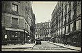
 14 Avenue Gallieni, Paris (01).jpg 585 × 1,009; 290 KB
-
 Avenue Gallieni - Courbevoie (FR92) - 2024-04-01 - 1.jpg 4,032 × 3,024; 4.06 MB
-
 Avenue Gallieni - Courbevoie (FR92) - 2024-04-01 - 2.jpg 4,032 × 3,024; 4.14 MB
-
 Avenue Gallieni.jpg 3,645 × 2,336; 5.66 MB
-
 Avenue Galliéni, Courbevoie, France.jpg 1,920 × 2,560; 1.47 MB
-
 Becon-les-Bruyeres - Avenue Pasteur prise de l'Avenue Gallieni.jpg 3,603 × 2,311; 6.13 MB
-
 Becon-les-Bruyeres - Pavillon - Avenue des Bruyeres.jpg 3,633 × 2,361; 5.99 MB
-
 Carte postale - Courbevoie - Avenue Galliéni - 9FI-COU 5.jpg 3,649 × 2,365; 5.31 MB
-
 Carte postale - Courbevoie - Avenue Galliéni - 9FI-COU 6.jpg 3,637 × 2,332; 5.57 MB
-
-
 Carte postale - Courbevoie - L'Avenue des Bruyères, près de l'avenue Pasteur - 9FI-COU 1.jpg 3,649 × 2,361; 6.05 MB
-

-
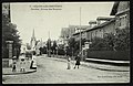
 Courbevoie.Bécon-les-Bruyères.Avenue des Bruyères.jpg 853 × 549; 93 KB
-
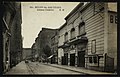
 Courbevoie.Rue Ambroise-Thomas.jpg 393 × 617; 42 KB
-
 IA00129908 14 avenue Gallieni.jpg 3,648 × 2,736; 3.07 MB
-
 IA00129975 18 avenue Gallieni.jpg 2,736 × 3,648; 1.8 MB
-
 Plaque Avenue Gallieni - Courbevoie (FR92) - 2024-04-01 - 1.jpg 3,460 × 2,028; 2.23 MB
-
 Plaque Avenue Gallieni - Courbevoie (FR92) - 2024-04-01 - 2.jpg 4,032 × 3,024; 3.65 MB
-

.jpg)
_-_2024-04-01_-_1.jpg)


_-_2024-04-01_-_2.jpg)
.jpg)