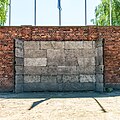
Category:Auschwitz I death wall
Jump to navigation
Jump to search
| Object location | | View all coordinates using: OpenStreetMap |
|---|
| Upload media | |||||
| Instance of | |||||
|---|---|---|---|---|---|
| Part of | |||||
| Location | Auschwitz I concentration camp | ||||
| Heritage designation |
| ||||
 | |||||
Media in category "Auschwitz I death wall"
The following 90 files are in this category, out of 90 total.
-
784648 Oświęcim zespół obozu zagłady "Auschwitz" - wejście przy Ścianie Straceń 06.JPG 4,272 × 2,848; 7.6 MB
-
Arbait Macht Frei.jpg 5,674 × 3,795; 5.29 MB
-
Auschwitz - Blok Smierci and The Execution Wall Sk06 C P.jpg 1,778 × 1,198; 679 KB
-
Auschwitz - październik 2013 IX.jpg 3,456 × 1,944; 3.04 MB
-
Auschwitz - Poland (74210071).jpg 2,048 × 1,536; 825 KB
-
Auschwitz - Poland (74210121).jpg 2,048 × 1,536; 837 KB
-
Auschwitz - Poland (74210165).jpg 2,048 × 1,536; 823 KB
-
Auschwitz - widok na ścianę śmierci.jpg 5,456 × 3,632; 4.19 MB
-
Auschwitz - ściana śmierci.jpg 5,456 × 3,632; 5.05 MB
-
Auschwitz 27.JPG 1,024 × 683; 205 KB
-
Auschwitz 8.JPG 3,024 × 2,016; 1.49 MB
-
Auschwitz 9.JPG 3,024 × 2,016; 1.47 MB
-
Auschwitz concentration camp I 30.JPG 3,648 × 2,736; 4.23 MB
-
Auschwitz concentration camp I 31.JPG 3,648 × 2,736; 4.18 MB
-
Auschwitz concentration camp I 32.JPG 3,648 × 2,736; 4.26 MB
-
Auschwitz Death wall 1.5.jpg 895 × 504; 231 KB
-
Auschwitz exicution ground.JPG 4,608 × 3,072; 3.61 MB
-
Auschwitz I - Death Wall.JPG 4,608 × 3,456; 5.78 MB
-
Auschwitz I - Execution wall.jpg 5,184 × 3,456; 4.63 MB
-
Auschwitz I 09.jpg 2,032 × 1,524; 950 KB
-
Auschwitz I 10.jpg 2,032 × 1,524; 993 KB
-
Auschwitz I 12.jpg 1,524 × 2,032; 943 KB
-
Auschwitz I 2020 P17 death wall.jpg 5,184 × 3,456; 8.87 MB
-
Auschwitz I 2020 P18 death wall.jpg 5,184 × 3,456; 8.69 MB
-
Auschwitz I Camp - Execution Wall - Oswiecim - Poland - 01.jpg 2,304 × 3,072; 2.79 MB
-
Auschwitz I Camp - Execution Wall with Floral Tributes - Oswiecim - Poland - 02.jpg 2,304 × 3,072; 3.01 MB
-
Auschwitz I Camp - Oswiecim - Poland - 08.jpg 3,072 × 2,304; 2.92 MB
-
Auschwitz I Death wall 2019 01.jpg 3,000 × 2,000; 6.66 MB
-
Auschwitz I Death wall 2019 02.jpg 3,000 × 2,000; 6.74 MB
-
Auschwitz I, 2024 (26).jpg 3,663 × 5,483; 6.32 MB
-
Auschwitz I, 2024 (27).jpg 5,509 × 3,673; 7.99 MB
-
Auschwitz I, april 2014, photo 14.jpg 4,493 × 2,960; 3.6 MB
-
Auschwitz I, april 2014, photo 6.jpg 4,726 × 3,096; 4.71 MB
-
Auschwitz I-24.jpg 5,117 × 3,401; 4.11 MB
-
Auschwitz I-25.jpg 2,946 × 3,929; 2.37 MB
-
Auschwitz I. Execution Yard with the Death Wall.jpg 4,032 × 3,024; 3.44 MB
-
Auschwitz II-Birkenau 2.jpg 1,600 × 1,200; 513 KB
-
Auschwitz July 2016 143034.jpg 5,312 × 2,988; 4.52 MB
-
Auschwitz July 2016 143119.jpg 5,312 × 2,988; 5.5 MB
-
Auschwitz múzeum - panoramio (10).jpg 2,048 × 1,536; 1.32 MB
-
Auschwitz, A Pennant over the Excution Wall - panoramio.jpg 1,536 × 2,048; 827 KB
-
Auschwitz3.jpg 604 × 453; 86 KB
-
AuschwitzBirkenau 09.jpg 4,752 × 3,168; 6.86 MB
-
AuschwitzExecutionWall2006.jpg 2,260 × 1,752; 2.08 MB
-
Before Block 11 - panoramio.jpg 2,736 × 3,648; 3.47 MB
-
BLOCK 15.jpg 6,000 × 3,753; 3.17 MB
-
Budynki ze ścieżką.jpg 6,000 × 4,000; 3.18 MB
-
Budynki zza siatki.jpg 6,000 × 3,753; 5.53 MB
-
Budynki.jpg 6,000 × 4,000; 2.8 MB
-
Close-up of the Death Wall at the Auschwitz I concentration camp.jpg 4,438 × 4,438; 15.46 MB
-
Death wall auschwitz.JPG 3,264 × 2,448; 3.57 MB
-
Dodenmuur Auschwitz.jpg 1,536 × 1,152; 376 KB
-
Drut kolczasty.jpg 6,000 × 4,000; 1.22 MB
-
Execution wall Auschwitz 1 2006 4070.jpg 3,504 × 2,336; 5.15 MB
-
Execution wall Auschwitz 1 2006 4072.jpg 3,504 × 2,336; 5.12 MB
-
Execution wall in Auschwitz.JPG 3,456 × 5,184; 9.63 MB
-
Execution Wall, Auschwitz (2434341770).jpg 2,592 × 1,728; 2.15 MB
-
Gedenkstelle.JPG 2,560 × 1,920; 2.78 MB
-
HALT-STÓJ!.jpg 6,000 × 3,763; 2.07 MB
-
Koncentračný tábor Auschwitz-Birkenau 2017 (33845131911).jpg 2,000 × 1,331; 2.72 MB
-
Muro de la muerte de Auschwitz I, Polonia.jpg 3,113 × 2,335; 5.35 MB
-
Muro della morte.jpg 3,648 × 2,736; 4.33 MB
-
Oswiecim, Poland - panoramio.jpg 3,136 × 2,352; 4.69 MB
-
Oświęcim03 - Pati.JPG 3,176 × 2,304; 1.86 MB
-
Plac między barakami i ściana śmierci.jpg 800 × 533; 237 KB
-
Poland-01333 - Death Wall (31387342000).jpg 6,000 × 4,000; 22.8 MB
-
Poland-01334 - Death Wall (31387372450).jpg 6,000 × 4,000; 24.02 MB
-
Replica of shooting wall, KZ Auschwitz, Dec 2012.jpg 3,648 × 2,736; 4.1 MB
-
Schwarze Wand Gedenkstätte Auschwitz I.jpg 3,888 × 2,592; 5.56 MB
-
Sciana stracen Auschwitz.jpg 3,072 × 2,304; 3.6 MB
-
Sciana stracen.JPG 2,048 × 1,536; 1.58 MB
-
Strażnica - D.jpg 6,000 × 3,737; 2.91 MB
-
Tablica - patrioci austriaccy.jpg 4,000 × 5,747; 5.66 MB
-
Tablica informacyjna VORSICHT.jpg 6,000 × 4,000; 1.66 MB
-
The Black Wall where prisoners were executed at Auschwitz.JPG 5,184 × 3,456; 10.91 MB
-
Todesmauer.JPG 2,048 × 1,536; 692 KB
-
Un dimanche d'hiver à Auschwitz-Birkenau (Pologne) 6.jpg 2,272 × 1,704; 464 KB
-
Wall of Death in Auschwitz I.jpg 2,032 × 1,524; 1.11 MB
-
Zdjęcia deportowanych.jpg 4,828 × 4,000; 1.93 MB
-
BASA-1771K-1-1172-49.jpg 1,613 × 1,027; 705 KB
-
Ściana śmierci obóz Auschwitz.jpg 800 × 533; 310 KB
-
Ściana śmierci.jpg 6,000 × 4,000; 3.96 MB
-
Ścieżka patrolowa.jpg 6,000 × 4,000; 3.04 MB
-
Τοίχος του Θανάτου, Άουσβιτς 5327.jpg 4,608 × 3,456; 9.35 MB
-
אושוויץ - קיר המוות.jpg 5,152 × 3,864; 7.65 MB
-
ナチスの残虐性.jpg 2,141 × 1,351; 424 KB


