Category:August 2009 in County Tyrone
Jump to navigation
Jump to search
English: Images taken in County Tyrone, Northern Ireland in this month of 2009 (not the date of the upload).
| Jan | Feb | Mar | Apr | May | Jun | Jul | Aug | Sep | Oct | Nov | Dec | ||
| ← | 253 | 234 | 282 | 332 | 110 | 24 | 116 | 204 | 75 | 143 | 93 | 96 | → |
|---|
Subcategories
This category has the following 3 subcategories, out of 3 total.
D
O
S
Media in category "August 2009 in County Tyrone"
The following 200 files are in this category, out of 201 total.
(previous page) (next page)-

-

-
 A farmhouse at Ardtole - geograph.org.uk - 1522005.jpg 640 × 377; 72 KB
-

-

-
 Abbey Villas, Ardstraw - geograph.org.uk - 1451149.jpg 640 × 247; 24 KB
-
 Access to Perry Street, Dungannon - geograph.org.uk - 1469993.jpg 640 × 479; 72 KB
-
 Aghagallon Townland - geograph.org.uk - 1445090.jpg 640 × 479; 56 KB
-
 Aghasessy Road - geograph.org.uk - 1450226.jpg 640 × 479; 51 KB
-
 Aghlish Road, Curly - geograph.org.uk - 1457768.jpg 640 × 479; 57 KB
-
 Aghlish Road, Curly - geograph.org.uk - 1457921.jpg 640 × 479; 51 KB
-
 Altoghal Road - geograph.org.uk - 1447767.jpg 640 × 479; 56 KB
-
 Altoghal Road - geograph.org.uk - 1447770.jpg 640 × 479; 68 KB
-
 Altoghal Road - geograph.org.uk - 1447773.jpg 640 × 479; 64 KB
-
 Altoghal Road - geograph.org.uk - 1447776.jpg 640 × 479; 78 KB
-
 Altoghal Road - geograph.org.uk - 1447785.jpg 640 × 479; 58 KB
-
 Altoghal Townland - geograph.org.uk - 1447761.jpg 640 × 479; 84 KB
-
 Altoghal Townland - geograph.org.uk - 1447762.jpg 640 × 479; 56 KB
-
 Altoghal Townland - geograph.org.uk - 1447772.jpg 640 × 479; 52 KB
-
 Altoghal Townland - geograph.org.uk - 1447775.jpg 640 × 479; 58 KB
-

-
 Annaghmurnin Townland - geograph.org.uk - 1453981.jpg 640 × 479; 58 KB
-
 Annaghmurnin Townland - geograph.org.uk - 1453989.jpg 640 × 479; 51 KB
-
 Annaghmurnin Townland - geograph.org.uk - 1453997.jpg 640 × 479; 66 KB
-
 Annaghmurnin Townland - geograph.org.uk - 1454000.jpg 640 × 479; 60 KB
-

-

-
 Archway with clock, The Diamond - geograph.org.uk - 1453953.jpg 640 × 479; 45 KB
-
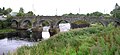 Ardstraw Bridge - geograph.org.uk - 1450425.jpg 640 × 291; 39 KB
-

-
 Ardstraw, County Tyrone - geograph.org.uk - 1450381.jpg 640 × 479; 62 KB
-
 Ardstraw, County Tyrone - geograph.org.uk - 1451147.jpg 640 × 479; 66 KB
-
 Arvalee Road, Arvalee - geograph.org.uk - 1497707.jpg 640 × 479; 74 KB
-
 Arvalee Townland - geograph.org.uk - 1497436.jpg 640 × 479; 132 KB
-
 Arvalee Townland - geograph.org.uk - 1497445.jpg 640 × 479; 163 KB
-
 Arvalee Townland - geograph.org.uk - 1497692.jpg 640 × 479; 128 KB
-
 Attaghmore Townland - geograph.org.uk - 1453921.jpg 640 × 479; 85 KB
-
 Attaghmore Townland - geograph.org.uk - 1453925.jpg 640 × 479; 77 KB
-
 Attaghmore Townland - geograph.org.uk - 1453934.jpg 640 × 479; 60 KB
-
 Attaghmore Townland - geograph.org.uk - 1453938.jpg 640 × 479; 64 KB
-
 Ballynahatty Road - geograph.org.uk - 1454139.jpg 640 × 479; 71 KB
-
 Ballynahatty Road - geograph.org.uk - 1457944.jpg 640 × 479; 58 KB
-
 Ballynahatty Road - geograph.org.uk - 1457949.jpg 640 × 479; 85 KB
-
 Ballynahatty Road, Cavan - geograph.org.uk - 1454133.jpg 640 × 479; 57 KB
-
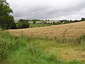
 Barley field near Ardstraw - geograph.org.uk - 1451153.jpg 640 × 479; 65 KB
-
 Barley field, Ardstraw - geograph.org.uk - 1451154.jpg 640 × 479; 63 KB
-
 Barley field, Creevy - geograph.org.uk - 1460537.jpg 640 × 479; 58 KB
-
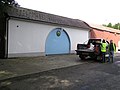
 Barn (side view) - geograph.org.uk - 1450488.jpg 640 × 479; 59 KB
-
 Barn, Ardstraw - geograph.org.uk - 1450486.jpg 640 × 479; 44 KB
-
 Baronscourt Road, Envagh - geograph.org.uk - 1458974.jpg 640 × 479; 59 KB
-
 Beltany Townland - geograph.org.uk - 1447850.jpg 640 × 479; 75 KB
-
 Beltany Townland - geograph.org.uk - 1447853.jpg 640 × 479; 59 KB
-
 Beltany Townland - geograph.org.uk - 1447855.jpg 640 × 479; 65 KB
-
 Beltany Townland - geograph.org.uk - 1447858.jpg 640 × 479; 60 KB
-
 Beltrim Townland - geograph.org.uk - 1432035.jpg 640 × 479; 71 KB
-
 Bird's eye view of Balance, Omagh - geograph.org.uk - 1452830.jpg 479 × 640; 105 KB
-
 Blacksessagh Road, Skreen - geograph.org.uk - 1453907.jpg 640 × 479; 59 KB
-
 Bog, Garvaghullion - geograph.org.uk - 1451423.jpg 640 × 479; 44 KB
-
 Boulder with inscription, Ardstraw - geograph.org.uk - 1450444.jpg 479 × 640; 163 KB
-
-
 Bridge, Aghlish Road - geograph.org.uk - 1457908.jpg 640 × 479; 64 KB
-
 Bus shelter, Cranny - geograph.org.uk - 1454482.jpg 640 × 479; 75 KB
-

-
 Bus stop, Ballygawley - geograph.org.uk - 1443084.jpg 640 × 479; 56 KB
-

-
 Byturn Road, Envagh - geograph.org.uk - 1459001.jpg 640 × 479; 85 KB
-
 Cairn Road - geograph.org.uk - 1451392.jpg 640 × 479; 58 KB
-
 Camowen River - geograph.org.uk - 1444641.jpg 640 × 479; 63 KB
-
 Cano's Pizzeria, Dungannon - geograph.org.uk - 1469954.jpg 640 × 479; 45 KB
-
 Carin Road - geograph.org.uk - 1451402.jpg 640 × 479; 64 KB
-
 Carnkenny Road - geograph.org.uk - 1450364.jpg 640 × 479; 49 KB
-
 Carnkenny Road - geograph.org.uk - 1450378.jpg 640 × 479; 57 KB
-
 Carnkenny Road - geograph.org.uk - 1450379.jpg 640 × 479; 79 KB
-
 Carnkenny Road, Ardstraw - geograph.org.uk - 1450383.jpg 640 × 479; 69 KB
-
 Carnkenny Road, Ardstraw - geograph.org.uk - 1450392.jpg 640 × 479; 76 KB
-
 Carnkenny Townland - geograph.org.uk - 1450380.jpg 640 × 479; 67 KB
-
 Cattle in a muddy field - geograph.org.uk - 1453994.jpg 640 × 479; 73 KB
-
 Cattle in field, Arvalee - geograph.org.uk - 1497702.jpg 640 × 479; 68 KB
-
 Cattle, Arvalee - geograph.org.uk - 1497715.jpg 640 × 479; 109 KB
-
 Cattle, Cavan - geograph.org.uk - 1454117.jpg 640 × 479; 69 KB
-
 Cattle, Eskeradooey - geograph.org.uk - 1447633.jpg 640 × 479; 64 KB
-
 Cattle, Legnabraid - geograph.org.uk - 1447644.jpg 640 × 479; 50 KB
-
 Cavan Road - geograph.org.uk - 1454001.jpg 640 × 479; 78 KB
-
 Cavan Road - geograph.org.uk - 1454031.jpg 640 × 479; 70 KB
-
 Cavan Road - geograph.org.uk - 1454128.jpg 640 × 479; 58 KB
-
 Cavan Road, Cavan - geograph.org.uk - 1454041.jpg 640 × 479; 85 KB
-
 Cavan Road, Cranny - geograph.org.uk - 1454475.jpg 640 × 479; 78 KB
-
 Cavan Road, Drumderg - geograph.org.uk - 1454166.jpg 640 × 479; 58 KB
-
 Cavan Road, Shannaragh - geograph.org.uk - 1454492.jpg 640 × 479; 66 KB
-
 Cavan Townland - geograph.org.uk - 1454051.jpg 640 × 479; 57 KB
-
 Church hall, Envagh - geograph.org.uk - 1458981.jpg 640 × 479; 45 KB
-
 Church Street, Dungannon - geograph.org.uk - 1469991.jpg 640 × 479; 54 KB
-
 Church Street, Dungannon - geograph.org.uk - 1469998.jpg 640 × 479; 62 KB
-
 Citizen's Advice Centre, Dungannon - geograph.org.uk - 1469947.jpg 640 × 479; 56 KB
-
 Clock, LW Surphlis - geograph.org.uk - 1459130.jpg 640 × 479; 42 KB
-
 Clock, The Diamond - geograph.org.uk - 1453960.jpg 640 × 479; 52 KB
-
 Cloonty Road, Envagh - geograph.org.uk - 1458969.jpg 640 × 479; 82 KB
-
 Cloonty Road, Envagh - geograph.org.uk - 1458985.jpg 640 × 479; 61 KB
-
 Coolaghy Road, Ardstraw - geograph.org.uk - 1450462.jpg 640 × 479; 56 KB
-
 Corner Bar, Ardstraw - geograph.org.uk - 1450390.jpg 640 × 479; 65 KB
-
 Cottage, Tullymuck - geograph.org.uk - 1451396.jpg 640 × 479; 66 KB
-
 Countryside at Ardstraw - geograph.org.uk - 1450502.jpg 640 × 479; 57 KB
-
 Covered footbridge, Omagh - geograph.org.uk - 1432876.jpg 640 × 480; 71 KB
-
 Cows, Magheralough - geograph.org.uk - 1460561.jpg 640 × 479; 59 KB
-
 Cows, Milltown - geograph.org.uk - 1450218.jpg 640 × 479; 62 KB
-
 Cows, Tullymuck - geograph.org.uk - 1451406.jpg 640 × 479; 62 KB
-
 Coyagh Road, Cranny - geograph.org.uk - 1457939.jpg 640 × 479; 77 KB
-

-
 Cranny Townland - geograph.org.uk - 1453968.jpg 640 × 479; 71 KB
-
 Cranny Townland - geograph.org.uk - 1453971.jpg 640 × 479; 68 KB
-
 Cranny Townland - geograph.org.uk - 1454472.jpg 640 × 479; 72 KB
-
 Creevy Road - geograph.org.uk - 1460498.jpg 640 × 479; 85 KB
-
 Creevy Road - geograph.org.uk - 1460510.jpg 640 × 479; 54 KB
-
 Creevy Road - geograph.org.uk - 1460517.jpg 640 × 479; 61 KB
-
 Creevy Townland - geograph.org.uk - 1460511.jpg 640 × 479; 62 KB
-
 Crew Lower - geograph.org.uk - 1478573.jpg 640 × 479; 86 KB
-
 Crossroads, Glennan Road - geograph.org.uk - 1454237.jpg 640 × 479; 80 KB
-
 Culvacullion Townland - geograph.org.uk - 1501224.jpg 640 × 479; 79 KB
-
 Curly Primary School - geograph.org.uk - 1457929.jpg 640 × 479; 53 KB
-
 Curly Road - geograph.org.uk - 1457936.jpg 640 × 479; 69 KB
-
 Curly Road, Cranny - geograph.org.uk - 1454486.jpg 640 × 479; 99 KB
-
 Curly Road, Cranny - geograph.org.uk - 1457934.jpg 640 × 479; 71 KB
-
 Curly Road, Curly - geograph.org.uk - 1457924.jpg 640 × 479; 56 KB
-
 Curly Townland - geograph.org.uk - 1457912.jpg 640 × 479; 63 KB
-
 Curly Townland - geograph.org.uk - 1457913.jpg 640 × 479; 68 KB
-
 Curly Townland - geograph.org.uk - 1457915.jpg 640 × 479; 51 KB
-
 Curly Townland - geograph.org.uk - 1457931.jpg 640 × 479; 65 KB
-
 Curly Townland - geograph.org.uk - 1457933.jpg 640 × 479; 55 KB
-
 Deerpark Road, Ardstraw - geograph.org.uk - 1450394.jpg 640 × 479; 62 KB
-
 Deerpark Road, Ardstraw - geograph.org.uk - 1450431.jpg 640 × 479; 59 KB
-
 Deerpark Road, Ardstraw - geograph.org.uk - 1450458.jpg 640 × 479; 46 KB
-
 Deerpark Road, Ardstraw - geograph.org.uk - 1450464.jpg 640 × 479; 57 KB
-
 Deerpark Road, Ardstraw - geograph.org.uk - 1451151.jpg 640 × 479; 47 KB
-
 Deerpark Road, Ardstraw - geograph.org.uk - 1451158.jpg 640 × 479; 54 KB
-
 Derelict buildings, Glennan - geograph.org.uk - 1454391.jpg 640 × 311; 40 KB
-
 Derelict cottage at Magheralough - geograph.org.uk - 1460576.jpg 640 × 479; 57 KB
-
 Derelict farm building - geograph.org.uk - 1460502.jpg 640 × 479; 77 KB
-
 Derelict farm building - geograph.org.uk - 1460505.jpg 640 × 479; 73 KB
-
 Derelict farmhouse, Creevy Road - geograph.org.uk - 1460499.jpg 640 × 479; 53 KB
-

-
 Dernalear Road, Tullymuck - geograph.org.uk - 1451417.jpg 640 × 479; 42 KB
-
 Derry Road, Omagh - geograph.org.uk - 1451470.jpg 640 × 479; 52 KB
-
 Derrynasser Road - geograph.org.uk - 1457979.jpg 640 × 479; 71 KB
-
 Derryree Townland - geograph.org.uk - 1459169.jpg 640 × 479; 51 KB
-
 Deverney Road, Arvalee - geograph.org.uk - 1497711.jpg 640 × 479; 99 KB
-
 Deverney Road, Arvalee - geograph.org.uk - 1497718.jpg 640 × 479; 72 KB
-
 Donaghanie Road - geograph.org.uk - 1444957.jpg 640 × 479; 59 KB
-
 Donaghanie Road, Edenderry - geograph.org.uk - 1445043.jpg 640 × 479; 69 KB
-
 Donaghanie Townland - geograph.org.uk - 1444628.jpg 640 × 479; 70 KB
-
 Donaghanie Townland - geograph.org.uk - 1444650.jpg 640 × 479; 48 KB
-
 Donaghanie Townland - geograph.org.uk - 1444965.jpg 640 × 479; 69 KB
-
 Donkeys, Tullymuck - geograph.org.uk - 1451421.jpg 640 × 479; 70 KB
-
 Drumderg Glebe - geograph.org.uk - 1454186.jpg 640 × 479; 71 KB
-
 Drumderg Glebe - geograph.org.uk - 1454197.jpg 640 × 479; 67 KB
-
 Drumderg Glebe - geograph.org.uk - 1454203.jpg 640 × 479; 65 KB
-
 Drumderg Glebe - geograph.org.uk - 1454209.jpg 640 × 479; 74 KB
-
 Drumderg Townland - geograph.org.uk - 1454162.jpg 640 × 479; 66 KB
-
 Drumderg Townland - geograph.org.uk - 1454180.jpg 640 × 479; 68 KB
-
 Drumderg Townland - geograph.org.uk - 1454201.jpg 640 × 479; 61 KB
-
 Drumlegagh Church Road - geograph.org.uk - 1459144.jpg 640 × 479; 69 KB
-

-
 Dryarch Road, Donaghanie - geograph.org.uk - 1444960.jpg 640 × 479; 65 KB
-
 Dunnamore Townland - geograph.org.uk - 1453940.jpg 640 × 479; 48 KB
-
 Dunteige Townland - geograph.org.uk - 1458907.jpg 640 × 479; 82 KB
-
 Dunteige Townland - geograph.org.uk - 1458923.jpg 640 × 479; 56 KB
-

-
 Envagh Road - geograph.org.uk - 1459002.jpg 640 × 479; 84 KB
-
 Envagh Townland - geograph.org.uk - 1458958.jpg 640 × 479; 89 KB
-
 Envagh Townland - geograph.org.uk - 1458978.jpg 640 × 479; 50 KB
-
 Envagh Townland - geograph.org.uk - 1458995.jpg 640 × 479; 59 KB
-
 Envagh Townland - geograph.org.uk - 1459006.jpg 640 × 479; 68 KB
-
 Envagh Townland - geograph.org.uk - 1459020.jpg 640 × 479; 67 KB
-
 Envagh Townland - geograph.org.uk - 1459031.jpg 640 × 479; 70 KB
-
 Envagh Townland - geograph.org.uk - 1459037.jpg 640 × 479; 61 KB
-
 Farm buildings, Dunteige - geograph.org.uk - 1458912.jpg 640 × 479; 62 KB
-
 Farm buildings, Whitehouse Road - geograph.org.uk - 1460568.jpg 640 × 479; 56 KB
-
 Farm, Kinstrule - geograph.org.uk - 1450371.jpg 640 × 479; 60 KB
-
 Farmhill Road, Arvalee - geograph.org.uk - 1497695.jpg 640 × 479; 112 KB
-
 Glennan Road - geograph.org.uk - 1454368.jpg 640 × 479; 72 KB
-
 Glennan Townland - geograph.org.uk - 1454370.jpg 640 × 479; 65 KB
-
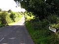
 Gortnagarn Road - geograph.org.uk - 1451193.jpg 640 × 479; 55 KB
-
 Gortnagarn Road - geograph.org.uk - 1451195.jpg 640 × 479; 59 KB
-
-

-
 Legnabraid Road - geograph.org.uk - 1447765.jpg 640 × 479; 65 KB
-
 Liscabble Road - geograph.org.uk - 1432041.jpg 640 × 479; 60 KB
-
 Liscabble Road - geograph.org.uk - 1432063.jpg 640 × 479; 68 KB
-
 Liscabble Road - geograph.org.uk - 1432826.jpg 640 × 479; 72 KB
-
 Liscabble Road - geograph.org.uk - 1432841.jpg 640 × 479; 74 KB
-
 Lough Road, Envagh - geograph.org.uk - 1459022.jpg 640 × 479; 77 KB
-
 Lough Road, Envagh - geograph.org.uk - 1459040.jpg 640 × 479; 55 KB
-
 Overgrown lane, Arvalee - geograph.org.uk - 1497453.jpg 640 × 479; 178 KB
-
 Shanmullagh Road, Garvaghullion - geograph.org.uk - 1451426.jpg 640 × 479; 85 KB
-
 Sheep, Envagh - geograph.org.uk - 1459029.jpg 640 × 479; 59 KB
-
 St Mary's Church, Envagh - geograph.org.uk - 1458990.jpg 479 × 640; 73 KB
-
 St Mary's RC Church, Envagh - geograph.org.uk - 1458988.jpg 640 × 479; 49 KB
-
 Stile, Donaghanie - geograph.org.uk - 1444626.jpg 640 × 479; 98 KB
-
 Sunday morning joggers, Arvalee - geograph.org.uk - 1497724.jpg 640 × 479; 57 KB
-
 SV markers, Arvalee - geograph.org.uk - 1497448.jpg 640 × 479; 162 KB
-
 Whitehill Road, Envagh - geograph.org.uk - 1459016.jpg 640 × 479; 145 KB


_-_geograph.org.uk_-_1450488.jpg)


