Category:August 2007 in the City of Wakefield
Jump to navigation
Jump to search
Media in category "August 2007 in the City of Wakefield"
The following 61 files are in this category, out of 61 total.
-
Annie Street - geograph.org.uk - 534587.jpg 640 × 404; 33 KB
-
Barclays Bank - Bank Street - geograph.org.uk - 532507.jpg 640 × 506; 57 KB
-
Beech House - Leeds Road, Outwood - geograph.org.uk - 534596.jpg 640 × 388; 48 KB
-
Bingham Engineering Factory. - geograph.org.uk - 531054.jpg 640 × 480; 86 KB
-
Blacker Hall Farm shop. - geograph.org.uk - 518676.jpg 640 × 439; 124 KB
-
Bridle Path, East Hardwick - geograph.org.uk - 535630.jpg 640 × 480; 110 KB
-
Castleford Railway Signal Box - geograph.org.uk - 518794.jpg 640 × 480; 82 KB
-
Castleford Railway Station - geograph.org.uk - 518790.jpg 640 × 480; 75 KB
-
Castleford Railway Station - geograph.org.uk - 518791.jpg 640 × 480; 77 KB
-
Causeway Garth, Thorpe Audlin - geograph.org.uk - 527963.jpg 640 × 480; 107 KB
-
Cedar Court Hotel. - geograph.org.uk - 517469.jpg 636 × 476; 84 KB
-
Cedar Court Offices. - geograph.org.uk - 518673.jpg 640 × 396; 92 KB
-
Coach Road - Outwood - geograph.org.uk - 534598.jpg 640 × 387; 37 KB
-
Common Lane, Thorpe Audlin - geograph.org.uk - 527968.jpg 640 × 480; 150 KB
-
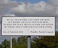
Composed by the City bard^ - geograph.org.uk - 518684.jpg 640 × 531; 95 KB
-
Cutsyke rooftops - geograph.org.uk - 538957.jpg 639 × 433; 107 KB
-
Field Boundary - geograph.org.uk - 527993.jpg 640 × 480; 150 KB
-
Fishing in the pond - geograph.org.uk - 531748.jpg 640 × 480; 94 KB
-
Footbridge and stile - geograph.org.uk - 532561.jpg 640 × 480; 153 KB
-
Footbridge over the River Went. - geograph.org.uk - 531037.jpg 640 × 480; 150 KB
-
Footpath under the Railway Viaduct. - geograph.org.uk - 532542.jpg 640 × 480; 119 KB
-
Frickley Athletic Football ground. - geograph.org.uk - 539244.jpg 640 × 480; 54 KB
-
HSBC Bank - Bank Street - geograph.org.uk - 532499.jpg 640 × 584; 57 KB
-
Hundhill Farm - geograph.org.uk - 533981.jpg 640 × 480; 90 KB
-
Junction 32, Castleford - geograph.org.uk - 538537.jpg 480 × 639; 99 KB
-
Kirklands Hotel - Leeds Road, Outwood - geograph.org.uk - 534592.jpg 640 × 444; 55 KB
-
Lonesome tree off Sheepwalk Lane. - geograph.org.uk - 534124.jpg 640 × 480; 82 KB
-
Moor House - geograph.org.uk - 532579.jpg 640 × 480; 120 KB
-
Mornington Farm - geograph.org.uk - 534189.jpg 640 × 480; 90 KB
-
Moto services Woolley Edge. - geograph.org.uk - 513785.jpg 640 × 480; 96 KB
-
Outwood Library - Leeds Road - geograph.org.uk - 534585.jpg 640 × 336; 50 KB
-
Public footpath, Sheepwalk Lane. - geograph.org.uk - 534134.jpg 640 × 480; 116 KB
-
South Elmsall Fire Station - geograph.org.uk - 539262.jpg 640 × 480; 51 KB
-
Streethouse working men's club.jpg 640 × 492; 65 KB
-
Tesco Supermarket, Pontefract - geograph.org.uk - 527118.jpg 640 × 480; 148 KB
-
Upton communications mast. - geograph.org.uk - 534131.jpg 480 × 640; 106 KB


