Category:August 2006 in Lincolnshire
Jump to navigation
Jump to search
Ok
Deutsch: Bilder, die im August 2006 in Lincolnshire aufgenommen worden sind. Bitte beachten Sie, dass dies weder das Datum des Uploads noch das Datum des Scannens eines Fotos ist.
English: Images/pictures taken in Lincolnshire during August 2006. Note this is not the date of the upload, nor the date a photo was scanned.
Español: Fotografías o imágenes tomadas en Lincolnshire durante agosto 2006. No es la fecha de subida ni escaneo, sino la fecha en que las fotografías o imágenes se crearon.
Esperanto: Bildoj faritaj en Lincolnshire en aŭgusto 2006. Tio ne estas la dato, kiam la bildoj estis alŝutitaj aŭ skanitaj.
Français : Photographies ou images prises en Lincolnshire durant août 2006. Ce n'est pas la date du téléchargement ou du scan.
Galego: Fotografías ou imaxes tomadas en Lincolnshire durante agosto 2006. Non é a data de subida nin escaneamento, senón a data na que se crearon as fotografías ou imaxes.
Italiano: Fotografie o immagini scattate a Lincolnshire nel agosto 2006. Nota bene: la data non si riferisce né a quella di upload né a quella in cui la foto è stata digitalizzata.
Norsk bokmål: Bilder tatt i Lincolnshire i løpet av august 2006. Merk at dette ikke er datoen for opplasting, eller når et bilde har blitt skannet.
Norsk nynorsk: Bilete teke i Lincolnshire i løpet av august 2006. Merk at dette ikkje er datoen for opplasting, eller når eit bilete har vorte skanna.
Русский: Изображения, сделанные в Lincolnshire в течение август 2006 (не дата загрузки изображения).
Українська: Зображення, зроблені в Lincolnshire протягом серпень 2006. Зауважте, що це не дата завантаження чи дата сканування фотографії.
| August 2005 | ← | August 2006 | → | August 2007 | |||||||
| Jan | Feb | Mar | Apr | May | Jun | Jul | Aug | Sep | Oct | Nov | Dec |
| 72 | 63 | 98 | 194 | 106 | 107 | 155 | 156 | 151 | 123 | 131 | 56 |
|---|---|---|---|---|---|---|---|---|---|---|---|
Subcategories
This category has only the following subcategory.
Media in category "August 2006 in Lincolnshire"
The following 155 files are in this category, out of 155 total.
-
 Ermine Farm, Appleby - geograph.org.uk - 216598.jpg 640 × 480; 73 KB
-
 Barn - geograph.org.uk - 262510.jpg 640 × 487; 117 KB
-
 Barnetby Methodist Church - geograph.org.uk - 212718.jpg 640 × 566; 118 KB
-

-
 Church Street, Barrow on Humber - geograph.org.uk - 217531.jpg 640 × 480; 85 KB
-
 Baysgarth House Museum - geograph.org.uk - 213748.jpg 640 × 498; 131 KB
-
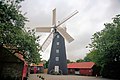 Windmill at Burgh Le Marsh - geograph.org.uk - 216370.jpg 440 × 293; 195 KB
-
 Church Street, Kirton-in-Lindsey - geograph.org.uk - 215686.jpg 640 × 480; 71 KB
-
 Church Farm Museum - geograph.org.uk - 216435.jpg 440 × 242; 153 KB
-
 Elmsae House - geograph.org.uk - 213928.jpg 640 × 427; 64 KB
-
 The Danish Invader - geograph.org.uk - 213972.jpg 640 × 427; 46 KB
-
 Fields near Elsham - geograph.org.uk - 217026.jpg 640 × 480; 94 KB
-
 Track to Moor Farm - geograph.org.uk - 217534.jpg 640 × 480; 71 KB
-
 Brigg Road, Hibaldstow - geograph.org.uk - 217283.jpg 640 × 480; 120 KB
-

-
 Fields Near Kirton-in-Lindsey - geograph.org.uk - 217189.jpg 640 × 480; 115 KB
-
 Interesting Buildings near Redbourne - geograph.org.uk - 217196.jpg 640 × 480; 107 KB
-
 Bridleway to Well - geograph.org.uk - 231882.jpg 640 × 480; 97 KB
-
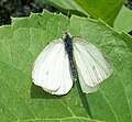 Pieris sp. - geograph.org.uk - 1403625.jpg 640 × 592; 130 KB
-
 Donington South Ing, Donington, Lincs - geograph.org.uk - 217008.jpg 640 × 480; 193 KB
-
-
 Hibaldstow Bridge - geograph.org.uk - 583474.jpg 480 × 640; 61 KB
-
 Charlies, Fleetgate - geograph.org.uk - 215991.jpg 640 × 582; 137 KB
-
-
 Town Bridge, Boston, Lincs - geograph.org.uk - 227523.jpg 640 × 480; 247 KB
-
 Barrow Haven - The Beck - geograph.org.uk - 217465.jpg 478 × 640; 136 KB
-

-
 Barton Library - geograph.org.uk - 221170.jpg 640 × 480; 137 KB
-
 The Hopper Building - geograph.org.uk - 219530.jpg 640 × 480; 127 KB
-
 The Victory Club, Hungate - geograph.org.uk - 219537.jpg 640 × 480; 119 KB
-
 Looking West from the Old Dock - geograph.org.uk - 221354.jpg 640 × 479; 118 KB
-
 Barclays Bank - geograph.org.uk - 222386.jpg 640 × 506; 108 KB
-
 George's Gent's Hairdressing - geograph.org.uk - 281959.jpg 480 × 640; 136 KB
-
 Hasina Indian Take Away - geograph.org.uk - 227697.jpg 380 × 640; 88 KB
-
 The Red Lion Hotel - geograph.org.uk - 222484.jpg 640 × 477; 110 KB
-
 BardneyLock.jpg 1,280 × 960; 463 KB
-
 Track by Spring Wood - geograph.org.uk - 216597.jpg 640 × 480; 69 KB
-
 West Street, Barnetby le Wold - geograph.org.uk - 212725.jpg 640 × 480; 85 KB
-
 Broughton, Lincolnshire.jpg 640 × 480; 56 KB
-
 Slate House from the Fishery - geograph.org.uk - 216595.jpg 640 × 480; 88 KB
-
 Scawby Mill - geograph.org.uk - 216504.jpg 640 × 480; 81 KB
-
 Fields Near Grasby - geograph.org.uk - 217529.jpg 640 × 480; 86 KB
-
 Huntcliff School, Kirton-in-Lindsey - geograph.org.uk - 217217.jpg 640 × 480; 64 KB
-
 Kirton Cliff, Kirton-in-Lindsey - geograph.org.uk - 217186.jpg 640 × 480; 86 KB
-
 Field and Bridge - geograph.org.uk - 214630.jpg 640 × 480; 86 KB
-
 Red Field - geograph.org.uk - 214627.jpg 640 × 480; 102 KB
-
 Long Drove, Hundred Fen, Gosberton, Lincs - geograph.org.uk - 216136.jpg 640 × 480; 199 KB
-
 Harvesting wheat, Quadring Low Fen, Lincs - geograph.org.uk - 217001.jpg 640 × 469; 125 KB
-

-
 North Drove, Quadring Low Fen, Lincs - geograph.org.uk - 217002.jpg 640 × 451; 126 KB
-
 The Viking Way near Marston - geograph.org.uk - 215710.jpg 640 × 427; 83 KB
-
 Wrawby Electricity Sub-station - geograph.org.uk - 216954.jpg 640 × 426; 125 KB
-
 Mick's Cars - geograph.org.uk - 218384.jpg 640 × 480; 106 KB
-
 Field with Goats - geograph.org.uk - 223927.jpg 640 × 465; 112 KB
-
 Conveyor Bridge at South Ferriby - geograph.org.uk - 311479.jpg 640 × 480; 127 KB
-
 Old River Ancholme Sluice - geograph.org.uk - 224788.jpg 480 × 640; 143 KB
-
 Owl Box - geograph.org.uk - 293297.jpg 480 × 640; 143 KB
-
 South Ferriby Lock - geograph.org.uk - 224792.jpg 480 × 640; 102 KB
-
 South Ferriby Marina - geograph.org.uk - 256184.jpg 480 × 640; 92 KB
-
 The Public Footpath to Winterton - geograph.org.uk - 293364.jpg 640 × 480; 118 KB
-
 Ings Lane Signpost - geograph.org.uk - 224783.jpg 480 × 640; 162 KB
-
 Stubble Field with Glider - geograph.org.uk - 223914.jpg 640 × 480; 116 KB
-
 Winterton Ings - geograph.org.uk - 223883.jpg 640 × 480; 132 KB
-
 Chapel Lane, Barrowby - geograph.org.uk - 224787.jpg 640 × 480; 129 KB
-
 Pylon by Barrowby Lodge - geograph.org.uk - 224785.jpg 480 × 640; 88 KB
-

-
 Read's Island - geograph.org.uk - 308738.jpg 640 × 283; 57 KB
-
 The road to Winteringham from the A1077 - geograph.org.uk - 225885.jpg 640 × 480; 106 KB
-
 Channel Buoy 29 - geograph.org.uk - 225833.jpg 480 × 640; 104 KB
-
 Humber - geograph.org.uk - 225813.jpg 640 × 480; 92 KB
-
 Humber View - geograph.org.uk - 225799.jpg 640 × 230; 65 KB
-
 Near Fox Covert. - geograph.org.uk - 225872.jpg 640 × 480; 131 KB
-
 Near South Ferriby Hall - geograph.org.uk - 308622.jpg 640 × 480; 151 KB
-
 Public Footpath to the Humber Bank - geograph.org.uk - 308656.jpg 480 × 640; 165 KB
-
 South Ferriby Cliff - geograph.org.uk - 308684.jpg 480 × 640; 121 KB
-
 South Ferriby Hall - geograph.org.uk - 225791.jpg 640 × 480; 128 KB
-
 The Viking Way - geograph.org.uk - 308639.jpg 640 × 480; 116 KB
-

-
 Donington High Bridge, Donington, Lincs - geograph.org.uk - 227333.jpg 640 × 480; 262 KB
-
 Bales of wheat straw, Laughton, Lincs - geograph.org.uk - 227505.jpg 640 × 480; 295 KB
-

-

-
 Cattle in South Ferriby Hall Park - geograph.org.uk - 226201.jpg 640 × 499; 194 KB
-
 Drain - geograph.org.uk - 327199.jpg 640 × 616; 185 KB
-
 Footpath to Sluice Lane - geograph.org.uk - 327191.jpg 640 × 451; 122 KB
-
 Methodist Chapel - geograph.org.uk - 226189.jpg 640 × 480; 97 KB
-
 Sluice Road, South Ferriby - geograph.org.uk - 226330.jpg 640 × 480; 111 KB
-
 South Ferriby Hall - geograph.org.uk - 226180.jpg 640 × 588; 171 KB
-
 South Ferriby Hall - geograph.org.uk - 231238.jpg 640 × 482; 158 KB
-
 South Ferriby Post Office - geograph.org.uk - 226185.jpg 640 × 480; 103 KB
-
 Road to the Wood - geograph.org.uk - 236198.jpg 640 × 480; 93 KB
-
 Cows and Track - geograph.org.uk - 236212.jpg 640 × 480; 111 KB
-
 Mausoleum Woods - geograph.org.uk - 236205.jpg 640 × 480; 128 KB
-
 Oats and Hedge - geograph.org.uk - 236214.jpg 640 × 480; 113 KB
-
 Roman Fields - geograph.org.uk - 236190.jpg 640 × 480; 101 KB
-
 The Red Lion - geograph.org.uk - 937586.jpg 640 × 427; 56 KB
-
 Humber Defence Pillbox - geograph.org.uk - 223112.jpg 640 × 480; 167 KB
-
 Former Chapel - geograph.org.uk - 230954.jpg 640 × 480; 89 KB
-
 Friskney and Dales - geograph.org.uk - 230952.jpg 640 × 480; 85 KB
-
 Footpath and Stream - geograph.org.uk - 230959.jpg 640 × 480; 120 KB
-
 Horkstow Carrs - geograph.org.uk - 224357.jpg 640 × 480; 84 KB
-
 Horkstow Carrs - geograph.org.uk - 224486.jpg 640 × 480; 95 KB
-
 Saxby All Saints Carrs - geograph.org.uk - 224447.jpg 640 × 480; 75 KB
-
 The House at the end of North Carr Lane - geograph.org.uk - 224466.jpg 640 × 480; 274 KB
-
 Well Turn - geograph.org.uk - 231885.jpg 640 × 480; 91 KB
-
 Humberside International Airport - geograph.org.uk - 281945.jpg 640 × 480; 72 KB
-
 South Ferriby Cliff - geograph.org.uk - 225819.jpg 640 × 480; 100 KB
-
 Footpath to Mill Hill - geograph.org.uk - 225834.jpg 640 × 480; 100 KB
-
 The Beltoft to Belton Road - geograph.org.uk - 225838.jpg 640 × 406; 54 KB
-
 The footpath to Mill Hill Wood - geograph.org.uk - 225840.jpg 640 × 460; 78 KB
-
 The Beltoft to Epworth road. - geograph.org.uk - 225811.jpg 640 × 480; 91 KB
-
 The road to Beltoft - geograph.org.uk - 225809.jpg 640 × 480; 76 KB
-
 Near South Ferriby Cliff - geograph.org.uk - 308671.jpg 640 × 480; 121 KB
-
 Well Lane Trees - geograph.org.uk - 232407.jpg 640 × 480; 142 KB
-
 Humber Bank - geograph.org.uk - 226332.jpg 640 × 480; 107 KB
-
-
 Misty Wheat - geograph.org.uk - 233926.jpg 640 × 480; 97 KB
-
 Withern Methodist Church - geograph.org.uk - 233924.jpg 640 × 480; 74 KB
-
 Priestgate, Barton-Upon-Humber - geograph.org.uk - 226944.jpg 640 × 481; 135 KB
-
 Linga Longa - geograph.org.uk - 235565.jpg 640 × 480; 92 KB
-
 Fleetgate, Barton Upon Humber - geograph.org.uk - 1381238.jpg 640 × 480; 139 KB
-
 High Street - geograph.org.uk - 262648.jpg 640 × 480; 101 KB
-
 Peking Palace Chinese Take Away - geograph.org.uk - 227687.jpg 480 × 640; 114 KB
-
 Queen Street School - geograph.org.uk - 262647.jpg 640 × 480; 121 KB
-
 The Water Margin Chinese Restaurant - geograph.org.uk - 227677.jpg 480 × 640; 114 KB
-
 Grimsby Crown & County Court.jpg 640 × 479; 487 KB
-
 Church of St. Augustine Webster - geograph.org.uk - 229706.jpg 640 × 476; 67 KB
-
 A Humber Tug - geograph.org.uk - 247499.jpg 640 × 480; 104 KB
-
 Aerial view of Castle Wood and Castle Hill.jpg 640 × 427; 57 KB
-
 Authorpe Station - geograph.org.uk - 233890.jpg 640 × 480; 112 KB
-
 Aylesby Lane - geograph.org.uk - 236326.jpg 640 × 480; 103 KB
-
 Brackenholmes Lane, Risby - geograph.org.uk - 216926.jpg 640 × 480; 62 KB
-

-
 Chris Curve, Cadwell Park.jpg 640 × 427; 64 KB
-
 Church of St. Peter, East Halton - geograph.org.uk - 218413.jpg 640 × 465; 124 KB
-
 Corporate Skip - geograph.org.uk - 214636.jpg 640 × 480; 84 KB
-

-
 Farm Track - geograph.org.uk - 225806.jpg 640 × 480; 111 KB
-
 Ford Consul (245215253).jpg 1,024 × 683; 417 KB
-
 Fresh Ploughing - geograph.org.uk - 230802.jpg 640 × 480; 116 KB
-
 George Street - geograph.org.uk - 215499.jpg 640 × 480; 109 KB
-
 TheLincolnImp.jpg 2,592 × 1,944; 2.01 MB
-
 Muddy Waters - geograph.org.uk - 247501.jpg 640 × 480; 105 KB
-
 Neslam Bridge, Pointon, Lincs - geograph.org.uk - 215183.jpg 640 × 480; 351 KB
-
 No. 59 Fleetgate - geograph.org.uk - 222127.jpg 640 × 534; 147 KB
-
 Pasture By The Estuary - geograph.org.uk - 247657.jpg 640 × 480; 102 KB
-
-
 Towards The South Bank - geograph.org.uk - 247488.jpg 640 × 480; 105 KB
-
 Waterside Garden Centre, Greatford, Lincs - geograph.org.uk - 227466.jpg 640 × 480; 266 KB
-
 Field and Cumberworth - geograph.org.uk - 230701.jpg 640 × 480; 136 KB
-

-
 Looking towards Barrow Road - geograph.org.uk - 220923.jpg 640 × 479; 114 KB
-
 Near the Old Brickworks Dock - geograph.org.uk - 221365.jpg 640 × 479; 101 KB
-
 Old Hammond Beck, Frampton West, Lincs - geograph.org.uk - 227561.jpg 640 × 480; 332 KB
-


.jpg)


