Category:August 2006 in County Londonderry
Jump to navigation
Jump to search
English: Images taken in County Londonderry, Northern Ireland in this month of 2006 (not the date of the upload).
| Jan | Feb | Mar | Apr | May | Jun | Jul | Aug | Sep | Oct | Nov | Dec | ||
| ← | 18 | 1 | 11 | 5 | 30 | 10 | 26 | 62 | 4 | 39 | 4 | 18 | → |
|---|
Media in category "August 2006 in County Londonderry"
The following 62 files are in this category, out of 62 total.
-
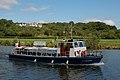 "The Lady Sandel" on the Bann (1) - geograph.org.uk - 220953.jpg 640 × 426; 142 KB
-
 "The Lady Sandel" on the Bann (2) - geograph.org.uk - 220961.jpg 640 × 426; 142 KB
-
 Abandoned cottage at Ballyriff - geograph.org.uk - 226641.jpg 640 × 189; 22 KB
-
 Ardmore - geograph.org.uk - 224922.jpg 640 × 479; 51 KB
-
 Ardmore RC Church - geograph.org.uk - 224920.jpg 640 × 479; 51 KB
-
 Art Gallery, Coleraine - geograph.org.uk - 222948.jpg 329 × 480; 36 KB
-
 Articlave - geograph.org.uk - 222954.jpg 640 × 479; 56 KB
-
 Articlave Orange Hall - geograph.org.uk - 222953.jpg 640 × 491; 48 KB
-
 Ballyneal Orange Hall - geograph.org.uk - 226633.jpg 640 × 479; 54 KB
-
 Ballyreagh - geograph.org.uk - 222453.jpg 640 × 479; 49 KB
-
 Ballyriff Townland - geograph.org.uk - 226639.jpg 640 × 479; 51 KB
-
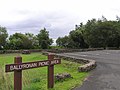 Ballyronan Picnic area - geograph.org.uk - 226652.jpg 640 × 479; 56 KB
-
 Ballyronan Picnic area - geograph.org.uk - 226655.jpg 640 × 479; 91 KB
-
 Ballyronan village.jpg 640 × 297; 28 KB
-

-
-
 Barn at Carnfarn - geograph.org.uk - 224873.jpg 640 × 479; 59 KB
-
 Binevenagh - geograph.org.uk - 213510.jpg 640 × 426; 130 KB
-
 Brookmount Road - geograph.org.uk - 226637.jpg 640 × 479; 77 KB
-
 Carrickatane Townland - geograph.org.uk - 224832.jpg 640 × 479; 82 KB
-

-
 Cloverhill Road - geograph.org.uk - 226631.jpg 640 × 479; 65 KB
-
 Coleraine Diamond.jpg 1,200 × 1,600; 1.11 MB
-
 Coleraine Monument - geograph.org.uk - 222950.jpg 359 × 480; 40 KB
-
 Coleraine Townhall - geograph.org.uk - 222949.jpg 268 × 480; 28 KB
-
 Colley's Restaurant - geograph.org.uk - 222969.jpg 640 × 479; 45 KB
-
 Crab Isle - geograph.org.uk - 238557.jpg 640 × 314; 53 KB
-
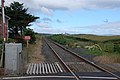
 Cromore level crossing near Portstewart - geograph.org.uk - 219769.jpg 640 × 426; 136 KB
-
 Cromore station near Portstewart - geograph.org.uk - 219758.jpg 640 × 426; 124 KB
-
 Desertmartin RC Church - geograph.org.uk - 222317.jpg 640 × 479; 56 KB
-
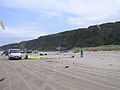 Downhill beach - geograph.org.uk - 222958.jpg 640 × 479; 39 KB
-
 Downhill beach, Co. Londonderry - geograph.org.uk - 222957.jpg 640 × 479; 32 KB
-
 Downhill Strand, Derry - Londonderry - geograph.org.uk - 222956.jpg 640 × 478; 29 KB
-
 Downhill Strand, Derry - Londonderry - geograph.org.uk - 222960.jpg 640 × 479; 30 KB
-
 Fruit and Veg Stall near Maghera - geograph.org.uk - 232287.jpg 640 × 427; 65 KB
-
 Garvagh - geograph.org.uk - 216716.jpg 640 × 283; 32 KB
-
 Gortgranagh Townland - geograph.org.uk - 224915.jpg 640 × 479; 57 KB
-
 Lifeguard on duty - geograph.org.uk - 222955.jpg 640 × 479; 37 KB
-
 Maghera Church - geograph.org.uk - 222328.jpg 640 × 479; 70 KB
-
 Maghera Presbyterian Church - geograph.org.uk - 222322.jpg 307 × 480; 21 KB
-
 Moneymore Presbyterian Church - geograph.org.uk - 222315.jpg 640 × 479; 65 KB
-
 Moneymore RC Church - geograph.org.uk - 226618.jpg 359 × 480; 22 KB
-
 Movanagher lock, Lower Bann navigation - geograph.org.uk - 229890.jpg 640 × 426; 132 KB
-

-
-
 Pedestrian bridge, Coleraine - geograph.org.uk - 222947.jpg 640 × 479; 57 KB
-
 Portstewart harbour - geograph.org.uk - 219818.jpg 640 × 426; 155 KB
-
 Rankin Memorial Orange Hall.jpg 640 × 484; 49 KB
-
 River Bann at Hutchinson's Quay - geograph.org.uk - 220928.jpg 640 × 426; 139 KB
-
 River Bann, Coleraine (1) - geograph.org.uk - 219721.jpg 640 × 426; 142 KB
-
 River bridge near Castlerock - geograph.org.uk - 213321.jpg 640 × 426; 153 KB
-
 Springhill House, Moneymore.jpg 640 × 479; 56 KB
-
 Spuds for sale at Ballyronan - geograph.org.uk - 226644.jpg 640 × 479; 52 KB
-
 St Patrick's, Coleraine - geograph.org.uk - 219638.jpg 640 × 426; 153 KB
-
 Sunset at Portstewart Strand - geograph.org.uk - 222461.jpg 359 × 480; 21 KB
-
 Sunset at Portstewart Strand - geograph.org.uk - 222464.jpg 640 × 479; 27 KB
-
-
 The Burnside roundabout, Portstewart - geograph.org.uk - 229814.jpg 640 × 426; 116 KB
-
 The Promenade, Portstewart - geograph.org.uk - 219905.jpg 640 × 426; 128 KB
-
 The train now passing . . . - geograph.org.uk - 213481.jpg 640 × 426; 129 KB
-
 Ulster Bank, Maghera - geograph.org.uk - 222324.jpg 640 × 479; 53 KB
-
 Warbleshinny.jpg 640 × 479; 56 KB
_-_geograph.org.uk_-_220953.jpg)
_-_geograph.org.uk_-_220961.jpg)


_-_geograph.org.uk_-_213332.jpg)
_-_geograph.org.uk_-_213340.jpg)


_-_geograph.org.uk_-_219697.jpg)


_-_geograph.org.uk_-_219721.jpg)


