Category:Auchentiber, North Ayrshire
Jump to navigation
Jump to search
village in North Ayrshire, Scotland, UK  | |||||
| Upload media | |||||
| Instance of | |||||
|---|---|---|---|---|---|
| Location |
| ||||
 | |||||

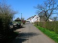
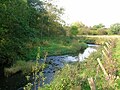
English: The hamlet of Auchentiber is in North Ayrshire, Parish of Kilwinning, Scotland. Auchentiber is from the village of Barrmill. Grid Ref. NS3647. Some new housing has been built, but the settlement is still very much a hamlet. The settlement is on the Lugton Water, which runs into the River Garnock after running through Montgreenan and Eglinton Country Park in Irvine.
Subcategories
This category has the following 5 subcategories, out of 5 total.
Media in category "Auchentiber, North Ayrshire"
The following 78 files are in this category, out of 78 total.
-
 Auchenamde loading dock.JPG 2,288 × 1,712; 1.33 MB
-
 Auchenmade brickworks infrastructure.JPG 2,288 × 1,712; 1.27 MB
-
 Auchenmade brickworks office.JPG 2,288 × 1,712; 1.35 MB
-
 Auchenmade factory office.JPG 2,288 × 1,712; 1.3 MB
-
 Auchenmade managers house.JPG 2,288 × 1,712; 1.27 MB
-
 Auchenmade station 2008.jpg 4,304 × 2,560; 2.14 MB
-
 Auchenmsde clay pit.JPG 2,288 × 1,712; 1.32 MB
-
 Auchentiber Ford site, Lugton Water, East Ayrshire.jpg 4,870 × 2,105; 1.65 MB
-
 Auchentiber Main Street.jpg 2,288 × 1,712; 1.3 MB
-
 Auchentiberlugtonwater.JPG 2,288 × 1,712; 1.3 MB
-
 Auchentibermoss.JPG 2,288 × 1,712; 1.33 MB
-
 Auchentiberschool.JPG 2,288 × 1,712; 1.29 MB
-
 B778 at A736 - geograph.org.uk - 1805016.jpg 2,180 × 1,405; 1.04 MB
-
 B778 towards Wardlaw - geograph.org.uk - 1769221.jpg 1,632 × 1,224; 918 KB
-
 B778, Kilwinning-Auchentiber Road - geograph.org.uk - 1715801.jpg 3,648 × 2,736; 3.01 MB
-
 B778, Stewarton Road - geograph.org.uk - 1722238.jpg 3,648 × 2,736; 4.19 MB
-
 B778, Stewarton Road - geograph.org.uk - 1737059.jpg 3,648 × 2,736; 2.98 MB
-
 B778, Stewarton Road - geograph.org.uk - 1737064.jpg 3,648 × 2,736; 2.75 MB
-
 Blairtavernauchentiber.JPG 2,288 × 1,712; 1.25 MB
-
 Bloak Wood Art.JPG 1,712 × 2,288; 1.34 MB
-
 Bloakmoss1.JPG 2,288 × 1,712; 1.27 MB
-
 Bloakwell.jpg 875 × 528; 55 KB
-
 Blue Barns - geograph.org.uk - 96255.jpg 640 × 479; 63 KB
-
 Bridge over small burn - geograph.org.uk - 1426566.jpg 640 × 480; 92 KB
-
 Burn and Bridge, B778 Road - geograph.org.uk - 1722080.jpg 3,648 × 2,736; 3.49 MB
-
 Cleikuminnsite.JPG 2,288 × 1,712; 1.31 MB
-
 Country Road - geograph.org.uk - 1722073.jpg 3,648 × 2,736; 3.33 MB
-
 Crossgates - geograph.org.uk - 261999.jpg 640 × 480; 64 KB
-
 Crossgates farm - geograph.org.uk - 261995.jpg 640 × 480; 56 KB
-
 Farmland - geograph.org.uk - 174885.jpg 640 × 480; 52 KB
-
 Farmland near Ward Farm - geograph.org.uk - 1737067.jpg 3,648 × 2,736; 3.25 MB
-
 Field - geograph.org.uk - 96248.jpg 640 × 479; 100 KB
-
 Gallinago gallinago MHNT.jpg 3,302 × 3,061; 3.62 MB
-
 Hall Burn - geograph.org.uk - 1716509.jpg 2,736 × 3,648; 5.58 MB
-
 Hall Burn - geograph.org.uk - 1716514.jpg 2,736 × 3,648; 4.56 MB
-
 Hillside - geograph.org.uk - 102881.jpg 640 × 479; 103 KB
-
 Lochliboroad.JPG 2,288 × 1,712; 1.31 MB
-
 Lugtonwaterauchentiberford.JPG 2,288 × 1,712; 1.36 MB
-
 Megswells Bridge - geograph.org.uk - 1716491.jpg 3,648 × 2,736; 4.31 MB
-
 Minor road south of Auchentiber - geograph.org.uk - 3361065.jpg 5,184 × 3,456; 7.37 MB
-
 Minor road west of Auchentiber Bridge - geograph.org.uk - 3360847.jpg 5,184 × 3,456; 7.05 MB
-
 Montgreenanbridge1.JPG 2,288 × 1,712; 1.3 MB
-
 Mosside farm.JPG 2,288 × 1,712; 1.38 MB
-
 Mossideauchentiber.JPG 2,288 × 1,712; 1.26 MB
-
 Mound Wood, details of dyrstone dyking.JPG 4,608 × 3,456; 9.15 MB
-
 Mound Wood, Kennox Moss, Ayrshire.JPG 4,197 × 2,536; 3.06 MB
-
 Mound Wood, Kennox Moss, View from the north.JPG 4,300 × 2,573; 4.12 MB
-
 Mound Wood, Kennox Moss, west facing side.JPG 4,604 × 3,452; 5.43 MB
-
 Nettlehirst Farm byre, North Ayrshire.JPG 2,288 × 1,712; 1.38 MB
-
 Nettlehirst farm, North Ayrshire.JPG 2,288 × 1,712; 1.32 MB
-
 Old Auchentiber School, Auchentiber, North Ayrshire.jpg 4,455 × 2,740; 2.87 MB
-
 Old farm track - geograph.org.uk - 171112.jpg 640 × 480; 50 KB
-
 Quiet Country Road - geograph.org.uk - 1428595.jpg 640 × 480; 41 KB
-
 Red Barn - geograph.org.uk - 96388.jpg 640 × 479; 61 KB
-
 Redwells Ford, Auchentiber.JPG 4,608 × 3,456; 3.59 MB
-
 Rough Grazing - geograph.org.uk - 1716501.jpg 3,648 × 2,736; 4.31 MB
-
 Scots Pine - geograph.org.uk - 1715881.jpg 2,736 × 3,648; 3.87 MB
-
 Smithyauchentiber.JPG 2,288 × 1,712; 1.23 MB
-
 South Auchenmade overbridge.jpg 5,392 × 2,960; 3.13 MB
-
 Spout Linn Bridge - geograph.org.uk - 1722067.jpg 3,648 × 2,736; 4.89 MB
-
 Undulations - geograph.org.uk - 96266.jpg 640 × 479; 80 KB
-
 West Lambroughton - geograph.org.uk - 174815.jpg 640 × 480; 67 KB
-
 BandB - geograph.org.uk - 160090.jpg 640 × 479; 83 KB
-
 Buistonend Farm - geograph.org.uk - 264106.jpg 640 × 480; 90 KB
-
 Buistonhead - geograph.org.uk - 263908.jpg 640 × 480; 71 KB
-
 Farm entrance - geograph.org.uk - 243479.jpg 640 × 427; 74 KB
-
 Fields - geograph.org.uk - 94590.jpg 640 × 479; 94 KB
-
 Greenlee Farm - geograph.org.uk - 183405.jpg 640 × 480; 81 KB
-
 Iron gate - geograph.org.uk - 243482.jpg 640 × 427; 88 KB
-
 Langlands Farm - geograph.org.uk - 174808.jpg 640 × 480; 100 KB
-
 Merryhagen Farm - geograph.org.uk - 183403.jpg 640 × 480; 70 KB
-
 Mid Buiston Farm - geograph.org.uk - 264108.jpg 640 × 480; 86 KB
-
 Sevenacres Wood - geograph.org.uk - 94574.jpg 640 × 479; 85 KB
-
 Sourlie Wood - geograph.org.uk - 125221.jpg 640 × 479; 179 KB
-
 Tyre Tracks - geograph.org.uk - 94592.jpg 479 × 640; 83 KB
-
 Wooded Track - geograph.org.uk - 263914.jpg 480 × 640; 154 KB
-
 Woodland - geograph.org.uk - 102935.jpg 640 × 479; 96 KB
-
 Woodland Track - geograph.org.uk - 94573.jpg 640 × 479; 142 KB


