Category:Astwood Bank
Jump to navigation
Jump to search
village in Worcestershire, United Kingdom  | |||||
| Upload media | |||||
| Instance of | |||||
|---|---|---|---|---|---|
| Location | Redditch, Worcestershire, West Midlands, England | ||||
 | |||||
Media in category "Astwood Bank"
The following 36 files are in this category, out of 36 total.
-
 "The Stables" farm shop. - geograph.org.uk - 1508060.jpg 640 × 360; 80 KB
-
 Astwood Bank Allotments.jpg 2,592 × 4,608; 2.79 MB
-
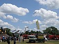 Astwood Bank Steam and Country Fair - geograph.org.uk - 1355901.jpg 640 × 480; 64 KB
-
 Astwood Bank Steam and Country Fair - geograph.org.uk - 1355917.jpg 640 × 480; 85 KB
-
 Astwood Farm - geograph.org.uk - 635127.jpg 640 × 480; 59 KB
-
 Claas Challenger 75E at Astwood Bank 09 - IMG 3391.jpg 2,256 × 1,504; 1.95 MB
-
 Cookhill Allotments - geograph.org.uk - 438053.jpg 640 × 480; 76 KB
-
 County Sea Horse at Astwood Bank - geograph.org.uk - 1372507.jpg 640 × 480; 106 KB
-
 Edgioake Lane, Astwood Bank - geograph.org.uk - 51913.jpg 640 × 480; 60 KB
-
 Evesham Road, Astwood Bank - geograph.org.uk - 7371.jpg 640 × 480; 93 KB
-
 Fowler Steam Roller, Astwood Bank - geograph.org.uk - 1373563.jpg 640 × 480; 101 KB
-

-
 House on the Ridageway - geograph.org.uk - 438031.jpg 640 × 480; 86 KB
-
 Never Forgotten (15725158986).jpg 5,456 × 3,632; 9.57 MB
-
 Old plant machines, Astwood Bank - geograph.org.uk - 1373581.jpg 640 × 480; 97 KB
-
 Sign for the Nevill Arms, New End (geograph 5348066).jpg 499 × 640; 80 KB
-
 The Green, Sambourne - geograph.org.uk - 163008.jpg 640 × 480; 336 KB
-
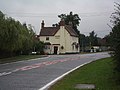 The Nevill Arms, New End - geograph.org.uk - 51912.jpg 640 × 480; 60 KB
-
 View from the Ridgeway - geograph.org.uk - 438040.jpg 640 × 480; 96 KB
-

-
 Astwood Business Park - geograph.org.uk - 635117.jpg 640 × 480; 65 KB
-
 Astwood developments - geograph.org.uk - 635121.jpg 640 × 480; 58 KB
-
 Astwood Farm - geograph.org.uk - 7625.jpg 640 × 397; 60 KB
-
 Blue Remembered Hills - geograph.org.uk - 7269.jpg 640 × 480; 67 KB
-
 Butler's Coppice - geograph.org.uk - 160692.jpg 640 × 480; 313 KB
-
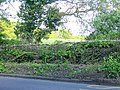 Laid Hedge - geograph.org.uk - 7627.jpg 640 × 480; 163 KB
-
 Oak Tree Lane crossroads, Sambourne - geograph.org.uk - 160689.jpg 640 × 480; 304 KB
-
 Oak Tree Lane, Sambourne - geograph.org.uk - 163127.jpg 640 × 480; 262 KB
-
 Perrymill Lane, Sambourne - geograph.org.uk - 163130.jpg 640 × 480; 318 KB
-
 Ridgeway - geograph.org.uk - 10913.jpg 640 × 568; 155 KB
-
 The Saltway - geograph.org.uk - 8687.jpg 480 × 640; 116 KB
-
 The Why Not - geograph.org.uk - 438015.jpg 640 × 480; 64 KB
-
 View from Alcester Warren - geograph.org.uk - 160690.jpg 640 × 480; 318 KB
-
 View towards New End - geograph.org.uk - 140229.jpg 640 × 480; 250 KB
-
 Weavers Hill - geograph.org.uk - 7626.jpg 640 × 418; 118 KB
-
 Whitemoor Road, Sambourne - geograph.org.uk - 163131.jpg 640 × 480; 287 KB


.jpg)

.jpg)


