Category:Ashton-in-Makerfield
Jump to navigation
Jump to search
English: Ashton-in-Makerfield is a town within the Metropolitan Borough of Wigan, in Greater Manchester, England. It lies in the historic Hundred of Makerfield, west of the city of Manchester. In 2021 it has a population of 29852.
Italiano: Ashton-in-Makerfield è una cittadina di 29.852 abitanti della contea della Greater Manchester, in Inghilterra.
Nederlands: Ashton-in-Makerfield is een plaats in het bestuurlijke gebied Wigan, in het Engelse graafschap Greater Manchester. De plaats telt 29.852 inwoners.
Norsk bokmål: Ashton-in-Makerfield (tidligere Ashton-in-the-Willows) er en by i Stor-Manchester, England. Den tilhørte tidligere Lancashire.
Polski: Ashton-in-Makerfield - miasto w Wielkiej Brytanii, w Anglii, w regionie North West England, w hrabstwie Greater Manchester. W 2001r. miasto to zamieszkiwało 29 852 osób.
Română: Ashton-in-Makerfield este un oraş în comitatul Greater Manchester, regiunea North West England, Anglia. Oraşul se află în districtul metropolitan Wigan.
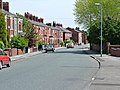
town in Wigan, Greater Manchester, UK  Gerard Street, Ashton-in-Makerfield | |||||
| Upload media | |||||
| Instance of | |||||
|---|---|---|---|---|---|
| Location | Wigan, Greater Manchester, North West England, England | ||||
 | |||||
Subcategories
This category has the following 16 subcategories, out of 16 total.
A
B
G
J
P
S
T
W
Media in category "Ashton-in-Makerfield"
The following 112 files are in this category, out of 112 total.
-
 603 Strawberry bus on Low Bank Road, Ashton-in-Makerfield.jpg 4,320 × 3,240; 3.39 MB
-
 A deserted play area on Golbourne Road - geograph.org.uk - 1579554.jpg 640 × 426; 104 KB
-
 A49 in Ashton-in-Makerfield geograph-3240085-by-Ben-Brooksbank.jpg 2,392 × 1,412; 3.7 MB
-
 Alexandra Road, Ashton - geograph.org.uk - 3335672.jpg 1,024 × 742; 141 KB
-
 Almost 3 o'clock at Edge Green Street, Ashton Town FC - geograph.org.uk - 5369425.jpg 3,456 × 2,304; 7.62 MB
-
 Ashton Cross Lodge - geograph.org.uk - 920734.jpg 640 × 423; 155 KB
-
 Ashton Golf Club gates - geograph.org.uk - 920731.jpg 640 × 422; 262 KB
-
 Ashton Heath - geograph.org.uk - 920721.jpg 640 × 443; 174 KB
-
 Ashton Heath - geograph.org.uk - 920723.jpg 640 × 419; 167 KB
-
 Ashton Heath - geograph.org.uk - 924491.jpg 640 × 425; 158 KB
-
 Ashton Heath - geograph.org.uk - 924494.jpg 640 × 425; 163 KB
-
 Ashton in Makerfield - Ashton Market.jpg 640 × 426; 196 KB
-
 Ashton Market - geograph.org.uk - 922250.jpg 640 × 426; 234 KB
-
 Ashton Market on Christmas Day, 2011 - geograph.org.uk - 2741043.jpg 640 × 480; 75 KB
-
 Ashton-in-Makerfield , M6 Motorway - geograph.org.uk - 6298059.jpg 6,000 × 4,000; 5.5 MB
-
 Ashton-in-Makerfield , M6 Motorway - geograph.org.uk - 6298060.jpg 6,000 × 4,000; 5.49 MB
-
 Ashton-in-Makerfield , M6 Motorway - geograph.org.uk - 6298061.jpg 6,000 × 4,000; 5.33 MB
-
 Ashton-in-Makerfield , M6 Motorway - geograph.org.uk - 6298064.jpg 6,000 × 4,000; 5.42 MB
-
 Ashton-in-Makerfield , M6 Motorway - geograph.org.uk - 6298065.jpg 6,000 × 4,000; 5.3 MB
-
 Ashton-in-Makerfield - Wigan dot.png 417 × 599; 122 KB
-
 Autumn Path - Ashton - geograph.org.uk - 924503.jpg 640 × 437; 227 KB
-
 Report 1896 (IA b28812219).pdf 1,197 × 1,947, 14 pages; 903 KB
-

-
 Brocstedes Road, Downall Green - geograph.org.uk - 5311410.jpg 1,024 × 769; 333 KB
-
 Bryn Hall - geograph.org.uk - 921748.jpg 640 × 452; 232 KB
-
 Bryn Hall from Bryn Gates Lane - geograph.org.uk - 921750.jpg 640 × 428; 163 KB
-
 Carrmill dam sandy bay - panoramio.jpg 3,264 × 2,448; 3.83 MB
-
 Changing rooms, Edge Green Street, Ashton Town FC - geograph.org.uk - 5369417.jpg 2,246 × 3,368; 7.11 MB
-

-
 Crompton's Pond - geograph.org.uk - 923921.jpg 640 × 424; 182 KB
-
 Damsels at Three Sisters Wetlands - geograph.org.uk - 3573199.jpg 564 × 800; 72 KB
-
 Dismantled Railway at Ashton Heath - geograph.org.uk - 5912966.jpg 1,024 × 768; 421 KB
-
 Edge Green Road - geograph.org.uk - 3334332.jpg 640 × 480; 84 KB
-

-
 Entrance to Cansfield High School, Ashton-in-Makerfield.jpg 4,320 × 3,240; 4.65 MB
-
 Entrance to Skitters Wood from Woodedge - geograph.org.uk - 4802365.jpg 640 × 481; 641 KB
-
 Every which way... - geograph.org.uk - 884715.jpg 426 × 640; 54 KB
-
 Farmland off Ashton heath - geograph.org.uk - 924495.jpg 640 × 429; 158 KB
-
 Farmland off Edge Green Road - geograph.org.uk - 3334331.jpg 640 × 480; 77 KB
-
 Farmland off Riding Lane - geograph.org.uk - 3334339.jpg 640 × 480; 79 KB
-

-
 Footbridge over M6 at Long Covert, Downall Green - geograph.org.uk - 4351281.jpg 1,024 × 768; 420 KB
-
 Footpath between Town Green and Edge Green - geograph.org.uk - 5912938.jpg 1,024 × 768; 222 KB
-

-
 Gated track off Riding Lane - geograph.org.uk - 3334337.jpg 640 × 480; 78 KB
-
 General view, Edge Green Street, Ashton Town FC - geograph.org.uk - 5369410.jpg 3,396 × 2,252; 7.61 MB
-
 Goalmouth action at Edge Green Street, Ashton Town FC - geograph.org.uk - 5369431.jpg 3,380 × 2,196; 6.24 MB
-
 Golborne Road - geograph.org.uk - 3387048.jpg 640 × 480; 72 KB
-
 Golborne Road approaches Bolton Road - geograph.org.uk - 3387049.jpg 640 × 480; 61 KB
-
 Golborne Road, Edge Green - geograph.org.uk - 6217328.jpg 800 × 600; 615 KB
-

-
 Heath Road - geograph.org.uk - 924513.jpg 640 × 480; 201 KB
-
 Heath Road, Ashton-in-Makerfield - geograph.org.uk - 3335689.jpg 1,200 × 900; 261 KB
-
 Heron and swans at Three Sisters - geograph.org.uk - 918091.jpg 640 × 530; 228 KB
-
 Houghwood Grange, Ashton-in-Makerfield - geograph.org.uk - 2741034.jpg 640 × 480; 125 KB
-

-
 Houses on Wigan Road, Ashton-in-Makerfield.jpg 4,320 × 3,240; 3.8 MB
-
 Knowsley and Croxteth Country Park - geograph.org.uk - 4676969.jpg 3,264 × 2,448; 4.41 MB
-
 Landgate Lodges - geograph.org.uk - 920877.jpg 640 × 445; 280 KB
-
 Landgate Lodges - geograph.org.uk - 920881.jpg 640 × 461; 167 KB
-

-
 M6 Footbridge, Ashton-in-Makerfield - geograph.org.uk - 2076422.jpg 640 × 480; 185 KB
-
 M6 Motorway northbound by Junction 24 entry slip (geograph 6774474).jpg 1,800 × 1,200; 162 KB
-

-
 Millingford Brook, Ashton Heath - geograph.org.uk - 5911786.jpg 817 × 1,024; 422 KB
-

-
 Old Road - geograph.org.uk - 1579565.jpg 640 × 426; 108 KB
-
 Park off Wigan Road, Ashton - geograph.org.uk - 3335678.jpg 640 × 480; 96 KB
-
 Path on Ashton Heath - geograph.org.uk - 5911792.jpg 1,024 × 768; 257 KB
-
 Path Through Skitters Wood - geograph.org.uk - 4802376.jpg 640 × 481; 710 KB
-
 Pit Pony pub, Ashton-in-Makerfield.jpg 4,320 × 3,240; 2.91 MB
-
 Private fishing at Garswood Hall - geograph.org.uk - 1616221.jpg 640 × 426; 77 KB
-
 Quo vadis^ - geograph.org.uk - 83142.jpg 640 × 426; 98 KB
-
 Restricted standing, Edge Green Street, Ashton Town FC - geograph.org.uk - 5369392.jpg 2,304 × 3,456; 4.66 MB
-
 Riding Lane - geograph.org.uk - 3334341.jpg 640 × 480; 57 KB
-
 Ryecroft Farm - geograph.org.uk - 754640.jpg 640 × 479; 112 KB
-
 Saint Thomas, Ashton in Makerfield - geograph.org.uk - 2399794.jpg 800 × 600; 236 KB
-
 Shops in Gerrard Street - geograph.org.uk - 3611077.jpg 800 × 451; 200 KB
-
 Side gate, Edge Green Street, Ashton Town FC - geograph.org.uk - 5369402.jpg 3,456 × 2,304; 4.66 MB
-
 Skitters Wood Sign - geograph.org.uk - 4802366.jpg 640 × 480; 476 KB
-

-
 Skitters Wood, Millingford Brook - geograph.org.uk - 4802381.jpg 640 × 481; 633 KB
-

-
 South Lancashire Industrial Estate - geograph.org.uk - 1579545.jpg 640 × 426; 116 KB
-
 Spectator cover, Edge Green Street, Ashton Town FC - geograph.org.uk - 5369359.jpg 3,456 × 2,304; 5.31 MB
-
 Spectator cover, Edge Green Street, Ashton Town FC - geograph.org.uk - 5369369.jpg 3,456 × 2,304; 7.28 MB
-
 Spectators, Edge Green Street, Ashton Town FC - geograph.org.uk - 5369435.jpg 3,456 × 2,304; 6.7 MB
-
 St Thomas church on Warrington Road - geograph.org.uk - 2059809.jpg 1,600 × 1,112; 390 KB
-
 St. Oswalds Catholic Club, Ashton-in-Makerfield.jpg 4,320 × 3,240; 3.88 MB
-

-
 Stubshaw Cross - geograph.org.uk - 961498.jpg 640 × 425; 120 KB
-
 The bridge at Dover Lock - geograph.org.uk - 146294.jpg 640 × 426; 118 KB
-
 The Gerard Centre - geograph.org.uk - 922260.jpg 640 × 467; 166 KB
-
 The M6 motorway from Low Bank Road, Ashton-in-Makerfield.jpg 4,320 × 3,240; 3.1 MB
-
 The Planting of Viridor Wood 2003 - geograph.org.uk - 2257948.jpg 1,568 × 792; 214 KB
-
 The track to Dam Lane Farm at Edge Green - geograph.org.uk - 1739094.jpg 4,592 × 3,056; 3.49 MB
-
 Three Sisters Motor Racing Circuit - geograph.org.uk - 3905892.jpg 1,440 × 1,080; 544 KB
-
 Three Sisters Motor Racing Circuit - geograph.org.uk - 3905893.jpg 1,440 × 1,080; 674 KB
-
 Three Sisters Visitor's Centre - geograph.org.uk - 921699.jpg 640 × 426; 166 KB
-
 Traffic Light Junction at the end of the B5207 - geograph.org.uk - 2735190.jpg 4,000 × 2,645; 4.1 MB
-
 Tudor Style Housing, Wigan Road - geograph.org.uk - 922257.jpg 640 × 425; 162 KB
-
 Turnstile at Edge Green Street, Ashton Town FC - geograph.org.uk - 5369337.jpg 3,212 × 2,120; 6.15 MB
-
 Tyrers Lane Ashton - geograph.org.uk - 924486.jpg 640 × 428; 251 KB
-
 Violet Street - geograph.org.uk - 924512.jpg 640 × 480; 171 KB
-
 Viridor Wood from Riding Lane - geograph.org.uk - 923849.jpg 640 × 425; 138 KB
-
 Warrington Road, Ashton-in-Makerfield - geograph.org.uk - 606600.jpg 640 × 480; 169 KB
-
 Warrington Road, Ashton-in-Makerfield.jpg 3,462 × 5,198; 23.97 MB
-
 Wigan Road, Ashton - geograph.org.uk - 922252.jpg 640 × 428; 146 KB
-
 Wigan Road, Ashton-in-Makerfield - geograph.org.uk - 2197611.jpg 640 × 480; 99 KB
-
 Wotton Drive joining Golborne Road - geograph.org.uk - 5841451.jpg 1,024 × 768; 461 KB
-
 Wotton Drive, looking south-west - geograph.org.uk - 5841449.jpg 1,024 × 768; 444 KB
-
 YMCA-Yale training centre, Ashton-in-Makerfield.jpg 4,320 × 3,240; 3.07 MB


.jpg)


