Category:Ashill, Norfolk
Jump to navigation
Jump to search
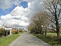
English: Ashill is a village and civil parish in the English county of Norfolk. The village is between Watton and Swaffham.
village and civil parish in the English county of Norfolk  | |||||
| Upload media | |||||
| Instance of | |||||
|---|---|---|---|---|---|
| Location | Breckland, Norfolk, East of England, England | ||||
| Population |
| ||||
| Area |
| ||||
 | |||||
Subcategories
This category has the following 3 subcategories, out of 3 total.
E
N
W
Media in category "Ashill, Norfolk"
The following 200 files are in this category, out of 216 total.
(previous page) (next page)-
 "No dig" notice on field headland - geograph.org.uk - 6109645.jpg 3,456 × 2,592; 3.88 MB
-
 A few of the free range chickens kept here - geograph.org.uk - 6086966.jpg 1,024 × 769; 266 KB
-
 Agricultural Crops - geograph.org.uk - 6206437.jpg 1,024 × 768; 157 KB
-
 Agricultural landscape - geograph.org.uk - 6099410.jpg 1,024 × 769; 216 KB
-
 Agricultural landscape - geograph.org.uk - 6206448.jpg 1,024 × 768; 162 KB
-
 Alternative path - geograph.org.uk - 6061795.jpg 1,024 × 769; 234 KB
-
 Approaching Quidney Farm - geograph.org.uk - 278759.jpg 640 × 480; 92 KB
-
 Arable crop - geograph.org.uk - 6116282.jpg 1,024 × 768; 207 KB
-
 Arable crop adjasent estate road - geograph.org.uk - 6186476.jpg 1,024 × 768; 176 KB
-
 Arable field - geograph.org.uk - 6086977.jpg 1,024 × 769; 285 KB
-
 Arable field - geograph.org.uk - 6087027.jpg 1,024 × 769; 207 KB
-
 Arable field and hedge - geograph.org.uk - 6116298.jpg 1,024 × 768; 194 KB
-
 Arable field opposite Lodge Farm - geograph.org.uk - 6086959.jpg 1,024 × 769; 283 KB
-
 Arable landscape with wind turbines in distance - geograph.org.uk - 6099415.jpg 1,024 × 769; 195 KB
-
 Ashill Common - geograph.org.uk - 6109675.jpg 3,456 × 2,592; 3.95 MB
-
 Ashill Common boundary - geograph.org.uk - 6060082.jpg 769 × 1,024; 234 KB
-
 Ashill Common looking towards car park - geograph.org.uk - 6060035.jpg 1,024 × 769; 202 KB
-
 Ashill Common path - geograph.org.uk - 6013021.jpg 4,592 × 3,448; 1.39 MB
-
 Ashill Common sign - geograph.org.uk - 6013004.jpg 3,654 × 3,232; 858 KB
-
 Ashill village sign (north face) - geograph.org.uk - 6803744.jpg 2,785 × 2,785; 2.61 MB
-
 Ashill village sign (south face) - geograph.org.uk - 6803739.jpg 1,492 × 1,492; 821 KB
-
 Ashill village sign - geograph.org.uk - 5424428.jpg 800 × 519; 126 KB
-
 Ashill village sign - geograph.org.uk - 6803751.jpg 4,608 × 3,072; 5.45 MB
-
 Ashill village sign - geograph.org.uk - 6803754.jpg 4,608 × 3,072; 5.65 MB
-
 Attractive flint bungalow at Ashill - geograph.org.uk - 6109621.jpg 2,961 × 2,223; 1.85 MB
-
 Bank of Gorse - geograph.org.uk - 6091378.jpg 1,024 × 769; 343 KB
-
 Battlefield cross of Cpl. Frederick Cater - geograph.org.uk - 6604361.jpg 2,592 × 3,456; 2.78 MB
-
 Battlefield cross of Lt. K G Ford - geograph.org.uk - 6604294.jpg 2,592 × 3,456; 2.92 MB
-
 Becoming overcast on the Peddars Way - geograph.org.uk - 6109481.jpg 3,456 × 2,592; 2.31 MB
-
 Bend in a ditch - geograph.org.uk - 6060246.jpg 1,024 × 769; 379 KB
-
 Bend in the road - geograph.org.uk - 6205495.jpg 1,024 × 768; 324 KB
-
 Boundary of Ashill Common - geograph.org.uk - 6060033.jpg 1,024 × 769; 251 KB
-
 Camp site entrance - geograph.org.uk - 6086987.jpg 1,024 × 769; 217 KB
-
 Camp site sign - geograph.org.uk - 6086986.jpg 1,024 × 769; 180 KB
-
 Caravan site - geograph.org.uk - 6086980.jpg 1,024 × 769; 172 KB
-
 Caudle Hill and Watton Road junction - geograph.org.uk - 5422703.jpg 800 × 566; 124 KB
-
 Cereal crop - geograph.org.uk - 6116279.jpg 1,024 × 768; 182 KB
-
 Cereal crop - geograph.org.uk - 6186447.jpg 1,024 × 768; 245 KB
-
 Commemorative plaque - geograph.org.uk - 6013048.jpg 4,592 × 3,448; 1.7 MB
-
 Commonplace - geograph.org.uk - 293946.jpg 640 × 480; 95 KB
-
 Cottages facing the Green, Ashill. - geograph.org.uk - 1178888.jpg 640 × 480; 82 KB
-
 Cottages on Cressingham Road, Ashill - geograph.org.uk - 6109609.jpg 3,456 × 2,592; 3.85 MB
-
 Cressingham Road and English Oaks - geograph.org.uk - 6109556.jpg 3,456 × 2,592; 4.03 MB
-
 Cressingham Road as it enters Ashill - geograph.org.uk - 6109618.jpg 3,456 × 2,592; 3.83 MB
-
 Cressingham Road heading to Ashill - geograph.org.uk - 6109591.jpg 3,316 × 2,487; 2.99 MB
-
 Cressingham Road, by Low Common, Ashill - geograph.org.uk - 6109616.jpg 3,456 × 2,592; 1.93 MB
-
 Crop field east of Great Cressingham - geograph.org.uk - 5433992.jpg 640 × 480; 98 KB
-
 Dandelions on Ashill Common - geograph.org.uk - 5990844.jpg 5,184 × 3,456; 1.83 MB
-
 Dedication plaque - geograph.org.uk - 6013057.jpg 3,218 × 4,608; 1.78 MB
-
 Devil's Ditch - geograph.org.uk - 6013040.jpg 4,592 × 3,448; 1.22 MB
-
 Direction Sign – Signpost - geograph.org.uk - 6529159.jpg 1,550 × 2,066; 984 KB
-
 Distant Houses - geograph.org.uk - 293630.jpg 640 × 480; 96 KB
-
 Disused farm buildings - geograph.org.uk - 6186452.jpg 1,024 × 768; 224 KB
-
 Dog walkers - geograph.org.uk - 6091383.jpg 1,024 × 769; 198 KB
-
 Drainage ditch - geograph.org.uk - 6061791.jpg 1,024 × 769; 468 KB
-
 Entering Ashill on Hale Road - geograph.org.uk - 6109623.jpg 3,456 × 2,592; 3.53 MB
-
 Entrance to field of rape - geograph.org.uk - 6206366.jpg 1,024 × 768; 256 KB
-
 Entrance to Greengate Farm - geograph.org.uk - 6109613.jpg 3,232 × 2,424; 3.16 MB
-
 Entrance to Panworth Hall - geograph.org.uk - 6109661.jpg 3,300 × 2,475; 1.9 MB
-
 Entrance to Plymouth Brethren church - geograph.org.uk - 6086972.jpg 1,024 × 769; 283 KB
-
 Ewes and lambs - geograph.org.uk - 6109595.jpg 3,456 × 2,592; 3.91 MB
-
 Ewes and lambs - geograph.org.uk - 6109598.jpg 3,456 × 2,592; 3.89 MB
-
 Farm entrance - geograph.org.uk - 6109558.jpg 3,456 × 2,592; 3.54 MB
-
 Farm road to Allotment Farm - geograph.org.uk - 6116267.jpg 1,024 × 768; 192 KB
-
 Farm road to Cutbush Farm - geograph.org.uk - 6116257.jpg 1,024 × 768; 215 KB
-
 Farm track and footpath - geograph.org.uk - 6060260.jpg 1,024 × 769; 237 KB
-
 Farm track beside field of Wheat - geograph.org.uk - 6206379.jpg 1,024 × 768; 240 KB
-
-
 Field and farm track entrance - geograph.org.uk - 6205464.jpg 1,024 × 768; 264 KB
-
 Field edge footpath - geograph.org.uk - 6087023.jpg 1,024 × 769; 177 KB
-
 Field headland with "no dig" notices - geograph.org.uk - 6109642.jpg 3,456 × 2,592; 3.89 MB
-
 Field headland with last year's crop of sunflowers - geograph.org.uk - 6109798.jpg 3,456 × 2,592; 3.83 MB
-
 Field hedge and headland - geograph.org.uk - 6091336.jpg 1,024 × 769; 233 KB
-
 Field used to graze sheep - geograph.org.uk - 6061786.jpg 1,024 × 769; 223 KB
-
 Fields as far as the eye can see - geograph.org.uk - 907175.jpg 640 × 430; 147 KB
-
 Flowery seat - geograph.org.uk - 5990849.jpg 5,472 × 3,648; 2.84 MB
-
 Former farm houses now private - geograph.org.uk - 6087066.jpg 1,024 × 769; 385 KB
-
 Former farm houses now private - geograph.org.uk - 6087070.jpg 1,024 × 769; 351 KB
-
 Freshly cleared ditch - geograph.org.uk - 6060259.jpg 769 × 1,024; 324 KB
-
 Generous nature strip beside wheat crop - geograph.org.uk - 905816.jpg 480 × 640; 194 KB
-
 Grassland, Gorse and Brambles - geograph.org.uk - 6061797.jpg 1,024 × 769; 179 KB
-
 Great Cressingham Road near the Peddars Way - geograph.org.uk - 6109551.jpg 3,456 × 2,592; 3.89 MB
-
 Hale Road at Ashill near Reeves Farm - geograph.org.uk - 4249933.jpg 4,000 × 3,000; 2.99 MB
-
 Hale Road, near Reeve's Farm - geograph.org.uk - 6109629.jpg 3,216 × 2,412; 1.98 MB
-
 Heading east towards Saham Toney - geograph.org.uk - 5433996.jpg 640 × 480; 63 KB
-
 Hedge and headland of arable field - geograph.org.uk - 6091401.jpg 1,024 × 769; 163 KB
-
 Hedge bordering Ashill Common - geograph.org.uk - 6061778.jpg 795 × 1,024; 298 KB
-
 Information board - geograph.org.uk - 6013028.jpg 4,608 × 3,456; 559 KB
-
 Junction with Watton Swaffham road - geograph.org.uk - 6087055.jpg 1,024 × 769; 253 KB
-
 Last year's sunflower crop - geograph.org.uk - 6109799.jpg 3,456 × 2,592; 3.84 MB
-
 Leaving Ashill on Hale Road - geograph.org.uk - 6186467.jpg 1,024 × 768; 154 KB
-
 Little used road to Ashill - geograph.org.uk - 6109791.jpg 3,456 × 2,592; 2.69 MB
-
 Locked field gate with opening gate to Bridleway - geograph.org.uk - 6205481.jpg 1,024 × 768; 291 KB
-
 Looking across Ashill Common - geograph.org.uk - 6060243.jpg 1,024 × 769; 192 KB
-
 Looking along Devil's Dyke - geograph.org.uk - 6061800.jpg 1,024 × 769; 193 KB
-
 Looking along lane to Ashill - geograph.org.uk - 6091396.jpg 1,024 × 769; 220 KB
-
 Looking along minor road to Saham Toney - geograph.org.uk - 6206468.jpg 1,024 × 768; 131 KB
-
 Looking back to Ashill - geograph.org.uk - 6116263.jpg 1,024 × 768; 256 KB
-
 Looking back to Ashill - geograph.org.uk - 6116275.jpg 1,024 × 768; 194 KB
-
 Looking down from the parapet of the old railway bridge - geograph.org.uk - 6109766.jpg 3,456 × 2,592; 3.96 MB
-
 Looking East down country lane - geograph.org.uk - 6116261.jpg 1,024 × 768; 221 KB
-
 Looking East down Country lane - geograph.org.uk - 6116274.jpg 1,024 × 768; 146 KB
-
 Looking easterly down country lane - geograph.org.uk - 6091392.jpg 1,024 × 769; 161 KB
-
 Looking into Ashill from Hale Road - geograph.org.uk - 6186407.jpg 1,024 × 768; 163 KB
-
 Looking North on Hale Road Ashill - geograph.org.uk - 6186402.jpg 1,024 × 768; 164 KB
-
 Looking northwest on path on Ashill Common - geograph.org.uk - 6091364.jpg 1,024 × 769; 371 KB
-
 Looking south east from path on Ashill Common - geograph.org.uk - 6091360.jpg 1,024 × 769; 260 KB
-
 Looking towards Ashill along B1077 - geograph.org.uk - 6099476.jpg 1,024 × 769; 388 KB
-
 Looking towards Ashill Church - geograph.org.uk - 6087014.jpg 1,024 × 769; 244 KB
-
 Looking towards South Pickenham - geograph.org.uk - 6099422.jpg 1,024 × 769; 207 KB
-
 Marker posts to show land drain outfall - geograph.org.uk - 6091334.jpg 1,024 × 769; 407 KB
-
 McTaggart's public house in Church Street, Ashill - geograph.org.uk - 6109631.jpg 3,456 × 2,592; 2.2 MB
-
 Meadow viewed over locked gate - geograph.org.uk - 6205486.jpg 1,024 × 768; 304 KB
-
 Millfield Ashill - geograph.org.uk - 6186403.jpg 1,024 × 768; 168 KB
-
 Minor road to Ashill - geograph.org.uk - 6181344.jpg 1,024 × 768; 286 KB
-
 New bridge over ditch - geograph.org.uk - 6060261.jpg 1,024 × 769; 358 KB
-
 New bungalows on former arable field - geograph.org.uk - 6186413.jpg 1,024 × 685; 174 KB
-
 New hedge along field used for sheep grazing - geograph.org.uk - 6061781.jpg 769 × 1,024; 203 KB
-
 North on Hale Road - geograph.org.uk - 6186445.jpg 1,024 × 768; 228 KB
-
 Northerly on minor rural road - geograph.org.uk - 6206371.jpg 1,024 × 768; 255 KB
-
 Number on a disused railway bridge - geograph.org.uk - 6109761.jpg 3,456 × 2,592; 3.97 MB
-
 Old railway bridge on the Swaffham to Watton line - geograph.org.uk - 6109771.jpg 3,456 × 2,592; 3.91 MB
-
 Ordnance Survey Cut Mark - geograph.org.uk - 4217771.jpg 480 × 640; 113 KB
-
 Ordnance Survey Cut Mark - geograph.org.uk - 4290216.jpg 4,000 × 3,000; 3.74 MB
-
 Ordnance Survey Flush Bracket G1545 - geograph.org.uk - 4290186.jpg 4,000 × 3,000; 2.7 MB
-
 Panworth Hall private drive entrance - geograph.org.uk - 6091390.jpg 1,024 × 769; 182 KB
-
 Part of Ashill Common - geograph.org.uk - 6013097.jpg 4,608 × 3,456; 1.88 MB
-
 Path between hedge and scrubby area - geograph.org.uk - 6060275.jpg 1,024 × 769; 346 KB
-
 Peddars Way or Bridleway - geograph.org.uk - 6109484.jpg 3,456 × 2,592; 3.95 MB
-
 Plymouth Brethren's sign - geograph.org.uk - 6086969.jpg 1,024 × 769; 273 KB
-
 Primitive Methodist Chapel - geograph.org.uk - 706339.jpg 640 × 480; 152 KB
-
 Private road to Quidney farm - geograph.org.uk - 6109788.jpg 3,456 × 2,592; 4.01 MB
-
 Public bridleway - geograph.org.uk - 6109487.jpg 3,456 × 2,592; 3.83 MB
-
 Public path leading to road to village - geograph.org.uk - 6091349.jpg 1,024 × 769; 188 KB
-
 Rape field entrance - geograph.org.uk - 6205436.jpg 1,024 × 768; 282 KB
-
 Rape field from roadside - geograph.org.uk - 6099456.jpg 1,024 × 769; 242 KB
-
 Road to Ashill Norfolk - geograph.org.uk - 6086989.jpg 1,024 × 769; 248 KB
-
 Road to Great Cressingham - geograph.org.uk - 6181350.jpg 1,024 × 768; 238 KB
-
 Road to Uphall Grange - geograph.org.uk - 6186462.jpg 1,024 × 768; 156 KB
-
 Roadside Rape field - geograph.org.uk - 6099460.jpg 1,024 × 769; 256 KB
-
 Roadway to Allotment Farm - geograph.org.uk - 6109708.jpg 3,456 × 2,592; 3.96 MB
-
 Round the bend towards Watton - geograph.org.uk - 6087063.jpg 1,024 × 769; 242 KB
-
 Rural signpost - geograph.org.uk - 6099486.jpg 1,024 × 769; 285 KB
-
 Seat with Dedication - geograph.org.uk - 6013062.jpg 4,608 × 3,456; 2.13 MB
-
 Sewage pumping station - geograph.org.uk - 6109651.jpg 3,456 × 2,592; 3.96 MB
-
 Sheep grazing in meadow North of Ashill Common - geograph.org.uk - 6116787.jpg 1,024 × 525; 152 KB
-
 Sign at entrance to Panworth Hall Farm - geograph.org.uk - 6116291.jpg 1,024 × 768; 397 KB
-
 Sign for McTaggart's public house - geograph.org.uk - 6109635.jpg 2,592 × 3,456; 2.49 MB
-
 Signpost for Peddars Way and Bridleway - geograph.org.uk - 6206361.jpg 768 × 1,024; 410 KB
-
 South on Hale Road - geograph.org.uk - 6186450.jpg 1,024 × 768; 220 KB
-
 South on Hale Road - geograph.org.uk - 6186470.jpg 1,024 × 768; 226 KB
-
 Stubble field on north side of minor road - geograph.org.uk - 5567647.jpg 1,500 × 860; 1.16 MB
-
 Sugar beet field - geograph.org.uk - 6181334.jpg 1,024 × 768; 195 KB
-
 The B1077 - geograph.org.uk - 293633.jpg 640 × 480; 98 KB
-
 The cereal crop has been harvested - geograph.org.uk - 907174.jpg 640 × 480; 169 KB
-
 The Driveway To Lower Homestead Farm - geograph.org.uk - 278611.jpg 640 × 480; 98 KB
-
 The Lane Beside The Common - geograph.org.uk - 293942.jpg 640 × 480; 100 KB
-
 The Peddars Way at Caudle Hill - geograph.org.uk - 5422691.jpg 800 × 527; 159 KB
-
 Track to and bridleway to Waite Farm - geograph.org.uk - 6109795.jpg 3,456 × 2,592; 3.99 MB
-
 Track to Waite Farm - geograph.org.uk - 6109801.jpg 3,456 × 2,592; 3.52 MB
-
 Trade entrance road to Panworth Hall Farm - geograph.org.uk - 6116296.jpg 1,024 × 768; 169 KB
-
 Un-named dead end road leading to Quidney Farm - geograph.org.uk - 6109711.jpg 3,456 × 2,592; 3.77 MB
-
 View across Ashill Common - geograph.org.uk - 6013012.jpg 4,592 × 3,448; 982 KB
-
 View across Ashill Common - geograph.org.uk - 6013016.jpg 4,592 × 3,448; 920 KB
-
 View across Ashill Common - geograph.org.uk - 6060030.jpg 1,024 × 769; 198 KB
-
 View across Ashill Common - geograph.org.uk - 6060031.jpg 1,024 × 769; 187 KB
-
 View east across a 'green' square - geograph.org.uk - 905783.jpg 640 × 480; 139 KB
-
 View from Ashill Common boundary - geograph.org.uk - 6060092.jpg 1,024 × 782; 246 KB
-
 View from edge of Ashill Common - geograph.org.uk - 5990840.jpg 8,624 × 3,471; 1.34 MB
-
 View from Watton to Swaffham road - geograph.org.uk - 6099401.jpg 1,024 × 769; 210 KB
-
 View of Ashill Common - geograph.org.uk - 6013104.jpg 4,608 × 3,456; 1.86 MB
-
 Village street - geograph.org.uk - 6087064.jpg 1,024 × 769; 216 KB
-
 Warning notice on locked farmyard gate - geograph.org.uk - 6205409.jpg 1,024 × 768; 293 KB
-
 Waterlogged arable crop - geograph.org.uk - 6087017.jpg 1,024 × 769; 231 KB
-
 Watton Road entering Ashill - geograph.org.uk - 4222761.jpg 1,500 × 1,125; 1.87 MB
-
 Watton to Swaffham road at Ashill Norfolk - geograph.org.uk - 6086995.jpg 1,024 × 769; 263 KB
-
 Well secured gate - geograph.org.uk - 707431.jpg 480 × 640; 152 KB
-
 Wheat emerging from field at Ashill - geograph.org.uk - 4225660.jpg 1,500 × 1,125; 2.18 MB
-
 Winter cereal crop - geograph.org.uk - 6091352.jpg 1,024 × 769; 157 KB
-
 Winter cereal crop - geograph.org.uk - 6091406.jpg 1,024 × 769; 190 KB
-
 Winter cereal crop with a wood in the background - geograph.org.uk - 6060252.jpg 1,024 × 710; 213 KB
-
 Winter cereals, Woodland and Barn - geograph.org.uk - 6060256.jpg 1,024 × 649; 150 KB
-
 Winter wheat beyond the grass at Green Farm - geograph.org.uk - 6109659.jpg 3,456 × 2,592; 3.85 MB
-
 Winter wheat beyond the grass at Green Farm - geograph.org.uk - 6109660.jpg 3,456 × 2,592; 3.96 MB
-
 Your on camera^ (Missing an apostrophe and e) - geograph.org.uk - 6109565.jpg 3,456 × 2,592; 3.78 MB
-
 A Dog-Walker's Delight - geograph.org.uk - 278740.jpg 640 × 480; 99 KB
-
 A Wooden Gate And Barn - geograph.org.uk - 293629.jpg 640 × 480; 99 KB
-
 Allotment Farm - geograph.org.uk - 293954.jpg 640 × 480; 87 KB
-
 Ashill Common - geograph.org.uk - 293944.jpg 640 × 480; 96 KB
-
 Ashill Common - geograph.org.uk - 433237.jpg 600 × 450; 44 KB
-
 Beet field on Low Common - geograph.org.uk - 475731.jpg 640 × 480; 133 KB
-
 Between Saham Hills And Shipdham - geograph.org.uk - 278466.jpg 640 × 480; 100 KB
-
 Coburg Lane - geograph.org.uk - 707393.jpg 640 × 480; 140 KB
-
 Corrugated iron shed - geograph.org.uk - 706329.jpg 480 × 640; 181 KB
-
 Dismantled - geograph.org.uk - 293468.jpg 640 × 480; 116 KB
-
 Dolphin Crescent - geograph.org.uk - 278460.jpg 640 × 479; 97 KB
-
 Entering Ashill - geograph.org.uk - 293626.jpg 640 × 480; 106 KB
-
 God And Mammon - geograph.org.uk - 293979.jpg 640 × 480; 99 KB
-
 Gooseberry cottage - geograph.org.uk - 475733.jpg 640 × 480; 151 KB
-
 I'll Finish It Tomorrow - geograph.org.uk - 293983.jpg 640 × 480; 98 KB


_-_geograph.org.uk_-_6803744.jpg)
_-_geograph.org.uk_-_6803739.jpg)


_-_geograph.org.uk_-_6109565.jpg)


