Category:Arthuret
Jump to navigation
Jump to search
Brezhoneg: Arthuret zo ur barrez eus kêr Carlisle, e gwalarn Bro-Saoz, e Cumbria, tost da harzoù Bro-Skos, ma c'hoarvezas Emgann Arfderydd er VIvet kantved.
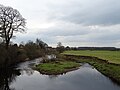
English: Arthuret is a civil parish in the Carlisle district of Cumbria, England. According to the 2001 census it had a population of 2,434. The parish includes the small town of Longtown and the village of Easton. It is bounded by the River Esk to the west and the River Lyne to the south.
Italiano: Arthuret è una parrocchia civile del Cumbria, in Inghilterra. Comprende i villaggi di Longtown e Easton. È circondata dai fiumi Esk a ovest e Lyne a sud.
civil parish in the Carlisle district of Cumbria, England  | |||||
| Upload media | |||||
| Instance of | |||||
|---|---|---|---|---|---|
| Location | Carlisle, Cumbria, North West England, England | ||||
| Population |
| ||||
| Area |
| ||||
 | |||||
Subcategories
This category has the following 7 subcategories, out of 7 total.
Media in category "Arthuret"
The following 200 files are in this category, out of 366 total.
(previous page) (next page)-
 2 and 2a Graham Street (geograph 7374074).jpg 1,024 × 731; 623 KB
-
 A cash kiosk at Longtown - geograph.org.uk - 3051686.jpg 470 × 640; 247 KB
-
 A cycle route towards Westlinton - geograph.org.uk - 2937699.jpg 800 × 600; 125 KB
-
 A restored milestone at Longtown - geograph.org.uk - 4359940.jpg 480 × 640; 429 KB
-
 A roadside strip, Slackbraes Wood - geograph.org.uk - 6064595.jpg 1,024 × 768; 530 KB
-
 A shop in Longtown High Street - geograph.org.uk - 2705961.jpg 640 × 427; 180 KB
-
 A6071 at Brisco Hill Bridge - geograph.org.uk - 4000983.jpg 640 × 327; 64 KB
-

-
 A6071 just south of Ladyseat Wood - geograph.org.uk - 4000942.jpg 640 × 425; 112 KB
-
 A6071 near Longtown - geograph.org.uk - 3716079.jpg 1,632 × 1,224; 685 KB
-
 A6071 near Longtown - geograph.org.uk - 3716080.jpg 1,632 × 1,224; 844 KB
-
 A7 at power line crossing - geograph.org.uk - 3474040.jpg 640 × 413; 64 KB
-
 A7 bend at Howend bridge - geograph.org.uk - 3474037.jpg 640 × 467; 79 KB
-
 A7 crossing Longtown Bridge - geograph.org.uk - 3061572.jpg 640 × 442; 36 KB
-
 A7 entering Longtown - geograph.org.uk - 3061539.jpg 640 × 425; 70 KB
-
 A7 north approaching Sandysike - geograph.org.uk - 3061524.jpg 640 × 392; 52 KB
-
 A7 north of Westlinton bridge - geograph.org.uk - 3474017.jpg 640 × 467; 46 KB
-
 A7 northbound - geograph.org.uk - 3494710.jpg 640 × 480; 40 KB
-
 A7 northbound - geograph.org.uk - 3494713.jpg 640 × 443; 57 KB
-
 A7 northbound - geograph.org.uk - 3494717.jpg 640 × 480; 85 KB
-
 A7 northbound - geograph.org.uk - 3494721.jpg 640 × 480; 48 KB
-
 A7 northbound - geograph.org.uk - 3494724.jpg 640 × 480; 45 KB
-
 A7 northbound - geograph.org.uk - 3494732.jpg 640 × 476; 33 KB
-
 A7 southbound near Oakwood - geograph.org.uk - 3549678.jpg 640 × 480; 100 KB
-
 A7 towards Longtown - geograph.org.uk - 6357982.jpg 800 × 600; 110 KB
-
 A7, Longtown - geograph.org.uk - 3161341.jpg 640 × 480; 44 KB
-
 An informative sign at Longtown - geograph.org.uk - 2705966.jpg 640 × 427; 182 KB
-
 An old building in Ward Street - geograph.org.uk - 4359926.jpg 640 × 480; 333 KB
-
 Approaching the A7 near Sandysike Bridge - geograph.org.uk - 2937726.jpg 800 × 600; 121 KB
-
 Arthuret Church, a masons mark, Longtown, Cumbria.jpg 3,694 × 1,937; 2.23 MB
-
 Arthuret Church, masons mark, Longtown, Cumbria.jpg 3,636 × 2,072; 1.94 MB
-
 Arthuret Council Centre - geograph.org.uk - 4359915.jpg 640 × 480; 282 KB
-
 Arthuret Council Centre - geograph.org.uk - 4890596.jpg 1,024 × 768; 112 KB
-
 Arthuret Road - geograph.org.uk - 6357949.jpg 800 × 600; 124 KB
-
 Avenue of trees near Wellknowe Rigg Farm - geograph.org.uk - 2386732.jpg 640 × 480; 137 KB
-
 Bank above the Esk - geograph.org.uk - 4890605.jpg 1,024 × 768; 196 KB
-
 Bank Street, Longtown - geograph.org.uk - 4205188.jpg 1,280 × 851; 236 KB
-
 Bank Street, Longtown - geograph.org.uk - 4914482.jpg 1,024 × 768; 99 KB
-
 Barclays Bank, Longtown - August 2016 (1) - geograph.org.uk - 5069813.jpg 986 × 1,250; 1.01 MB
-
 Barclays Bank, Longtown - August 2016 (2) - geograph.org.uk - 5069815.jpg 829 × 1,250; 1.04 MB
-
 Barclays Bank, Longtown Branch - geograph.org.uk - 4205241.jpg 1,280 × 851; 333 KB
-
 Barn at Draughtsike Wood - geograph.org.uk - 6150220.jpg 640 × 480; 304 KB
-
 Bend on the back road to Brisco Hill - geograph.org.uk - 6149171.jpg 640 × 480; 291 KB
-
 Blocked track of the A7, Parcelstown - geograph.org.uk - 6357998.jpg 800 × 600; 117 KB
-
 Boarded up church - geograph.org.uk - 4359934.jpg 640 × 480; 300 KB
-
 Bridge abutment - Longtown - April 2017 - geograph.org.uk - 5370793.jpg 1,250 × 834; 1.67 MB
-
 Bridge over The River Lyne - geograph.org.uk - 3322087.jpg 1,024 × 683; 164 KB
-
 Bridge south of The Fauld - geograph.org.uk - 2178204.jpg 640 × 480; 220 KB
-
 Bridge Street, Longtown - geograph.org.uk - 3161357.jpg 640 × 483; 44 KB
-
 Broomhill Farm River Eco Pods - geograph.org.uk - 6150189.jpg 640 × 480; 404 KB
-
 Building beside the Police Station - geograph.org.uk - 5514970.jpg 1,600 × 1,200; 384 KB
-
 Burn and footbridge near The Fauld - geograph.org.uk - 6357961.jpg 800 × 600; 93 KB
-
 Burn at Longtown - geograph.org.uk - 4914473.jpg 1,024 × 768; 228 KB
-
 Burnfoot Farm - geograph.org.uk - 2178126.jpg 611 × 454; 178 KB
-
 Burnside - geograph.org.uk - 4359933.jpg 640 × 480; 407 KB
-

-
 Bush Hotel, High Street, Longtown - geograph.org.uk - 2173918.jpg 640 × 480; 162 KB
-
 Bush Hotel, Longtown - April 2017 - geograph.org.uk - 5370788.jpg 1,250 × 766; 807 KB
-
 Bush Hotel, Longtown - August 2016 - geograph.org.uk - 5069822.jpg 1,250 × 814; 666 KB
-
 Bush Inn - geograph.org.uk - 3396012.jpg 640 × 360; 199 KB
-
 Car Wash on A6071 leaving Longtown - geograph.org.uk - 4000933.jpg 640 × 473; 80 KB
-
 Caravan Park at Low Moor Head Farm - geograph.org.uk - 2553492.jpg 3,206 × 2,072; 5.28 MB
-
 Carlisle bus at Longtown - August 2016 - geograph.org.uk - 5069825.jpg 1,250 × 830; 871 KB
-
 Carlisle Road (A7), Longtown - geograph.org.uk - 6357936.jpg 800 × 600; 77 KB
-
 Carpet of cherry blossom - geograph.org.uk - 2386713.jpg 640 × 480; 108 KB
-
 Cattle at Broomhills Farm - geograph.org.uk - 6150182.jpg 640 × 480; 285 KB
-
 Cattle pasture at Whitecloserigg - geograph.org.uk - 855961.jpg 640 × 480; 98 KB
-
 Chainsaw maiden - geograph.org.uk - 6149194.jpg 640 × 480; 360 KB
-
 Chapeltown Farm - geograph.org.uk - 6150207.jpg 640 × 480; 261 KB
-

-

-

-

-

-
 Clearing, Lockie's Wood - geograph.org.uk - 6064543.jpg 640 × 480; 81 KB
-
 Cleughfoot Wood - geograph.org.uk - 6064537.jpg 1,024 × 768; 527 KB
-
 Cliff Bridge - geograph.org.uk - 5180116.jpg 640 × 427; 139 KB
-
 Cobbinshaw House, Bridge Street, Longtown - August 2016 (1) - geograph.org.uk - 5070863.jpg 1,250 × 1,025; 1.24 MB
-
 Cobbinshaw House, Bridge Street, Longtown - August 2016 (2) - geograph.org.uk - 5070865.jpg 1,166 × 1,250; 1.22 MB
-
 Colourful houses on Moor Road, Longtown - geograph.org.uk - 6148492.jpg 640 × 480; 294 KB
-

-
 Cottages, Swan Street - geograph.org.uk - 4914468.jpg 1,024 × 768; 101 KB
-
 Country road at Lamb Hill - geograph.org.uk - 6150173.jpg 640 × 480; 309 KB
-
 Country road near Drybeck - geograph.org.uk - 6150204.jpg 640 × 480; 309 KB
-
 Country road near Easton - geograph.org.uk - 6150226.jpg 640 × 480; 269 KB
-
 Country road near Easton - geograph.org.uk - 6150229.jpg 640 × 480; 265 KB
-

-
 Country road south of Cleughhead - geograph.org.uk - 2386739.jpg 640 × 480; 79 KB
-
 Covered reservoir near Glengarth - geograph.org.uk - 6149258.jpg 640 × 480; 263 KB
-
 Crofthead Wood - geograph.org.uk - 6064533.jpg 1,024 × 768; 495 KB
-
 Cycle path To Longtown - geograph.org.uk - 3322085.jpg 1,024 × 768; 202 KB
-
 December Fungi - geograph.org.uk - 3272875.jpg 640 × 480; 90 KB
-
 Depot at Briscomire Bridge - geograph.org.uk - 4001269.jpg 640 × 221; 41 KB
-
 Dipper on the Lyne - geograph.org.uk - 2913831.jpg 1,024 × 686; 216 KB
-

-
 Dismantled railway near Arthuret House - geograph.org.uk - 2177714.jpg 640 × 480; 213 KB
-
 Dismantled railway near Arthuret House - geograph.org.uk - 2177715.jpg 640 × 480; 216 KB
-
 Disused railway near Arthuret - geograph.org.uk - 2638148.jpg 640 × 480; 111 KB
-
 Dolly's Brae - geograph.org.uk - 4359919.jpg 640 × 480; 376 KB
-
 Doorstep Green, Longtown - geograph.org.uk - 2638159.jpg 640 × 480; 87 KB
-
 Driveway to Cleughfoot - geograph.org.uk - 2386717.jpg 640 × 480; 127 KB
-
 Drybeck - geograph.org.uk - 6150200.jpg 640 × 480; 352 KB
-
 East Lodge at Netherby Hall - geograph.org.uk - 322403.jpg 640 × 480; 155 KB
-
 Easton Signpost - geograph.org.uk - 4552836.jpg 480 × 640; 95 KB
-
 Easton Village Hall - geograph.org.uk - 6150213.jpg 640 × 480; 263 KB
-

-
 English Street (A7), Longtown - geograph.org.uk - 2899703.jpg 816 × 612; 99 KB
-
 English Street, Longtown - geograph.org.uk - 2173901.jpg 640 × 480; 163 KB
-
 English Street, Longtown - geograph.org.uk - 5477517.jpg 800 × 600; 94 KB
-
 English Street, Longtown - geograph.org.uk - 6148488.jpg 640 × 480; 278 KB
-

-
 Entrance to Longtown - geograph.org.uk - 3494720.jpg 640 × 480; 58 KB
-
 Eskbank Farm - geograph.org.uk - 4359916.jpg 640 × 480; 282 KB
-
 Eskdale House - geograph.org.uk - 4359931.jpg 640 × 427; 248 KB
-
 Farm Track - River Lyne - geograph.org.uk - 1262171.jpg 640 × 427; 113 KB
-
 Farmland near Jackson Rigg - geograph.org.uk - 3716062.jpg 1,632 × 1,224; 1.15 MB
-
 Farmyard at Pedderhill Farm - geograph.org.uk - 6150180.jpg 640 × 480; 292 KB
-
 Fauld Mill - geograph.org.uk - 6148487.jpg 640 × 480; 298 KB
-
 Fauldmoor Crossing - geograph.org.uk - 2178218.jpg 640 × 480; 233 KB
-
 Field above the Lyne - geograph.org.uk - 6110546.jpg 1,024 × 683; 259 KB
-
 Field at Crofthead - geograph.org.uk - 2386711.jpg 640 × 480; 84 KB
-
 Field at Crofthead - geograph.org.uk - 2386712.jpg 640 × 480; 84 KB
-
 Field by Jackson Rigg - geograph.org.uk - 6110633.jpg 1,024 × 683; 270 KB
-

-
 Field near Whingate Farm - geograph.org.uk - 2386726.jpg 640 × 480; 76 KB
-
 Field of plastic strips - geograph.org.uk - 6148490.jpg 640 × 480; 247 KB
-
 Field with sheep near Bleaberryrigg Farm - geograph.org.uk - 6150196.jpg 640 × 480; 273 KB
-
 Field, Low Plains - geograph.org.uk - 6064588.jpg 1,024 × 768; 210 KB
-
 Field, Wellknowe - geograph.org.uk - 6110549.jpg 1,024 × 683; 337 KB
-
 Fields and trees new Broomhills Farm - geograph.org.uk - 6150193.jpg 640 × 480; 259 KB
-
 Fishing in the Esk - geograph.org.uk - 3602325.jpg 640 × 480; 212 KB
-
 Footpath - geograph.org.uk - 2177707.jpg 640 × 480; 142 KB
-
 Former "Kings Arms Hotel", Swan Street, Longtown - May 2017 - geograph.org.uk - 5412858.jpg 1,500 × 1,253; 1.42 MB
-
 Former "Scotch Arms Hotel", Swan Street, Longtown - May 2017 - geograph.org.uk - 5412877.jpg 1,500 × 1,054; 1.16 MB
-
 Former "Wheatsheaf Inn", Longtown - May 2017 - geograph.org.uk - 5412749.jpg 1,500 × 1,043; 1.37 MB
-
 Former "White Swan Inn", Longtown - April 2017 - geograph.org.uk - 5370716.jpg 1,250 × 1,149; 1,003 KB
-
 Former Church of Our Lady of Good Counsel - geograph.org.uk - 4890573.jpg 1,024 × 768; 148 KB
-
 Former Mechanics Institute, Longtown - April 2017 - geograph.org.uk - 5353241.jpg 1,355 × 1,200; 749 KB
-
 Former Mechanics' Hall, Albert Street - geograph.org.uk - 4359935.jpg 640 × 478; 252 KB
-
 Former Midland Bank, Longtown - April 2017 - geograph.org.uk - 5370747.jpg 1,250 × 1,220; 1.01 MB
-
 Former Post Office, Swan Street, Longtown - May 2017 - geograph.org.uk - 5412756.jpg 1,500 × 872; 1,014 KB
-
 Garden Centre entrance from A6071 - geograph.org.uk - 4001272.jpg 640 × 406; 73 KB
-
 Glade of trees by the Whisk Burn - geograph.org.uk - 6150155.jpg 640 × 480; 333 KB
-
 Glencroft - geograph.org.uk - 6064546.jpg 1,024 × 768; 142 KB
-
 Globe Inn - geograph.org.uk - 5516107.jpg 1,600 × 1,200; 400 KB
-
 Graham Arms Hotel, Longtown -May 2017 - geograph.org.uk - 5412854.jpg 1,500 × 915; 1.25 MB
-
 Graham Arms, Longtown - August 2016 - geograph.org.uk - 5069828.jpg 1,250 × 923; 846 KB
-
 Grazing and hedgerow near Sandysike - geograph.org.uk - 6357970.jpg 800 × 600; 122 KB
-
 Grazing near Sandysike - geograph.org.uk - 6357973.jpg 800 × 600; 87 KB
-
 Grazing near The Fauld - geograph.org.uk - 6357957.jpg 800 × 600; 81 KB
-
 Grazing sheep, Jackson Rigg - geograph.org.uk - 6110551.jpg 1,024 × 683; 173 KB
-
 Hall Burn - geograph.org.uk - 4890610.jpg 1,024 × 768; 188 KB
-
 Hall Burn at Howend Bridge - geograph.org.uk - 3147308.jpg 4,320 × 3,240; 2.99 MB
-
 Hallburn Farm - geograph.org.uk - 2386722.jpg 640 × 480; 58 KB
-
 Hallburn Farm - geograph.org.uk - 2386723.jpg 640 × 480; 62 KB
-
 Hemplands Wood - geograph.org.uk - 948253.jpg 640 × 480; 423 KB
-
 High Street - geograph.org.uk - 1943146.jpg 640 × 480; 60 KB
-
 High Street Longtown - geograph.org.uk - 3061548.jpg 640 × 436; 65 KB
-
 House at Easton - geograph.org.uk - 6150218.jpg 640 × 480; 285 KB
-
 House, The Fauld - geograph.org.uk - 6357954.jpg 800 × 543; 112 KB
-
 House, The Fauld - geograph.org.uk - 6357956.jpg 640 × 480; 76 KB
-
 Houses in Longtown - geograph.org.uk - 6299507.jpg 1,600 × 1,200; 536 KB
-
 Houses on Moor Road, Longtown - geograph.org.uk - 6148494.jpg 640 × 480; 272 KB
-
 Houses, Woodside - geograph.org.uk - 6357964.jpg 640 × 417; 56 KB
-
 Howend Bridge - geograph.org.uk - 3147309.jpg 4,320 × 3,240; 3.02 MB
-
 Huggonsmoor Wood - geograph.org.uk - 6110640.jpg 1,024 × 683; 264 KB
-
 Industrial unit, Sandysike - geograph.org.uk - 6357980.jpg 640 × 425; 85 KB
-
 Island in the River Esk - geograph.org.uk - 2638162.jpg 640 × 480; 97 KB
-
 Island in the River Lyne, Westlinton - geograph.org.uk - 6358008.jpg 800 × 600; 79 KB
-
 Jackson Rigg Farm - geograph.org.uk - 2386727.jpg 640 × 480; 63 KB
-
 John Graham's hardware store - geograph.org.uk - 4359907.jpg 640 × 475; 309 KB
-
 Junction for Sandysike from A6071 - geograph.org.uk - 4001276.jpg 640 × 316; 83 KB
-
 Junction on the A7 near Howend - geograph.org.uk - 3147311.jpg 4,320 × 3,240; 3.01 MB
-
 Lay-by on the A7 near Westlinton - geograph.org.uk - 6358004.jpg 800 × 600; 100 KB
-
 Little Falls - geograph.org.uk - 3272887.jpg 640 × 427; 144 KB
-
 Livestock pens - geograph.org.uk - 2386715.jpg 640 × 480; 68 KB
-
 Lockie's Wood - geograph.org.uk - 6064542.jpg 1,024 × 768; 341 KB
-
 Lodge on the Netherby Hall estate - geograph.org.uk - 2386719.jpg 640 × 480; 80 KB
-
 Logistics near Sandysike - geograph.org.uk - 6357975.jpg 800 × 600; 79 KB
-
 Longtown Bridge - April 2017 (1) - geograph.org.uk - 5370800.jpg 1,250 × 805; 792 KB
-
 Longtown Bridge - April 2017 (2) - geograph.org.uk - 5370803.jpg 1,250 × 823; 923 KB
-
 Longtown Bridge - geograph.org.uk - 3831023.jpg 640 × 480; 86 KB
-
 Longtown Bridge - geograph.org.uk - 4032728.jpg 3,448 × 4,592; 4.05 MB
-
 Longtown Bridge - geograph.org.uk - 4204221.jpg 851 × 1,280; 292 KB
-
 Longtown Estate - geograph.org.uk - 4130430.jpg 640 × 481; 70 KB
-
 Longtown fire station - geograph.org.uk - 2022456.jpg 640 × 427; 189 KB
-
 Longtown High Street - geograph.org.uk - 2960474.jpg 1,024 × 764; 144 KB
-
 Longtown Memorial Hall Community Centre - geograph.org.uk - 6357935.jpg 800 × 600; 104 KB
-

-
 Longtown Methodist Church - geograph.org.uk - 2173898.jpg 480 × 640; 176 KB
-
 Longtown Police Station - geograph.org.uk - 4359928.jpg 640 × 425; 249 KB
-
 Longtown Police Station - May 2017 (1) - geograph.org.uk - 5412861.jpg 1,500 × 933; 914 KB
-
 Longtown Police Station - May 2017 (2) - geograph.org.uk - 5412863.jpg 1,500 × 829; 1.26 MB
-

-
 Longtown Police Station - May 2017 (4) - geograph.org.uk - 5412868.jpg 1,239 × 1,500; 1.58 MB
-
 Longtown Police Station - May 2017 (5) - geograph.org.uk - 5412869.jpg 1,211 × 1,500; 1.34 MB
-
 Longtown Post Office - geograph.org.uk - 4359924.jpg 640 × 480; 278 KB
-
 Longtown Post Office - geograph.org.uk - 4914462.jpg 1,024 × 768; 124 KB
-
 Longtown, community centre - geograph.org.uk - 2960471.jpg 1,024 × 780; 113 KB
-
 Looking north west from St. Michael's Well - geograph.org.uk - 3949697.jpg 3,264 × 2,448; 3.32 MB
.jpg)


_-_geograph.org.uk_-_5069813.jpg)
_-_geograph.org.uk_-_5069815.jpg)


,_Longtown_-_geograph.org.uk_-_6357936.jpg)


_-_geograph.org.uk_-_5052211.jpg)
_-_geograph.org.uk_-_5052215.jpg)
_-_geograph.org.uk_-_5052217.jpg)
_-_geograph.org.uk_-_5052220.jpg)


_-_geograph.org.uk_-_5070863.jpg)
_-_geograph.org.uk_-_5070865.jpg)


,_Longtown_-_geograph.org.uk_-_2899703.jpg)


_-_geograph.org.uk_-_6357944.jpg)


_-_geograph.org.uk_-_5370800.jpg)
_-_geograph.org.uk_-_5370803.jpg)


_-_geograph.org.uk_-_5412861.jpg)
_-_geograph.org.uk_-_5412863.jpg)
_-_geograph.org.uk_-_5412864.jpg)
_-_geograph.org.uk_-_5412868.jpg)
_-_geograph.org.uk_-_5412869.jpg)


