Category:Arklow
Jump to navigation
Jump to search
town in County Wicklow at the east coast of Ireland | |||||
| Upload media | |||||
| Instance of | |||||
|---|---|---|---|---|---|
| Location | County Wicklow, Leinster, Ireland | ||||
| Elevation above sea level |
| ||||
| official website | |||||
 | |||||
Subcategories
This category has the following 8 subcategories, out of 8 total.
A
- Arklow Bridge (6 F)
- Arklow Methodist Church (1 F)
- Arklow railway station (7 F)
H
Media in category "Arklow"
The following 71 files are in this category, out of 71 total.
-
"Mary Kate" - geograph.org.uk - 3278381.jpg 2,112 × 2,816; 1.47 MB
-
22346 leaving Arklow for Rosslare - geograph.org.uk - 3277847.jpg 3,648 × 2,736; 3.45 MB
-
Abhainn Abhoca, Avoca River, Arklow - geograph.org.uk - 1618815.jpg 640 × 429; 93 KB
-
Admiralty Chart No 1410 Carnsore Point to Braich-y-Pwll, Published 1954.jpg 16,378 × 11,307; 56.88 MB
-
Admiralty Chart No 1787 Ireland Wexford to Wicklow, Published 1875.jpg 8,510 × 15,757; 15.89 MB
-
Arklow - geograph.org.uk - 6032035.jpg 1,024 × 681; 158 KB
-
Arklow Aerial.jpg 1,397 × 1,103; 377 KB
-
Arklow Bank Wind Park as seen from Arklow.jpg 5,150 × 3,431; 6.89 MB
-
Arklow Bay.jpg 3,264 × 2,448; 5.4 MB
-
Arklow Castle Wall, Arklow, Wicklow - geograph.org.uk - 6547578.jpg 1,024 × 768; 1.19 MB
-
Arklow harbour - geograph.org.uk - 171379.jpg 640 × 426; 125 KB
-
Arklow Library - geograph.org.uk - 692209.jpg 480 × 640; 45 KB
-
Arklow Post Office. - geograph.org.uk - 692201.jpg 640 × 480; 69 KB
-
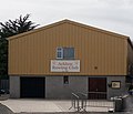
Arklow Rowing Club.jpg 960 × 824; 80 KB
-
Arklow Service Station - geograph.org.uk - 1063946.jpg 640 × 480; 50 KB
-
Arklow Town FC clubhouse and pitch.jpg 960 × 534; 68 KB
-
Arklow Town FC front gates, June 2020.jpg 960 × 720; 97 KB
-
Arklow.jpg 2,048 × 1,536; 979 KB
-
ArklowBankConstruction.jpg 500 × 375; 114 KB
-
ArklowHarbour1568.jpg 3,311 × 2,320; 1.84 MB
-
Attractive terrace - geograph.org.uk - 5534801.jpg 4,320 × 3,240; 2.04 MB
-
Avoca River (1) - geograph.org.uk - 5534649.jpg 4,320 × 3,240; 2.07 MB
-
Fancy houses - geograph.org.uk - 5534611.jpg 4,320 × 3,240; 2.73 MB
-
IMG ArklowBoats1554.jpg 3,888 × 2,592; 3.12 MB
-
IMG ArklowPort1572.jpg 3,883 × 2,051; 2.41 MB
-
IMG ArklowRock1576c.jpg 3,888 × 1,850; 2.1 MB
-
IMG FerrybankArklow1548.jpg 3,888 × 2,104; 2.94 MB
-
Laffin's Lane - geograph.org.uk - 5534777.jpg 4,320 × 3,240; 1.77 MB
-
Lower Main Street (1) - geograph.org.uk - 5534700.jpg 4,320 × 3,240; 2.51 MB
-
Lower Main Street (2) - geograph.org.uk - 5534732.jpg 4,320 × 3,240; 2.08 MB
-
McDonalds, Arklow. - geograph.org.uk - 692187.jpg 640 × 480; 64 KB
-
Memorial to Jack - geograph.org.uk - 5534799.jpg 4,320 × 3,240; 3.75 MB
-
Mouth of the River Avoca. - geograph.org.uk - 599466.jpg 640 × 480; 47 KB
-
Munitions factory site, Ferrybank, Arklow - geograph.org.uk - 644753.jpg 640 × 419; 104 KB
-
New Arklow Maritime Museum.jpg 1,167 × 646; 77 KB
-
North Quay, Arklow - geograph.org.uk - 305880.jpg 640 × 427; 74 KB
-
Old Factory in Arklow - geograph.org.uk - 599469.jpg 640 × 480; 45 KB
-
Old water pillar - geograph.org.uk - 5534791.jpg 3,071 × 4,095; 2.49 MB
-
Orange Service Station - geograph.org.uk - 1424146.jpg 640 × 480; 60 KB
-
River Avoca, near Arklow - geograph.org.uk - 692227.jpg 640 × 480; 53 KB
-
River Walk. - geograph.org.uk - 692235.jpg 480 × 640; 99 KB
-
South quay, Arklow - geograph.org.uk - 1618802.jpg 640 × 470; 93 KB
-
St Saviour's Church 2.jpg 3,024 × 4,032; 2.35 MB
-
St Saviour's church, Arklow - geograph.org.uk - 3809547.jpg 1,067 × 1,600; 279 KB
-
St Saviour's Church.jpg 3,024 × 4,032; 3.59 MB
-
Tanker, Arklow harbour - geograph.org.uk - 1632855.jpg 640 × 397; 65 KB
-
Tesco Extra Filling Station Arklow - geograph.org.uk - 1048697.jpg 640 × 480; 46 KB
-
Tesco Extra, Arklow - geograph.org.uk - 1582512.jpg 640 × 480; 45 KB
-
Tesco Extra, Arklow - geograph.org.uk - 599478.jpg 640 × 480; 54 KB
-
Texaco Petrol Station Arklow - geograph.org.uk - 1048720.jpg 640 × 480; 46 KB
-
The "Alidia" at Arklow - geograph.org.uk - 3297676.jpg 640 × 361; 57 KB
-
The "Breckland" at Arklow (1993) - geograph.org.uk - 3347805.jpg 640 × 383; 74 KB
-
The "Coral Antillarum" at Arklow - geograph.org.uk - 3266221.jpg 640 × 392; 57 KB
-
The "Harvest Seeker" at Arklow - geograph.org.uk - 632778.jpg 640 × 392; 69 KB
-
The "Mary Kate" at Arklow - geograph.org.uk - 1453991.jpg 640 × 480; 66 KB
-
The "Mytilus" at Arklow - geograph.org.uk - 632771.jpg 640 × 415; 70 KB
-
The "Tredagh" at Arklow (1988) - geograph.org.uk - 3347793.jpg 640 × 402; 85 KB
-
The Brook House - geograph.org.uk - 5534783.jpg 4,320 × 3,240; 2.47 MB
-
Topaz Petrol Station Arklow - geograph.org.uk - 1048711.jpg 640 × 480; 60 KB
-
Uh oh! (8661712101).jpg 2,000 × 1,525; 1.39 MB
-
Welcome to Arklow signage.jpg 570 × 503; 184 KB
-
Arklow town centre - geograph.org.uk - 627799.jpg 640 × 480; 66 KB
-
Irish Wheelchair Association - geograph.org.uk - 692219.jpg 640 × 480; 77 KB
-
New Housing on the North Quay - geograph.org.uk - 599460.jpg 640 × 480; 72 KB
-
Pasture land - geograph.org.uk - 627813.jpg 640 × 480; 92 KB
-
R747 Road - geograph.org.uk - 692237.jpg 640 × 480; 106 KB


