Category:Arizona State Route 77
Jump to navigation
Jump to search
 | number: | (seventy-seven) |
|---|---|---|
| State highways in Arizona: | 60 · 61 · 62 · 63 · 64 · 65 · 66 · 67 · 68 · 69 · 71 · 72 · 73 · 74 · 75 · 76 · 77 · 78 · 79 · 80 · 81 · 82 · 83 · 84 · 85 · 86 · 87 · 88 · 89 · 90 · 92 · 93 · 95 · 96 · 97 |
state highway in Arizona, United States  | |||||
| Upload media | |||||
| Instance of | |||||
|---|---|---|---|---|---|
| Location |
| ||||
| Transport network | |||||
| Owned by | |||||
| Maintained by | |||||
| Inception |
| ||||
| Length |
| ||||
 | |||||
English: Media related to Arizona State Route 77
Subcategories
This category has the following 2 subcategories, out of 2 total.
H
- Holbrook Bridge (22 F)
Media in category "Arizona State Route 77"
The following 17 files are in this category, out of 17 total.
-
 Arizona 77.svg 600 × 600; 8 KB
-
 Arizona 77 1927.svg 1,204 × 1,441; 20 KB
-
 Arizona 77 1941.svg 1,179 × 1,440; 13 KB
-
 Arizona 77 1956.svg 336 × 400; 16 KB
-
 Arizona 77 1963.svg 2,160 × 2,065; 14 KB
-
 Arizona 77 1973.svg 2,160 × 2,065; 11 KB
-
 Arizona 77 1978.svg 2,160 × 2,065; 15 KB
-
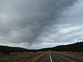
 Arizona State Route 77 Between Snowflake, Arizona and Holbrook, Arizona.jpeg 2,816 × 2,112; 1.89 MB
-
 AZ, View E, N'deh be nih, U.S. 60-S.R. 77, 2011 - panoramio.jpg 2,560 × 1,920; 3.04 MB
-
 AZ, View NE, N'deh be nih, U.S. 60- S.R. 77, 2011 - panoramio.jpg 4,000 × 3,000; 3.59 MB
-
 AZ, View NE, N'deh be nih, U.S. 60-S.R. 77, 2011 - panoramio.jpg 2,560 × 1,920; 2.99 MB
-
 AZ, View SW, N'deh be nih, U.S. 60- S.R. 77, 2011 - panoramio.jpg 4,000 × 3,000; 4.5 MB
-
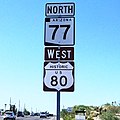 Historic US 80 and SR 77 in Tucson, Arizona.jpg 1,867 × 1,868; 807 KB
-
 Near Carrizo, AZ, US 60-SR 77,2011 - panoramio.jpg 4,000 × 3,000; 4.86 MB
-
 Saguaro National Park-situation map.png 1,143 × 650; 616 KB
-
 Salt River Canyon, AZ, US 60-SR 77, 2011 - panoramio.jpg 4,000 × 3,000; 4.67 MB
-
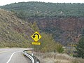
 State route 77 in the salt river canyon, arizona.jpg 1,000 × 814; 497 KB


