Category:Argentina-Chile border
Jump to navigation
Jump to search
divides the territories of Chile and Argentina | |||||
| Upload media | |||||
| Instance of |
| ||||
|---|---|---|---|---|---|
| Part of | |||||
| Location |
| ||||
| Applies to jurisdiction | |||||
| Length |
| ||||
 | |||||
Subcategories
This category has the following 15 subcategories, out of 15 total.
A
C
- Cardenal Samoré Pass (11 F)
- Cristo Redentor de los Andes (38 F)
M
P
- Paso de Agua Negra (19 F)
- Paso Dorotea (13 F)
- Paso Jama (10 F)
- Paso Roballos (4 F)
- Paso Río Don Guilermo (6 F)
- Paso San Francisco (12 F)
- Paso Sico (5 F)
T
Media in category "Argentina-Chile border"
The following 35 files are in this category, out of 35 total.
-
03 - cicloturismo.jpg 450 × 800; 302 KB
-
184 - Terre de Feu - Champ de mine - Janvier 2010.JPG 4,722 × 3,148; 8.63 MB
-
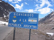
Bienvenidosargentina.jpg 1,600 × 1,200; 589 KB
-
Cabras Paso Pehuenche.JPG 4,592 × 3,056; 4.28 MB
-
Camino de Alta.jpg 1,536 × 2,048; 424 KB
-
Chile-Argentina border.jpg 2,048 × 1,536; 1.28 MB
-
Cruzando la frontera Argentina.jpg 3,553 × 2,369; 3.76 MB
-
ETH-BIB-"Hito" Grenzstein Argentina-Chile-Dia 247-11362.tiff 3,004 × 3,384; 29.23 MB
-
Fin ruta CH-199.jpg 4,288 × 3,216; 5.63 MB
-
Frontière Chili-Argentine Décembre 2007 - Courbes.jpg 2,592 × 1,944; 2.35 MB
-
Hito Gendarmería Nacional Argentina 1.JPG 3,456 × 4,608; 3.67 MB
-
Hito Gendarmería Nacional Argentina 2.JPG 3,456 × 4,608; 3.89 MB
-
HITO XXIV.jpg 2,582 × 4,129; 3.98 MB
-
Horses near Dos Lagunas (3259943871).jpg 3,072 × 2,304; 2.73 MB
-
Imagen satelital Anexo II.png 1,512 × 4,096; 3.52 MB
-
Los Andes cruzando desde Chile - panoramio.jpg 2,304 × 1,728; 726 KB
-
Los Andes, Región de Valparaíso, Chile - panoramio - Ricardo Astrauskas.jpg 1,280 × 800; 744 KB
-
Los Horcones, Argentina 01.jpg 4,958 × 3,306; 3.3 MB
-
Los Horcones, Argentina 02.jpg 3,456 × 5,184; 3.89 MB
-
Límite austral de la República Argentina, ca 1940.jpg 2,048 × 1,425; 214 KB
-
Límite Chile - Argentina.jpg 1,600 × 1,200; 331 KB
-
Massive temperature contrasts in South America.jpg 2,538 × 2,543; 5.23 MB
-
Monumento Cristo Redentor y edificaciones.jpg 2,592 × 1,944; 2.06 MB
-
Nice Road on Chilean Side of Pass to Lago Desierto (3259945905).jpg 2,304 × 3,072; 2.53 MB
-
Paso de Agua Negra, San Juan.jpg 2,272 × 1,704; 891 KB
-
Paso el bolsón.jpg 5,472 × 3,648; 6.86 MB
-
Paso Mamuil Malal.JPG 4,288 × 3,216; 4.43 MB
-
Paso Perez Rosales.jpg 3,264 × 2,448; 2.23 MB
-
Paso San Francisco-edit.jpg 2,922 × 1,734; 2.39 MB
-
Paso San Francisco.jpg 3,008 × 2,000; 2.71 MB
-
Rally Dakar 2009 Cristo Redentor cordillera de los Andes.jpg 1,600 × 1,200; 249 KB
-
Reto and Rosa Maria Making the Best of a Difficult Situation (3260772332).jpg 2,304 × 3,072; 2.63 MB
-
The border between Argentina and Chile.jpg 1,920 × 979; 208 KB


