Category:Areley Kings
Jump to navigation
Jump to search
village in United Kingdom | |||||
| Upload media | |||||
| Instance of |
| ||||
|---|---|---|---|---|---|
| Location | Stourport-on-Severn, Wyre Forest, Worcestershire, West Midlands, England | ||||
| Located in or next to body of water | |||||
 | |||||
Subcategories
This category has the following 5 subcategories, out of 5 total.
Media in category "Areley Kings"
The following 22 files are in this category, out of 22 total.
-
Across The Severn - geograph.org.uk - 1400758.jpg 480 × 640; 112 KB
-
Areley King Village Hall - geograph.org.uk - 218696.jpg 640 × 480; 47 KB
-
Areley Kings church (geograph 3262999).jpg 640 × 480; 73 KB
-
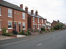
Areley Kings.jpg 640 × 480; 52 KB
-
Areley Lane Cottages (geograph 3534531).jpg 800 × 538; 75 KB
-
Areley Lane, Stourport-on-Severn (geograph 2811276).jpg 1,024 × 666; 293 KB
-
Farmland near Lickhill - geograph.org.uk - 417174.jpg 640 × 428; 102 KB
-
Lane off Areley Lane, Stourport-on-Severn (geograph 2814588).jpg 709 × 1,024; 277 KB
-
River Severn at Stourport-on-Severn on Christmas Day 2015 (geograph 4774427).jpg 1,024 × 683; 189 KB
-
The River Severn, south of Bewdley - geograph.org.uk - 418501.jpg 640 × 454; 72 KB
-
B Road Through Ribbesford Woods - geograph.org.uk - 1400761.jpg 480 × 640; 98 KB
-
Bewdley This Way - geograph.org.uk - 1400724.jpg 640 × 480; 211 KB
-
Bewdley Town F. C - geograph.org.uk - 1400703.jpg 640 × 480; 90 KB
-
Cattle grazing on farmland - geograph.org.uk - 1400740.jpg 640 × 480; 85 KB
-
Entrance To Ribbesford Woods - geograph.org.uk - 1400762.jpg 640 × 480; 256 KB
-
Field Near Oakhampton - geograph.org.uk - 1400736.jpg 640 × 480; 205 KB
-
Footpath on bank of River Severn - geograph.org.uk - 1400600.jpg 640 × 480; 130 KB
-
Footpath to Stourport on Severn - geograph.org.uk - 417191.jpg 640 × 428; 100 KB
-
Road beside Ribbesford Wood - geograph.org.uk - 703629.jpg 640 × 426; 97 KB


