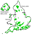
Category:Areas of Outstanding Natural Beauty in England
Jump to navigation
Jump to search
Wikimedia category | |||||
| Upload media | |||||
| Instance of | |||||
|---|---|---|---|---|---|
| |||||
Subcategories
This category has the following 20 subcategories, out of 20 total.
A
B
C
- Cranborne Chase (10 F)
D
F
H
- Howardian Hills (25 F)
L
- Lincolnshire Wolds (34 F)
M
N
Q
S
- Shropshire Hills (8 F)
T
- Tamar Valley (England) (14 F)
W
Media in category "Areas of Outstanding Natural Beauty in England"
The following 41 files are in this category, out of 41 total.
-
AONBSUK.png 886 × 915; 37 KB
-
Blackdown Hills AONB locator map.svg 1,648 × 2,000; 1.05 MB
-
Cannock Chase AONB locator map.svg 1,648 × 2,000; 1.05 MB
-
Chichester Harbour AONB locator map.svg 1,648 × 2,000; 1.04 MB
-
Chilterns AONB locator map.svg 1,648 × 2,000; 1.07 MB
-
Cornwall AONB locator map.svg 1,648 × 2,000; 1.07 MB
-
Cotswolds AONB locator map.svg 1,648 × 2,000; 1.08 MB
-
Cranborne Chase and West Wiltshire Downs AONB locator map.svg 1,648 × 2,000; 1.05 MB
-
Dedham Vale AONB locator map.svg 1,648 × 2,000; 1.05 MB
-
Dorset AONB locator map.svg 1,648 × 2,000; 1.06 MB
-
East Devon AONB locator map.svg 1,648 × 2,000; 1.05 MB
-
England and Wales AONBs map.svg 1,648 × 2,000; 1.53 MB
-
England and Wales NPs and AONBs map.svg 1,648 × 2,000; 1.79 MB
-
England AONBs map.svg 512 × 621; 1.92 MB
-
England, Northern Ireland, and Wales AONBs map.svg 512 × 516; 2.01 MB
-
Forest of Bowland AONB locator map.svg 1,648 × 2,000; 1.05 MB
-
High Weald AONB locator map.svg 1,648 × 2,000; 1.07 MB
-
Howardian Hills AONB locator map.svg 1,648 × 2,000; 1.05 MB
-
Isle of Wight AONB locator map.svg 1,648 × 2,000; 1.05 MB
-
Isles of Scilly AONB locator map.svg 1,648 × 2,000; 1.04 MB
-
Kent Downs AONB locator map.svg 1,648 × 2,000; 1.07 MB
-
Lincolnshire Wolds AONB locator map.svg 1,648 × 2,000; 1.05 MB
-
Malvern Hills AONB locator map.svg 1,648 × 2,000; 1.05 MB
-
Mendip Hills AONB locator map.svg 1,648 × 2,000; 1.05 MB
-
National Parks and AONBs in Northern England.svg 472 × 472; 1.26 MB
-
Nidderdale AONB locator map.svg 1,648 × 2,000; 1.05 MB
-
Norfolk Coast AONB locator map.svg 1,648 × 2,000; 1.06 MB
-
North Devon AONB locator map.svg 1,648 × 2,000; 1.06 MB
-
North Pennines AONB locator map.svg 1,648 × 2,000; 1.06 MB
-
North Wessex Downs AONB locator map.svg 1,648 × 2,000; 1.06 MB
-
Northumberland Coast AONB locator map.svg 1,648 × 2,000; 1.06 MB
-
Quantock Hills AONB locator map.svg 1,648 × 2,000; 1.05 MB
-
Shropshire Hills AONB locator map.svg 1,648 × 2,000; 1.06 MB
-
ShropshireHillsAONB.jpg 200 × 224; 54 KB
-
ShropshireHillsAONBMap.jpg 519 × 585; 169 KB
-
Solway Coast AONB locator map.svg 1,648 × 2,000; 1.05 MB
-
South Devon AONB locator map.svg 1,648 × 2,000; 1.06 MB
-
Suffolk Coast and Heaths AONB locator map.svg 1,648 × 2,000; 1.06 MB
-
Surrey Hills AONB locator map.svg 1,648 × 2,000; 1.06 MB
-
Tamar Valley AONB locator map.svg 1,648 × 2,000; 1.05 MB
-
Wye Valley AONB locator map.svg 1,648 × 2,000; 1.03 MB


