Category:Ardstraw
Jump to navigation
Jump to search
village in United Kingdom  | |||||
| Upload media | |||||
| Instance of | |||||
|---|---|---|---|---|---|
| Location | Northern Ireland | ||||
 | |||||
English: Ardstraw, previously known as Ardstra , is a small village, townland and civil parish in County Tyrone, Northern Ireland, three miles northwest of Newtownstewart. In the 2001 Census it had a population of 222 people. It lied within the Strabane district which became the Derry City and Strabane in 2015.
Nederlands: Ardstraw is een Noord-Iers dorpje in County Tyrone, 3 mijl noordwestwaarts van Newtownstewart. In 2001 telde het 222 inwoners. In de vroege middeleeuwen was het de zetel van een diocees met de H. Eonagh als eerste bisschop. In 1254 werd de bisschopszetel naar Derry overgebracht.
Subcategories
This category has only the following subcategory.
C
Media in category "Ardstraw"
The following 131 files are in this category, out of 131 total.
-

-
 Abbey Villas, Ardstraw - geograph.org.uk - 1451149.jpg 640 × 247; 24 KB
-
 Abbey Villas, Carnkenny - geograph.org.uk - 3965789.jpg 640 × 480; 136 KB
-
 Abbey Villas, Carnkenny - geograph.org.uk - 5799668.jpg 1,024 × 768; 329 KB
-
 Abbey villas, Carnkenny, Ardstraw - geograph.org.uk - 5799417.jpg 1,024 × 768; 342 KB
-
 Angler sculpture along the River Derg - geograph.org.uk - 6384012.jpg 1,024 × 685; 233 KB
-
 Ardstraw - geograph.org.uk - 135376.jpg 640 × 479; 90 KB
-
 Ardstraw Bridge - geograph.org.uk - 2711304.jpg 640 × 480; 66 KB
-
 Ardstraw Bridge - geograph.org.uk - 5799452.jpg 1,024 × 768; 350 KB
-
 Ardstraw Bridge on the River Derg - geograph.org.uk - 4011820.jpg 640 × 480; 168 KB
-
 Ardstraw Bridge, Tievenny Road - geograph.org.uk - 6384010.jpg 1,024 × 685; 237 KB
-

-
 Ardstraw Gospel Hall - geograph.org.uk - 135373.jpg 640 × 479; 83 KB
-
 Ardstraw Jubilee Primary School, Milltown - geograph.org.uk - 5799409.jpg 1,024 × 768; 365 KB
-
 Ardstraw old graveyard - geograph.org.uk - 135381.jpg 640 × 479; 136 KB
-
 Ardstraw Orange Hall - geograph.org.uk - 135244.jpg 640 × 512; 77 KB
-
 Ardstraw Orange Hall - geograph.org.uk - 4011823.jpg 640 × 481; 154 KB
-
 Ardstraw Orange Hall wall plaque - geograph.org.uk - 136184.jpg 640 × 479; 122 KB
-
 Ardstraw Orange Hall, Carnkenny - geograph.org.uk - 5799447.jpg 1,024 × 768; 332 KB
-
 ARDSTRAW plaque - geograph.org.uk - 135378.jpg 640 × 479; 168 KB
-
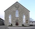 Ardstraw Presbyterian Church - geograph.org.uk - 135242.jpg 640 × 531; 99 KB
-
 Ardstraw Primary School - geograph.org.uk - 135246.jpg 640 × 479; 81 KB
-
 Ardstraw Village, Carnkenny - geograph.org.uk - 5799445.jpg 1,024 × 768; 354 KB
-
 Ardstraw, County Tyrone - geograph.org.uk - 1450381.jpg 640 × 479; 62 KB
-
 Barley field along Deerpark Road, Milltown - geograph.org.uk - 6569029.jpg 1,024 × 685; 217 KB
-
 Barley field, Carnkenny - geograph.org.uk - 6568990.jpg 1,024 × 685; 288 KB
-
 Barley field, Milltown - geograph.org.uk - 6569016.jpg 1,024 × 685; 264 KB
-
 Barley fields, Ardstraw - geograph.org.uk - 6569008.jpg 1,024 × 685; 300 KB
-
 Barn (side view) - geograph.org.uk - 1450488.jpg 640 × 479; 59 KB
-
 Barn, Ardstraw - geograph.org.uk - 1450486.jpg 640 × 479; 44 KB
-
 Barn, Ardstraw - geograph.org.uk - 5799459.jpg 1,024 × 768; 342 KB
-
 Barn, Meaghy - geograph.org.uk - 1478504.jpg 640 × 479; 66 KB
-
 Best kept village notice, Ardstraw Village - geograph.org.uk - 5799424.jpg 1,024 × 768; 447 KB
-
 Blue bin day, Ardstraw - geograph.org.uk - 6568998.jpg 1,024 × 685; 197 KB
-
 Boulder with inscription, Ardstraw - geograph.org.uk - 1450444.jpg 479 × 640; 163 KB
-

-
 Buildings in Ardstraw - geograph.org.uk - 6384003.jpg 1,024 × 685; 172 KB
-
 Carnkenny Road - geograph.org.uk - 4011798.jpg 640 × 480; 160 KB
-
 Carnkenny Road - geograph.org.uk - 4050111.jpg 640 × 480; 133 KB
-
 Carnkenny Road - geograph.org.uk - 5775660.jpg 640 × 480; 146 KB
-
 Carnkenny Road - geograph.org.uk - 6383999.jpg 1,024 × 685; 143 KB
-
 Carnkenny Road, Ardstraw - geograph.org.uk - 1450383.jpg 640 × 479; 69 KB
-
 Carnkenny Road, Ardstraw - geograph.org.uk - 1450392.jpg 640 × 479; 76 KB
-
 Carnkenny Road, Ardstraw - geograph.org.uk - 2711313.jpg 640 × 480; 65 KB
-
 Carnkenny Road, Ardstraw - geograph.org.uk - 6569001.jpg 1,024 × 685; 190 KB
-
 Carnkenny Road, Ardstraw, Carnkenny - geograph.org.uk - 4011847.jpg 640 × 480; 161 KB
-
 Carnkenny Road, Carnkenny - geograph.org.uk - 5799468.jpg 1,024 × 768; 344 KB
-
 Carnkenny Road, Carnkenny - geograph.org.uk - 6383998.jpg 1,024 × 685; 186 KB
-
 Carnkenny, Ardstraw - geograph.org.uk - 3965779.jpg 640 × 480; 144 KB
-
 Cast iron water pillar, Ardstraw, Carnkenny - geograph.org.uk - 5799659.jpg 1,024 × 768; 321 KB
-
 Chaffinch sitting on a fence, Ardstraw - geograph.org.uk - 6569004.jpg 1,024 × 685; 291 KB
-
 Close-up of cast iron water pillar, Ardstraw - geograph.org.uk - 5799662.jpg 1,024 × 768; 395 KB
-
 Contrasting view, Ardstraw - geograph.org.uk - 6144819.jpg 1,024 × 685; 490 KB
-
 Coolaghy Road, Ardstraw - geograph.org.uk - 1450462.jpg 640 × 479; 56 KB
-
 Coolaghy Road, Carnkenny - geograph.org.uk - 5799670.jpg 1,024 × 768; 360 KB
-
 Corner Bar and Restaurant, Ardstraw - geograph.org.uk - 6384008.jpg 1,024 × 685; 216 KB
-
 Corner Bar, Ardstraw - geograph.org.uk - 1450390.jpg 640 × 479; 65 KB
-
 Corner Bar, Ardstraw - geograph.org.uk - 2711297.jpg 640 × 480; 52 KB
-
 Corner Bar, Ardstraw, Carnkenny - geograph.org.uk - 4011816.jpg 640 × 480; 173 KB
-
 Crossing the Ardstraw Bridge - geograph.org.uk - 1322083.jpg 640 × 427; 64 KB
-
 Deerpark Road - geograph.org.uk - 4011825.jpg 640 × 480; 175 KB
-
 Deerpark Road - geograph.org.uk - 4053169.jpg 640 × 480; 134 KB
-
 Deerpark Road at Ardstraw - geograph.org.uk - 5799412.jpg 1,024 × 768; 362 KB
-
 Deerpark Road, Ardstraw - geograph.org.uk - 1450394.jpg 640 × 479; 62 KB
-
 Deerpark Road, Ardstraw - geograph.org.uk - 1450431.jpg 640 × 479; 59 KB
-
 Deerpark Road, Ardstraw - geograph.org.uk - 1450458.jpg 640 × 479; 46 KB
-
 Deerpark Road, Ardstraw - geograph.org.uk - 1450464.jpg 640 × 479; 57 KB
-
 Deerpark Road, Ardstraw - geograph.org.uk - 1451151.jpg 640 × 479; 47 KB
-
 Deerpark Road, Ardstraw - geograph.org.uk - 2711309.jpg 640 × 480; 63 KB
-
 Deerpark Road, Ardstraw - geograph.org.uk - 2711316.jpg 640 × 480; 45 KB
-
 Deerpark Road, Ardstraw - geograph.org.uk - 3965805.jpg 640 × 480; 146 KB
-
 Deerpark Road, Ardstraw - geograph.org.uk - 6569013.jpg 1,024 × 685; 164 KB
-
 Deerpark Road, Carnkenny - geograph.org.uk - 4011795.jpg 640 × 480; 155 KB
-
 Deerpark Road, Carnkenny - geograph.org.uk - 5799423.jpg 1,024 × 768; 325 KB
-
 Deerpark Road, Milltown - geograph.org.uk - 6569015.jpg 1,024 × 685; 227 KB
-
 Derelict pub, Carnkenny, Ardstraw - geograph.org.uk - 5799451.jpg 1,024 × 768; 337 KB
-
 Disused telephone box, Ardstraw - geograph.org.uk - 6384005.jpg 1,024 × 685; 223 KB
-
 Farm building, Urbalreagh - geograph.org.uk - 2231360.jpg 640 × 480; 47 KB
-
 Farm buildings, Coolaghty Road - geograph.org.uk - 1478637.jpg 640 × 479; 43 KB
-
 Farm buildings,Ardstraw - geograph.org.uk - 1451146.jpg 640 × 479; 43 KB
-
 Ford Cortina for sale - geograph.org.uk - 135393.jpg 640 × 479; 114 KB
-
 Former creamery, Carnkenny - Milltown (rear) - geograph.org.uk - 5799416.jpg 1,024 × 768; 315 KB
-
 Former creamery, Milltown - Carnkenny - geograph.org.uk - 5799413.jpg 1,024 × 768; 357 KB
-
 George Miller Motor Cycles, Ardstraw - geograph.org.uk - 135387.jpg 640 × 499; 115 KB
-
 George Miller Motor Cycles, Ardstraw - geograph.org.uk - 1451143.jpg 640 × 479; 76 KB
-
 George Miller Motor Cycles, Ardstraw - geograph.org.uk - 5799654.jpg 1,024 × 768; 297 KB
-
 Greenville Road, Carnkenny - geograph.org.uk - 6568993.jpg 1,024 × 685; 235 KB
-
 Hardware shop, Ardstraw - geograph.org.uk - 1450385.jpg 640 × 479; 61 KB
-
 Hillview Villas, Carnkenny - geograph.org.uk - 3965788.jpg 640 × 480; 136 KB
-
 Hillview Villas, Carnkenny, Ardstraw - geograph.org.uk - 5799672.jpg 1,024 × 768; 337 KB
-
 House at Killeen - geograph.org.uk - 135357.jpg 640 × 479; 152 KB
-
 JD's, Ardstraw - geograph.org.uk - 1450389.jpg 640 × 479; 63 KB
-

-
 Metal wall ties, Ardstraw Creamery - geograph.org.uk - 5799415.jpg 1,024 × 768; 357 KB
-
 Milltown Road - geograph.org.uk - 4053191.jpg 640 × 480; 144 KB
-
 Muddy entrance to field, Carnkenny - geograph.org.uk - 6384000.jpg 1,024 × 685; 154 KB
-
 Old store, Ardstraw - geograph.org.uk - 4011845.jpg 640 × 480; 133 KB
-
 Persbyterian Church and Hall, Ardstraw - geograph.org.uk - 4011834.jpg 640 × 480; 142 KB
-
 Plaque, Ardstraw Orange Hall - geograph.org.uk - 1450476.jpg 640 × 479; 54 KB
-
 Plaque, Ardstraw Presbyterian Church - geograph.org.uk - 1450472.jpg 640 × 479; 62 KB
-

-
 Road signs, Ardstraw - geograph.org.uk - 1450505.jpg 478 × 640; 87 KB
-
 Roadside well, Carnkenny - geograph.org.uk - 4053170.jpg 640 × 480; 168 KB
-
 Roadside well, Carnkenny - geograph.org.uk - 5799420.jpg 1,024 × 768; 332 KB
-
 Ruined buildings along Carnkenny Road - geograph.org.uk - 6384001.jpg 1,024 × 685; 161 KB
-
 Side entrance to church, Ardstraw - geograph.org.uk - 6384007.jpg 1,024 × 685; 186 KB
-
 Spar shop, Ardstraw - geograph.org.uk - 1450388.jpg 640 × 479; 52 KB
-
 Standing Stone at Killeen - geograph.org.uk - 135354.jpg 640 × 479; 132 KB
-
 Steps to leading to spout, Ardstraw - geograph.org.uk - 6569011.jpg 1,024 × 685; 272 KB
-
 Steps to well, Carnkenny - geograph.org.uk - 5799421.jpg 1,024 × 768; 373 KB
-
 Stone barn, Ardstraw - geograph.org.uk - 4010229.jpg 640 × 480; 177 KB
-
 Stone walled barn, Ardstraw - geograph.org.uk - 6237237.jpg 1,024 × 685; 472 KB
-
 Store, Ardstraw - geograph.org.uk - 6383996.jpg 1,024 × 685; 160 KB
-
 Straw bale, Carnkenny - geograph.org.uk - 6568997.jpg 1,024 × 685; 390 KB
-
 Sunnyside, Carnkenny, Ardstraw - geograph.org.uk - 3965791.jpg 640 × 480; 155 KB
-
 Taggart Jack, Ardstraw - geograph.org.uk - 5799648.jpg 1,024 × 768; 345 KB
-
 Telephone Box, Ardstraw - geograph.org.uk - 1450384.jpg 640 × 479; 75 KB
-
 Telephone box, Ardstraw - geograph.org.uk - 4011843.jpg 640 × 480; 159 KB
-
 Telephone box, Carnkenny - geograph.org.uk - 5799646.jpg 1,024 × 768; 316 KB
-
-
 The old bridge at Millbrook - geograph.org.uk - 94181.jpg 640 × 479; 84 KB
-

-
 Tievenny Road, Ardstraw - geograph.org.uk - 1450481.jpg 640 × 479; 53 KB
-
 Tievenny Road, Ardstraw - geograph.org.uk - 4011801.jpg 640 × 480; 144 KB
-
 Tievenny Road, Ardstraw - geograph.org.uk - 4011807.jpg 640 × 480; 154 KB
-
 Tievenny Road, Ardstraw - geograph.org.uk - 6144813.jpg 1,024 × 685; 448 KB
-
 Tivenny Road - Urbalreagh Road - geograph.org.uk - 5799457.jpg 1,024 × 768; 327 KB
-
 Tivenny Road, Ardstraw - geograph.org.uk - 5799464.jpg 1,024 × 768; 299 KB
-
 Urbalreagh Road, Ardstraw - geograph.org.uk - 1450484.jpg 640 × 479; 62 KB
-
 View of Ardstraw, Co Tyrone - geograph.org.uk - 135385.jpg 640 × 478; 148 KB
-
 Vivo shop, Ardstraw - geograph.org.uk - 5799666.jpg 1,024 × 768; 332 KB


_-_geograph.org.uk_-_1450488.jpg)


_-_geograph.org.uk_-_5799416.jpg)


