Category:Ardnave
Jump to navigation
Jump to search
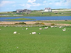
Ardnave is a geographic location on northwestern Islay on the north shore of Ardnave loch, and the west shore of Loch Gruinart. Currently occupied by Ardnave Farm, the terrain on which it is situated is Ardnave Peninsula, at the tip of which is Ardnave Point. "Peninsula" and "point" are used wholly or partially synonymously but without a clear understanding of where to the south either begins. Some consider it to be the gate of Ardnave Farm. The Atlantic side of the peninsula opposite Nave Island (Ardnave being "great Nave") is the Ardnave Coast.
human settlement on the Ardnave peninsula, northwest Islay, Argyll and Bute, Scotland, UK | |||||
| Upload media | |||||
| Instance of | |||||
|---|---|---|---|---|---|
| Location |
| ||||
 | |||||
Subcategories
This category has the following 5 subcategories, out of 5 total.
A
- Ardnave Farm (10 F)
C
- Carn Bhuaile Corc (7 F)
D
- Druim nan Crann (6 F)
M
- Mùirnemeall (4 F)
S
- Slèidmeall (5 F)
Media in category "Ardnave"
The following 25 files are in this category, out of 25 total.
-
Ardnave Coastal View - geograph.org.uk - 3907885.jpg 640 × 426; 112 KB
-
Ardnave Point Information Board - geograph.org.uk - 705284.jpg 640 × 469; 75 KB
-
Ardnave View - geograph.org.uk - 3910858.jpg 640 × 426; 77 KB
-
Barnacle Geese at Ardnave Farm - geograph.org.uk - 349781.jpg 640 × 466; 108 KB
-
Disused lobster farm, Ardnave, Islay - geograph.org.uk - 273828.jpg 640 × 480; 87 KB
-
Eilean Nostaig - geograph.org.uk - 2539753.jpg 3,241 × 1,632; 1.26 MB
-
Farmland, Ardnave, Islay - geograph.org.uk - 273741.jpg 640 × 493; 94 KB
-
Farmland, Ardnave, Islay - geograph.org.uk - 273767.jpg 640 × 479; 113 KB
-
Fence, Ardnave - geograph.org.uk - 5206945.jpg 1,024 × 683; 369 KB
-
Fishing boats passing Boghachan Mòra - geograph.org.uk - 2032752.jpg 1,280 × 960; 318 KB
-
Gravestone of Duncan Campbell - geograph.org.uk - 1804896.jpg 425 × 640; 100 KB
-
Loch Gruinart - geograph.org.uk - 5206943.jpg 1,024 × 683; 229 KB
-
Loch Gruinart from Ardnave, Islay - geograph.org.uk - 2587726.jpg 640 × 476; 65 KB
-
Loch Gruinart Rocks - geograph.org.uk - 3910869.jpg 640 × 426; 87 KB
-
Loch Gruinart View - geograph.org.uk - 3910839.jpg 640 × 415; 72 KB
-
Looking towards Nave Island, Islay - geograph.org.uk - 4236961.jpg 640 × 427; 31 KB
-
Machair, Ardnave - geograph.org.uk - 5206940.jpg 1,024 × 683; 324 KB
-
Sand by Gruinart - geograph.org.uk - 5146075.jpg 4,025 × 2,683; 1.27 MB
-
Sgeir Leith at Ardnave - geograph.org.uk - 5789553.jpg 3,264 × 2,448; 2.93 MB
-
Shore, Loch Gruinart - geograph.org.uk - 5206937.jpg 1,024 × 683; 312 KB
-
Track to the dunes - geograph.org.uk - 1420354.jpg 640 × 438; 355 KB
-
Tè-sgeir View - geograph.org.uk - 3907875.jpg 640 × 419; 98 KB
-
Wet Places On The Ardnave Peninsula - geograph.org.uk - 1779112.jpg 640 × 467; 103 KB
-
Wind scoured dune, Ardnave - geograph.org.uk - 5207628.jpg 1,024 × 683; 168 KB


