Category:Archives nationales (France) - série N
Jump to navigation
Jump to search
Media in category "Archives nationales (France) - série N"
The following 31 files are in this category, out of 31 total.
-
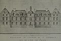
 Abbaye de Saint-Denis état ancien et projets de transformation (1) XVIIIe.jpg 17,322 × 8,465; 16.43 MB
-
 Abbaye de Saint-Denis état ancien et projets de transformation (2) XVIIIe.jpg 15,571 × 8,495; 14.78 MB
-
 Abbaye de Saint-Denis état ancien et projets de transformation (3) XVIIIe.jpg 13,471 × 9,375; 13.53 MB
-
 Aubervilliers. terroir d'Aubervilliers XVIIIe.jpg 13,140 × 9,167; 14.92 MB
-
 Bagatelle Blaikie.jpg 5,993 × 4,153; 8.13 MB
-
 Carte du marquisat de Magnac.jpg 4,481 × 3,385; 5.18 MB
-
 Carte générale de la capitainerie royale de La Varenne des Tuileries 1733.jpg 9,885 × 7,293; 16.45 MB
-

-
 Chateau de Liébaud AN 1738 NII3.jpg 1,958 × 1,340; 2.41 MB
-
 Chateau de Liébaud AN 1749 NII6.jpg 2,144 × 1,556; 3 MB
-
 Emprise du château d'issy au milieu du XVIIe siècle.JPG 3,272 × 2,264; 2.38 MB
-
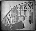
 Fief de Stains entre Garges et Pierrefitte XVIIIe.jpg 12,888 × 9,129; 13.88 MB
-
 Foire de Saint-Denis. Plan et arpentage des loges 1718.jpg 2,598 × 1,706; 795 KB
-
 Folie Saint James.jpg 6,993 × 4,425; 9.71 MB
-
 Gentilly AN propriété Jésuites - Copie.jpg 1,592 × 1,392; 778 KB
-
 Ile-Saint-Denis. Plan d'un atterrissement de la Seine XVIIIe.jpg 2,470 × 1,686; 594 KB
-

-
 Plan de Belleville (Paris) en 1845 - Archives nationales (France).jpg 9,170 × 7,988; 8.3 MB
-
 Plan de l'abbaye St-Nicaise de Reims - Archives Nationales.jpg 6,310 × 5,416; 10.3 MB
-

-
 Plan du terroir de Saint-Denis et des paroisses environnantes XVIIIe.jpg 8,173 × 6,508; 11.46 MB
-
 Plan du village de Saint-Denis et environs XVIIIe.jpg 3,080 × 2,396; 1.42 MB
-
 Plan forêt Carnoët.jpg 1,841 × 1,512; 2.22 MB
-
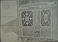
 Plan géométral de la terre de Stains 1688.jpg 6,772 × 7,957; 9.09 MB
-
 Projet de sacristie N-III-Seine 807-1 Archives nationales France.jpg 1,662 × 1,417; 239 KB
-
 Saint-Denis. Censive de l'abbaye de Saint-Denis XVIIIe.jpg 9,429 × 7,955; 9.68 MB
-
 Saint-Denis. Terres situées sur les bords du Croult XVIIIe.jpg 3,018 × 2,028; 819 KB
-
 Terroir d'Aubervilliers et terroirs adjacents (1) XVIIIe.jpg 11,003 × 8,287; 12.32 MB
-
 Terroir d'Aubervilliers et terroirs adjacents (2) XVIIIe.jpg 2,104 × 1,668; 630 KB
-
 Terroir d'Aubervilliers et terroirs adjacents (3) XVIIIe.jpg 2,454 × 1,654; 828 KB
-
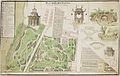
 Vue à vol d’oiseau du château et du parc de Montjeu - Archives nationales.jpg 7,350 × 3,655; 4.26 MB


_en_1845_-_Archives_nationales_(France).jpg)

_Archives_nationales_CP-N-III-Seine-1510.jpg)


_XVIIIe.jpg)
_XVIIIe.jpg)
_XVIIIe.jpg)

_XVIIIe.jpg)
_XVIIIe.jpg)
_XVIIIe.jpg)