Category:Archaeology in Scotland
Appearance
aspect of archaeology | |||||
| Upload media | |||||
| |||||
 | |||
|---|---|---|---|
| Scotland | |||
| |||
| |||
Subcategories
This category has the following 52 subcategories, out of 52 total.
*
A
C
D
E
F
G
H
I
L
M
N
O
P
R
S
T
W
Media in category "Archaeology in Scotland"
The following 46 files are in this category, out of 46 total.
-
Achmore Stone Circle - geograph.org.uk - 498945.jpg 640 × 480; 136 KB
-
Ancient Celt Playing Carnyx War Trumpet.jpg 2,057 × 3,532; 7.61 MB
-
Ancient Celt with Carnyx Trumpet.jpg 2,856 × 1,968; 3.44 MB
-
ArtCelte.jpg 1,095 × 848; 413 KB
-
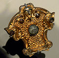
ArtCelteScotlandClunydetail.jpg 792 × 780; 249 KB
-
Artefact from the 1722 Waggonway Excavation 2021.jpg 6,016 × 4,000; 9.79 MB
-
Artefacts from the 1722 Waggonway Excavation in Prestonpans.jpg 6,016 × 4,000; 7.07 MB
-
Bakehouse Close.JPG 1,920 × 2,560; 1.1 MB
-
Boreland of Kelton Homestead Moat - geograph.org.uk - 722659.jpg 640 × 480; 62 KB
-
CeltCarnyx2.jpg 3,000 × 4,000; 7.35 MB
-
Fairy Lochs 1.jpg 1,600 × 1,200; 674 KB
-
Fairy Lochs 2.JPG 1,600 × 1,200; 979 KB
-
Fairy Lochs Air Crash Memorial.JPG 1,200 × 1,439; 706 KB
-
Fisher's Close.JPG 1,200 × 1,600; 1.48 MB
-
Kilwinning Abbey Dig 2011 part 2.webm 11 min 28 s, 1,280 × 720; 247.99 MB
-
Moving Soil at the Waggonway Excavation 2021.jpg 6,016 × 4,000; 11.02 MB
-
Pictish Stone distribution.jpg 400 × 526; 91 KB
-
Sempill's Close.JPG 1,920 × 2,560; 1,004 KB
-
Standing stone by a graveyard - geograph.org.uk - 658582.jpg 640 × 480; 95 KB
-
Trunk's Close.JPG 1,200 × 1,600; 1.4 MB
-
Two Volunteers at the Waggonway Excavation 2021.jpg 6,016 × 4,000; 7.7 MB
-
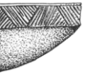
Unstan ware.gif 124 × 110; 5 KB
-
Waggonway dig, Cockenzie Harbour (geograph 5521177).jpg 1,024 × 683; 421 KB
-
Waggonway dig, Cockenzie Harbour (geograph 5521185).jpg 1,024 × 683; 423 KB
-
Waggonway dig, Cockenzie Harbour (geograph 5766761).jpg 1,024 × 683; 524 KB
-
Waggonway Excavation 2022.jpg 2,048 × 1,362; 498 KB
-
Waggonway Excavation Finds Tray 2021.jpg 6,016 × 4,000; 9.99 MB
-
Waggonway Excavation Volunteers 2021.jpg 4,000 × 6,016; 9.99 MB
-
White Horse Close.JPG 1,571 × 1,181; 515 KB
-
Alt Nan Ba, Islay - geograph.org.uk - 272314.jpg 640 × 475; 106 KB
-
Ancient cross - geograph.org.uk - 1156260.jpg 480 × 640; 89 KB
-
Breascleit Cairn - geograph.org.uk - 485894.jpg 640 × 480; 96 KB
-
Brough Castle - geograph.org.uk - 496315.jpg 640 × 427; 71 KB
-
Coombs Kirk - geograph.org.uk - 351566.jpg 640 × 480; 125 KB
-
Death, ancient and modern - geograph.org.uk - 604430.jpg 640 × 354; 177 KB
-
Earth dyke on Parkhead Hill - geograph.org.uk - 662454.jpg 640 × 480; 154 KB
-
Field boundary - geograph.org.uk - 333708.jpg 640 × 480; 125 KB
-
Forvie Moor - geograph.org.uk - 604418.jpg 640 × 480; 154 KB
-
Remains of Viking Longhouse at Hushinish - geograph.org.uk - 563042.jpg 640 × 480; 164 KB
-
Sign at road junction - geograph.org.uk - 544618.jpg 640 × 402; 54 KB
-
The Ringing Stone - geograph.org.uk - 157068.jpg 640 × 480; 73 KB


