Category:Archaeological sites in Illinois
Jump to navigation
Jump to search
States of the United States: Alabama · Alaska · Arizona · Arkansas · California · Colorado · Connecticut · Delaware · Florida · Georgia · Hawaii · Idaho · Illinois · Indiana · Iowa · Kansas · Kentucky · Louisiana · Maine · Maryland · Massachusetts · Michigan · Minnesota · Mississippi · Missouri · Montana · Nebraska · Nevada · New Hampshire · New Jersey · New Mexico · New York · North Carolina · North Dakota · Ohio · Oklahoma · Oregon · Pennsylvania · Rhode Island · South Carolina · South Dakota · Tennessee · Texas · Utah · Vermont · Virginia · Washington · West Virginia · Wisconsin · Wyoming – Washington, D.C.
Guam · Puerto Rico · United States Virgin Islands
Guam · Puerto Rico · United States Virgin Islands
Wikimedia category | |||||
| Upload media | |||||
| Instance of | |||||
|---|---|---|---|---|---|
| Category combines topics | |||||
| Illinois | |||||
state of the United States of America | |||||
| Pronunciation audio | |||||
| Instance of | |||||
| Part of | |||||
| Named after | |||||
| Location |
| ||||
| Located in or next to body of water |
| ||||
| Capital | |||||
| Legislative body | |||||
| Executive body | |||||
| Highest judicial authority | |||||
| Official language |
| ||||
| Anthem |
| ||||
| Head of government |
| ||||
| Inception |
| ||||
| Highest point |
| ||||
| Population |
| ||||
| Area |
| ||||
| Elevation above sea level |
| ||||
| Different from | |||||
| Maximum temperature record |
| ||||
| Minimum temperature record |
| ||||
| official website | |||||
 | |||||
Subcategories
This category has the following 16 subcategories, out of 16 total.
*
B
C
F
G
- Glassford House location (2 F)
J
- John Deere House and Shop (1 P, 44 F)
K
- Kincaid Mounds site (13 F)
M
- Millstone Bluff (4 F)
O
P
- Petroglyphs in Illinois (8 F)
Media in category "Archaeological sites in Illinois"
The following 55 files are in this category, out of 55 total.
-
27-Plat 1.jpg 896 × 917; 240 KB
-
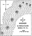
31- I Group of Mounds.jpg 1,441 × 1,622; 1.16 MB
-
62-mound-areas.jpg 2,087 × 1,481; 1.5 MB
-
Archeological dig, Starved Rock, Illinois 1974.jpg 1,374 × 933; 402 KB
-
Beattie Park Mound Group (9905348975).jpg 3,648 × 2,137; 4.73 MB
-
Bieker-Wilson Village Site.jpg 2,816 × 1,584; 819 KB
-
Briscoe Mounds and Illinois River.jpg 1,695 × 1,371; 997 KB
-
Briscoe Mounds.jpg 2,223 × 1,170; 2.24 MB
-
Carrier Mills Archaeological District.jpg 2,816 × 1,584; 1.01 MB
-
CCC Camp Shiloh at night.jpg 6,016 × 4,000; 6.17 MB
-
Chromesun kincaid site 01.jpg 503 × 400; 78 KB
-
Dickson-mound.jpg 1,600 × 1,074; 385 KB
-
Dogtooth Bend Village Site.jpg 2,816 × 2,112; 2.28 MB
-
Duffy Site south of New Haven.jpg 2,816 × 1,584; 997 KB
-
Duncan Farm Site.jpg 6,016 × 4,000; 4.91 MB
-
Fields at the Riverton Site.jpg 2,816 × 1,584; 2.46 MB
-
Grand Tower Park hillside.jpg 2,816 × 2,112; 1.5 MB
-
Horseshoe Lake Village.jpg 6,016 × 4,000; 6.46 MB
-
Hubele Mounds and Village Site.jpg 2,816 × 1,584; 942 KB
-
Illinois River from Briscoe Mounds.jpg 2,163 × 1,536; 2.21 MB
-
John Deere site6.jpg 2,048 × 1,536; 358 KB
-
John Deere site7.jpg 2,048 × 1,536; 299 KB
-
John Deere site8.jpg 2,048 × 1,536; 320 KB
-
John Roy Site from north.jpg 6,016 × 4,000; 6.36 MB
-
Kamp Mound Site.jpg 6,016 × 4,000; 6.78 MB
-
Kolmer Site.jpg 2,816 × 1,584; 2.13 MB
-
Kuhn Station Site.jpg 6,016 × 4,000; 6.42 MB
-
Larson Site from the road.jpg 6,016 × 4,000; 5.84 MB
-
Lunsford-Pulcher Site from Oklahoma Hill Road.jpg 6,016 × 4,000; 6.17 MB
-
Mayberry Mound and Village Site.jpg 2,816 × 1,584; 2.02 MB
-
McCune Village near Sterling.jpg 6,016 × 4,000; 5.07 MB
-
Mitchell Archaeological Site.jpg 6,016 × 4,000; 4.96 MB
-
Modoc Rock Shelter.jpg 2,112 × 2,816; 3.5 MB
-
Morris Wide Water Canal Boat Site.jpg 3,648 × 2,736; 4.35 MB
-
Naples-Russel Mound 8.jpg 4,000 × 3,000; 13.61 MB
-
Orr-Herl Village Site from road.jpg 2,816 × 1,584; 717 KB
-
Pierre Martin House front.jpg 6,016 × 4,000; 6.38 MB
-
Rockwell Mound steps from south.jpg 6,016 × 4,000; 6.28 MB
-
Schudel No. 2 Site.jpg 6,016 × 4,000; 6.58 MB
-
Site core at the Collins Archeological District.jpg 2,816 × 2,112; 4.39 MB
-
Sleeth Site from the road.jpg 6,016 × 4,000; 6.18 MB
-
StarvedRockStatePark CouncilOverhang.jpg 680 × 1,024; 250 KB
-
StarvedRockStatePark LonePoint.jpg 1,024 × 680; 247 KB
-
StarvedRockStatePark SaltWellSite.jpg 1,024 × 680; 225 KB
-
Stoner Site fields.jpg 2,816 × 2,112; 3.15 MB
-
Swan Island Site.jpg 2,816 × 1,584; 1.78 MB
-
Toppmeyer Site.jpg 6,016 × 4,000; 5.35 MB
-
Wapello Land and Water Reserve.jpg 2,816 × 1,584; 1.34 MB
-
Wilson Mounds at Rising Sun.jpg 2,816 × 1,584; 1.31 MB


