Category:Archaeological sites in Cumbria
Jump to navigation
Jump to search
Ceremonial counties of England: Cornwall · Cumbria · Derbyshire · Devon · Dorset · Durham · East Riding of Yorkshire · East Sussex · Essex · Greater London · Greater Manchester · Herefordshire · Kent · Lancashire · Leicestershire · Lincolnshire · Norfolk · North Yorkshire · Northamptonshire · Northumberland · Nottinghamshire · Oxfordshire · Rutland · Somerset · Surrey · Warwickshire · West Sussex · West Yorkshire · Wiltshire ·
City-counties:
Former historic counties:
Other former counties:
City-counties:
Former historic counties:
Other former counties:
Wikimedia category | |||||
| Upload media | |||||
| Instance of | |||||
|---|---|---|---|---|---|
| Category combines topics | |||||
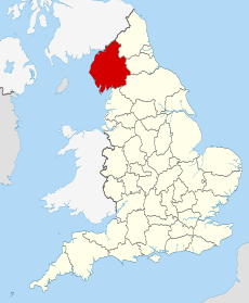
| Cumbria | |||||
ceremonial county of England | |||||
| Instance of |
| ||||
| Location |
| ||||
| Capital | |||||
| Legislative body |
| ||||
| Inception |
| ||||
| Highest point | |||||
| Population |
| ||||
| Area |
| ||||
| Replaces |
| ||||
| Different from | |||||
| official website | |||||
 | |||||
Subcategories
This category has the following 6 subcategories, out of 6 total.
C
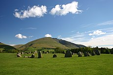
- Castlerigg Stone Circle (262 F)
D
- Dacre Bears (17 F)
G
- Giant's Grave, Copeland (1 F)
S
- Swinside Stone Circle (10 F)
Media in category "Archaeological sites in Cumbria"
The following 12 files are in this category, out of 12 total.
-
Burial chamber, Tosthills near Great Urswick (geograph 2488857).jpg 640 × 480; 138 KB
-
Carrock Fell from the Caldew Valley.jpg 1,658 × 1,204; 117 KB
-
Irton Cross, Irton, Cumbria.JPG 2,000 × 3,259; 1.1 MB
-
Remains of Medieval Settlement - geograph.org.uk - 764075.jpg 640 × 480; 125 KB
-
Remains of Medieval Settlement - geograph.org.uk - 764100.jpg 640 × 480; 134 KB
-
Standing Stones - geograph.org.uk - 929857.jpg 640 × 480; 71 KB
-
Standing Stones on Four Stones Hill - geograph.org.uk - 914077.jpg 640 × 480; 75 KB
-
The Dog Hole.jpg 480 × 640; 132 KB
-
Ancient Settlement, Hartsop - geograph.org.uk - 693825.jpg 640 × 427; 70 KB
-
Catrail - geograph.org.uk - 1490538.jpg 640 × 480; 115 KB
-
Catrail - geograph.org.uk - 773713.jpg 640 × 480; 81 KB


