Category:Arabic-language maps of Africa
Jump to navigation
Jump to search
Temperate regions: North America · South America · Africa · Europe · Asia · Oceania – Polar regions: – Other regions:
Countries of Africa: Algeria · Angola · Benin · Botswana · Burkina Faso · Burundi · Cameroon · Cape Verde · the Central African Republic ≈ Central African Republic · Chad · the Comoros ≈ Comoros · the Democratic Republic of the Congo ≈ Democratic Republic of the Congo · the Republic of the Congo ≈ Republic of the Congo · Djibouti · Egypt‡ · Equatorial Guinea · Eritrea · Eswatini · Ethiopia · Gabon · the Gambia ≈ Gambia · Ghana · Guinea · Guinea-Bissau · Ivory Coast · Kenya · Lesotho · Liberia · Libya · Madagascar · Malawi · Mali · Mauritania · Mauritius · Morocco · Mozambique · Namibia · Niger · Nigeria · Rwanda · São Tomé and Príncipe · Senegal · the Seychelles ≈ Seychelles · Sierra Leone · Somalia · South Africa · South Sudan · Sudan · Tanzania · Togo · Tunisia · Uganda · Zambia · Zimbabwe
Limited recognition: Ambazonia · Azawad · Puntland · the Sahrawi Arab Democratic Republic ≈ Sahrawi Arab Democratic Republic · Somaliland – Other areas: Bir Tawil · the Canary Islands ≈ Canary Islands · Ceuta · Madeira · Mayotte · Melilla · Réunion · Saint Helena, Ascension and Tristan da Cunha · the Scattered Islands in the Indian Ocean ≈ Scattered Islands in the Indian Ocean · Western Sahara
‡: partly located in Africa
Subcategories
This category has only the following subcategory.
Media in category "Arabic-language maps of Africa"
The following 59 files are in this category, out of 59 total.
-
2012 US presidential election Electoral College map-ar.svg 1,020 × 593; 40 KB
-
Acinonyx jubatus subspecies range-ar.jpg 895 × 720; 190 KB
-
African continent-ar.png 1,634 × 1,521; 625 KB
-
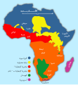
African language families ar.svg 600 × 650; 59 KB
-
Aires linguistiques du nord-est algérien AR.svg 1,461 × 881; 114 KB
-
Almohad dynasty of Morocco-ar.svg 555 × 361; 942 KB
-
Almoravid dynasty of Morocco-ar.svg 362 × 457; 957 KB
-
Ar-Senegal-Regions-location map.png 796 × 600; 174 KB
-
Arabic Varieties Map-2023.svg 2,051 × 1,151; 2.08 MB
-
CAF Champions league winners-ar.svg 332 × 330; 118 KB
-
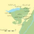
Canal des Pharaons-ar.svg 684 × 738; 33 KB
-
Carte de l'émirat Hafside de Bejaia.jpg 2,500 × 1,433; 146 KB
-
Carthage archaeological sites map-ar.svg 1,030 × 880; 427 KB
-
Congo, Democratic Republic of the-CIA WFB Map-ar.png 330 × 355; 66 KB
-
Distibución gorilla-ar.png 473 × 364; 34 KB
-
Egypt administrative divisions map (Arabic).svg 1,055 × 973; 759 KB
-
Egypt map arabic.jpg 727 × 800; 58 KB
-
Ethno-Demography of Djibouti-ar.png 640 × 497; 54 KB
-
First Congo War map ar.png 2,990 × 2,848; 2.23 MB
-
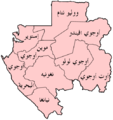
Gabon provinces named Arabic.png 500 × 533; 38 KB
-
Gambia Divisions-ar.png 618 × 161; 32 KB
-
Grand maroc.jpg 562 × 393; 30 KB
-
Greater cairo1.jpg 950 × 672; 172 KB
-
Imouzzer kandar-Morocco map Arabic copy.jpg 290 × 348; 45 KB
-
Koppen-Geiger Map COD present-ar.svg 1,360 × 850; 1.03 MB
-
Languages of Africa map-ar.svg 1,534 × 1,461; 751 KB
-
Lower Egypt-ar.png 994 × 994; 164 KB
-
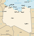
LY-map Arabic.png 326 × 350; 24 KB
-
Maghreb central.jpg 752 × 956; 550 KB
-
Map - DR Congo, major languages-ar.svg 729 × 679; 118 KB
-
Map of Addis Ababa-Djibouti Railway-ar.png 1,170 × 712; 3.18 MB
-
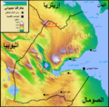
Map of Djibouti in Arabic.png 1,361 × 1,337; 2.98 MB
-
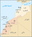
Map of Morocco and Western Sahara-ar.svg 625 × 705; 157 KB
-
Map of the hafside emirate of Bejaia.jpg 3,465 × 1,804; 297 KB
-
Map of the sultanate of touggourt.jpg 5,000 × 2,592; 387 KB
-
Mapa dos Assentamento de Faium-ar.gif 341 × 347; 21 KB
-
Mapa sobre las posiciones del ELM, 1957-1958.png 722 × 783; 582 KB
-
Marinid dynasty of Morocco-ar.svg 701 × 363; 175 KB
-
Metro Alger - Plan Ligne - Juillet 2017.svg 1,535 × 1,024; 50 KB
-
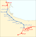
Metro Alger - Plan Ligne 1 ar.png 1,015 × 1,021; 101 KB
-
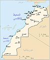
Morocco map Ar.JPG 377 × 453; 22 KB
-
Morocco3Protection.png 406 × 388; 30 KB
-
Mrc Africa.jpg 630 × 720; 100 KB
-
Niger departments named-ar.png 1,122 × 880; 168 KB
-
Nubia today-ar.png 495 × 1,035; 139 KB
-
Oqba Ibn Naafi en Afrique du nord ARABE.svg 1,160 × 658; 94 KB
-
Ottoman-map-Africa.jpg 657 × 571; 113 KB
-
Parcs rdc-ar.png 452 × 373; 74 KB
-
Population density map of Nigerian states - Arabic.png 823 × 638; 73 KB
-
Regions of mali (AR).png 775 × 833; 124 KB
-
Saadi dynasty of Morocco-ar.svg 402 × 388; 904 KB
-
Spice Islands (Zanzibar highlighted)-ar.svg 713 × 879; 29 KB
-
Tuareg area-ar.png 400 × 395; 29 KB
-
Djerba topographic map-ar.svg 1,100 × 990; 570 KB
-
Tunis Gulf topo map-ar.svg 1,990 × 1,800; 2.62 MB
-
Western sahara walls moroccan map-ar.svg 1,676 × 1,302; 187 KB
-
Wilaya alger Daira arabic.jpg 1,122 × 611; 88 KB
-
استعمار افريقيا.jpg 276 × 382; 75 KB
-
توزيع المجموعات القبلية في الصحراء الغربية.jpg 361 × 498; 79 KB


