Category:Apollo 15 EVA at Station 6A
Jump to navigation
Jump to search
From the Apollo 15 Preliminary Science Report (NASA SP-289, 1972):
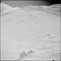
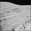
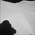
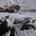
- Station 6A is the highest location explored on the Apennine Front. It was an intermediate stop made at a distinctive isolated boulder en route to Spur Crater (station 7). The station is approximately 130 m above the mare and 250 m south-southeast of Spur Crater. The boulder was sighted as a distinctive landmark and sampling target during the traverse to station 6, and, upon returning to it, the crew described it as a "big breccia" and as the "first green rock" they had seen.
Media in category "Apollo 15 EVA at Station 6A"
The following 33 files are in this category, out of 33 total.
-
AS15-86-11659 (21495809470).jpg 4,175 × 4,175; 6.42 MB
-
A15 PSR Fig 5-95 Planimetric map Station 6A.jpg 358 × 266; 21 KB
-
AS15-86-11658 (21672311412).jpg 4,175 × 4,175; 6.22 MB
-
AS15-86-11660 (21495907248).jpg 4,175 × 4,175; 7.01 MB
-
AS15-86-11661 (21495809030).jpg 4,175 × 4,175; 6.59 MB
-
AS15-90-12179 (21501928988).jpg 4,081 × 4,081; 4.22 MB
-
AS15-90-12180 (21501823590).jpg 4,057 × 4,057; 3.64 MB
-
AS15-90-12181 (21501927368).jpg 4,091 × 4,091; 3.78 MB
-
AS15-90-12181 Spur crater annotated.jpg 1,190 × 780; 352 KB
-
AS15-90-12181 Spur crater.jpg 1,190 × 780; 348 KB
-
AS15-90-12182 (21689764025).jpg 4,072 × 4,072; 3.81 MB
-
AS15-90-12183 (21068771393).jpg 4,050 × 4,050; 3.85 MB
-
AS15-90-12184 (21067069134).jpg 4,069 × 4,069; 3.88 MB
-
AS15-90-12185 (21501819610).jpg 3,978 × 3,978; 3.67 MB
-
AS15-90-12186 (21067067344).jpg 4,023 × 4,023; 3.85 MB
-
AS15-90-12187 (21501817950).jpg 4,044 × 4,044; 3.93 MB
-
AS15-90-12188 (21501816980).jpg 3,992 × 3,992; 3.46 MB
-
AS15-90-12188 sketch map.gif 451 × 443; 68 KB
-
AS15-90-12189 (21663691866).jpg 3,971 × 3,971; 3.69 MB
-
AS15-90-12190 (21663690876).jpg 3,968 × 3,968; 3.73 MB
-
AS15-90-12191 (21068764413).jpg 3,985 × 3,985; 3.46 MB
-
AS15-90-12192 (21663689216).jpg 3,976 × 3,976; 3.64 MB
-
AS15-90-12193 (21698949801).jpg 3,971 × 3,971; 3.52 MB
-
AS15-90-12194 (21502918899).jpg 3,992 × 3,992; 3.61 MB
-
AS15-90-12195 (21502918019).jpg 4,052 × 4,052; 3.91 MB
-
AS15-90-12196 (21663685916).jpg 3,944 × 3,944; 3.67 MB
-
AS15-90-12197 (21067057994).jpg 3,984 × 3,984; 3.73 MB
-
AS15-90-12198 (21689750205).jpg 3,995 × 3,995; 3.73 MB
-
AS15-90-12199 (21698837571).jpg 3,971 × 3,971; 3.29 MB
-
AS15-90-12199 contrast enhanced.jpg 1,986 × 1,986; 1.39 MB
-
AS15-90-12199 sketch map.gif 451 × 443; 88 KB
-
AS15-90-12200 (21678311502).jpg 3,992 × 3,992; 3.55 MB
-
Follow the Tracks (LROC491 - AS15-86-11659 4post).png 900 × 900; 1.47 MB


