Category:Apollo 15 EVA at Station 4
Jump to navigation
Jump to search
From the Apollo 15 Preliminary Science Report (NASA SP-289, 1972):
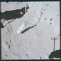
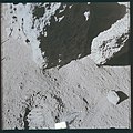
- Station 4 is on the south rim of Dune Crater, a 460-m-diameter crater in South Cluster and just west of a slightly younger 100-m-diameter crater that has been inset into the Dune rim. Photographs of the northern wall of Dune Crater indicate that the upper one-third has a rather uniform exposure of boulders, probably representative of the upper mare flows. The smoother, lower slopes of the crater wall and floor are covered with fine-grained infilling materials. The relatively low abundance of fragments away from the rim crest of Dune Crater indicates a relatively mature surface and a fairly early Copernican age for the South Cluster secondary cratering event. Two areas, separated by approximately 30 m, were sampled. The surface immediately surrounding the site of samples 15470 to 15478 and 15495 has a moderate cover of fragments. Small nearby craters are sparse. Lineaments are not visible in the documentary photographs, and the slope in the sample vicinity is negligible. Rock fragments greater than 6 cm across in the sample area are not filleted. The 17-cm rock partly hidden by the gnomon staff (in AS15-87-11759) appears to be the only large fragment that is significantly buried. Nearly all the rocks appear to be moderately dust covered. The apparent albedo of the fragments is low to average, and no photographic evidence exists of any light-clast breccia in the immediate vicinity. The local surface immediately south of the basalt block from which samples 15485, 15486, and 15499 were taken is a well-developed fillet banked against the block, with a moderate abundance of rock fragments. The rocks on the fillet are partially buried and coated with dust. Only a few fragments that are smaller than 2 cm or so are resolvable on the fillet, possibly because of the downslope movement of fines covering them. Possibly for the same reason, no small craters exist on the fillet.
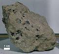
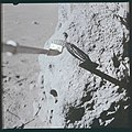
- The proximity of the large boulder to the junction of the two craters suggests that the boulder position and the associated prominent boulder group may be the result of a double excavation-once when Dune Crater was formed and again when the slightly younger 100-m-diameter crater was formed. Eight samples were collected from two points 30 m apart at station 4. Of these samples, one is a soil, one is a soil breccia, and six are mare-type basalts. The sample locations are such that samples 15475, 15476, and 15495 may represent shallower levels and that samples 15485, 15486, and 15499 represent deeper levels in mare material excavated by Dune Crater.
- The diameter of Dune Crater is such that blocks near the rim may have come from depths as great as 90 m below the mare surface. If so, the chilled nature of samples taken from the boulder on the lip of Dune Crater suggests that the underlying basalts consist of more than one flow unit. The breccia, apparently a soil breccia containing mare-type basalt clasts, and the soil samples may show evidence of flow units in addition to those represented by the large samples.
Media in category "Apollo 15 EVA at Station 4"
The following 47 files are in this category, out of 47 total.
-
150520 Apollo 15 Moon Sea Stone.jpg 1,955 × 1,955; 1.88 MB
-
A15 PSR Fig 5-74 Planimetric map Station 4.jpg 462 × 300; 41 KB
-
Apollo 15 sample 15485 S71-44232.jpg 1,724 × 1,192; 354 KB
-
Apollo 15 sample 15486 S71-44250.jpg 1,528 × 900; 369 KB
-
Apollo 15 sample 15495 S71-44209.jpg 1,616 × 1,480; 646 KB
-
Apollo 15 sample 15498 S71-44194.jpg 2,180 × 1,636; 544 KB
-
Apollo 15 sample 15499 S71-44160.jpg 1,568 × 1,608; 766 KB
-
AS15-87-11759 (21037964374).jpg 4,175 × 4,175; 6.25 MB
-
AS15-87-11759 sketch map.gif 454 × 375; 35 KB
-
AS15-87-11760 (21634567136).jpg 4,175 × 4,175; 6.32 MB
-
AS15-87-11761 (21037963844).jpg 4,175 × 4,175; 6.5 MB
-
AS15-87-11762 (21473798939).jpg 4,175 × 4,175; 6.17 MB
-
AS15-87-11763 (21649227492).jpg 4,175 × 4,175; 5.5 MB
-
AS15-87-11764 (21669772141).jpg 4,175 × 4,175; 6.82 MB
-
AS15-87-11765 (21669771761).jpg 4,175 × 4,175; 5.97 MB
-
AS15-87-11765 sketch map.gif 458 × 465; 41 KB
-
AS15-87-11766 (21039618003).jpg 4,175 × 4,175; 5.97 MB
-
AS15-87-11767 (21037961794).jpg 4,175 × 4,175; 6.07 MB
-
AS15-87-11768 (21039595433).jpg 4,175 × 4,175; 6.53 MB
-
AS15-87-11768 sketch map.gif 452 × 659; 43 KB
-
AS15-87-11769 (21037961474).jpg 4,175 × 4,175; 5.36 MB
-
AS15-87-11770 (21472704450).jpg 4,175 × 4,175; 5.45 MB
-
AS15-87-11771 (21634563626).jpg 4,175 × 4,175; 4.47 MB
-
AS15-87-11772 (21634563316).jpg 4,175 × 4,175; 4.63 MB
-
AS15-87-11773 (21473795389).jpg 4,175 × 4,175; 6 MB
-
AS15-87-11774 (21634542146).jpg 4,175 × 4,175; 5.85 MB
-
AS15-87-11775 (21669768931).jpg 4,175 × 4,175; 6.22 MB
-
AS15-87-11776 (21037959244).jpg 4,175 × 4,175; 6.64 MB
-
AS15-87-11777 (21669768571).jpg 4,175 × 4,175; 6.14 MB
-
AS15-87-11778 (21473794469).jpg 4,175 × 4,175; 6.77 MB
-
AS15-87-11779 (21039615133).jpg 4,175 × 4,175; 5.81 MB
-
AS15-87-11780 (21472784518).jpg 4,175 × 4,175; 4.97 MB
-
AS15-90-12237 (21698913481).jpg 4,000 × 4,000; 3.57 MB
-
AS15-90-12238 (21663651896).jpg 4,000 × 4,000; 3.25 MB
-
AS15-90-12239 (21663651006).jpg 4,000 × 4,000; 3.34 MB
-
AS15-90-12240 (21678277022).jpg 4,000 × 4,000; 3.27 MB
-
AS15-90-12241 (21502879749).jpg 4,000 × 4,000; 3.4 MB
-
AS15-90-12242 (21501876768).jpg 4,000 × 4,000; 3.71 MB
-
AS15-90-12243 (21068721443).jpg 4,000 × 4,000; 3.68 MB
-
AS15-90-12244 (21689712725).jpg 4,000 × 4,000; 3.91 MB
-
AS15-90-12245 (21698906821).jpg 4,000 × 4,000; 4.08 MB
-
AS15-90-12246 (21501873008).jpg 4,000 × 4,000; 3.96 MB
-
AS15-90-12247 (21068717763).jpg 4,000 × 4,000; 3.63 MB
-
AS15-90-12248 (21678269952).jpg 4,000 × 4,000; 4.17 MB
-
Dune crater AS15-90-12240-12242-12244-12245.jpg 3,440 × 1,164; 796 KB
-
Dune crater AS15-P-9370.jpg 480 × 480; 47 KB
-
Dune crater Station 4 boulders AS15-87-11779HR.jpg 1,896 × 1,305; 724 KB
