Category:Aper Tief in Apen
Jump to navigation
Jump to search
Subcategories
This category has the following 7 subcategories, out of 7 total.
Media in category "Aper Tief in Apen"
The following 31 files are in this category, out of 31 total.
-
 Apen - Hauptstraße - Aper Tief + Freibad 01 ies.jpg 5,616 × 3,744; 22.48 MB
-
 Apen - Hauptstraße - Hengstforder Mühle + Aper Tief + Freibad 01 ies.jpg 5,616 × 3,744; 21.73 MB
-
 Apen - RuWaAT + Aper Tief + Aussichtsturm Schöpfwerk Hengstforde 01 ies.jpg 5,616 × 3,744; 22.41 MB
-
 Apen - RuWaAT + Aper Tief 01 ies.jpg 5,616 × 3,743; 20.88 MB
-
 Apen - Saterlandstraße - Aper Tief (Staaßenbrücke) 01 ies.jpg 5,616 × 3,743; 20.16 MB
-
 Apen - Saterlandstraße - Aper Tief (Staaßenbrücke) 02 ies.jpg 5,616 × 3,744; 17.22 MB
-
 Apen - Zur Schanze + Aper Tief 01 ies.jpg 5,616 × 3,744; 18.79 MB
-
 Apen - Zur Schanze + Aper Tief 02 ies.jpg 5,616 × 3,744; 20.34 MB
-
 Apen - Zur Schanze - Aper Tief (Brücke) 01 ies.jpg 5,616 × 3,744; 17.71 MB
-
 Apen - Zur Schanze - Aper Tief (Brücke) 02 ies.jpg 5,616 × 3,744; 17.97 MB
-
 Apen - Zur Schanze - Aper Tief (Brücke) 03 ies.jpg 5,616 × 3,744; 19.93 MB
-
 Aper Tief (bei Augustfehn) - 1.jpg 614 × 461; 21 KB
-
 Aper Tief (bei Holtgast) - 1.jpg 614 × 461; 26 KB
-
 Aper Tief (bei Holtgast) - 2.jpg 614 × 461; 21 KB
-
 Aper Tief (bei Vreschen-Bokel) - 1.jpg 614 × 461; 41 KB
-
 Aper Tief (bei Vreschen-Bokel) - 2.jpg 614 × 461; 34 KB
-
 Aper Tief.jpg 1,920 × 1,228; 443 KB
-
 Ausdeichungsgebiet Aper Tief bei Hochwasser.jpg 2,048 × 1,536; 1.5 MB
-
 Ausdeichungsgebiet Aper Tief.jpg 5,184 × 3,456; 8.3 MB
-
 Ausdeichungsgebiet(1).jpg 250 × 188; 20 KB
-
 Freibad Hengstforde.jpg 3,840 × 2,160; 3.82 MB
-
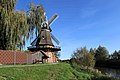
 Hengstforde Windmühle.JPG 1,536 × 2,048; 653 KB
-
 Hengstforder Mühle, Freibad Hengstforde und Aper Tief (2024).jpg 4,800 × 3,000; 11.69 MB
-
 Hengstforder Mühle.jpg 2,592 × 3,872; 5.66 MB
-
 Hengstforder Pumpengraben im Ausdeichungsgebiet in 26689 Apen.jpg 4,000 × 3,000; 5.87 MB
-
 Naturschutzgebiet Aper Tief - 4.jpg 614 × 461; 44 KB
-
 Naturschutzgebiet Aper Tief - 5.jpg 614 × 461; 36 KB
-
 Naturschutzgebiet Aper Tief - 6.jpg 614 × 461; 41 KB
-
 Naturschutzgebiet Aper Tief - 7.jpg 614 × 461; 35 KB
-
 Naturschutzgebiet Aper Tief - 8.jpg 614 × 461; 32 KB
-
 Pano-BokelerBrücke-02 web.jpg 2,580 × 720; 339 KB


_01_ies.jpg)
_02_ies.jpg)


_01_ies.jpg)
_02_ies.jpg)
_03_ies.jpg)
_-_1.jpg)
_-_1.jpg)
_-_2.jpg)
_-_1.jpg)
_-_2.jpg)


.jpg)


.jpg)


