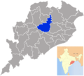
Category:Angul district
Jump to navigation
Jump to search
district of Odisha, India | |||||
| Upload media | |||||
| Pronunciation audio | |||||
|---|---|---|---|---|---|
| Instance of | |||||
| Location | Northern division, Odisha, India | ||||
| Capital | |||||
| Inception |
| ||||
| Population |
| ||||
| Area |
| ||||
| Elevation above sea level |
| ||||
| official website | |||||
 | |||||

Angul is a district of Odisha state in India.
Subcategories
This category has the following 7 subcategories, out of 7 total.
Media in category "Angul district"
The following 22 files are in this category, out of 22 total.
-
Banadurga temple premises.jpg 2,592 × 1,456; 1.7 MB
-
Durga Mandapa, Nalconagar.jpg 4,000 × 2,248; 1.22 MB
-
Gharial Breeding Centre.JPG 3,456 × 2,592; 1.97 MB
-
Khudurikuni Puja Odisha Nalco.jpg 4,032 × 3,024; 5.25 MB
-
Maa saraswati.jpg 4,128 × 3,096; 5.39 MB
-
Malaygiri Hills.jpg 1,920 × 1,080; 684 KB
-
OrissaAngul.png 1,823 × 1,635; 450 KB
-
Pampasarr.jpg 2,592 × 1,456; 2.4 MB
-
Panoramic View of NTPC Kaniha Power Station Odisha.jpg 2,560 × 1,920; 1.12 MB
-
River Mahanadi near Tikarpada.JPG 3,456 × 2,592; 538 KB
-
Villagecricket.jpg 480 × 640; 29 KB
-
Water fall at Khuludi.JPG 6,000 × 4,000; 3.66 MB
-
ଟାଙ୍ଗିଆ.jpg 3,096 × 4,128; 4.62 MB
-
ଧନିଆ ଗଛ.jpg 4,128 × 3,096; 3.12 MB
-
ବିଶଲ୍ଯକରଣୀ ଫୂଲ 2.jpg 3,096 × 4,128; 1.91 MB
-
ବିଶଲ୍ଯକରଣୀ ଫୂଲ.jpg 3,096 × 4,128; 2.03 MB
-
ମନ୍ଦାର ଗଛ .jpg 4,128 × 3,096; 3.28 MB
-
ମନ୍ଦାର ଫୁଲ 2.jpg 4,128 × 3,096; 3.68 MB
-
ମନ୍ଦାର ଫୁଲ 3.jpg 4,128 × 3,096; 3.11 MB
-
ମନ୍ଦାର ଫୁଲ 4.jpg 4,128 × 3,096; 3.76 MB
-
ମା ବୁଢୀ ଠାକୁରାଣୀ ଅନୁଗୋଳ - 1.jpg 3,264 × 2,448; 1.23 MB
-
ମା ବୁଢୀ ଠାକୁରାଣୀ ଅନୁଗୋଳ - 2.jpg 3,264 × 2,448; 1.15 MB


