Category:Amlikon-Bissegg
Jump to navigation
Jump to search
municipality in the canton of Thurgau, Switzerland | |||||
| Upload media | |||||
| Instance of | |||||
|---|---|---|---|---|---|
| Location |
| ||||
| Located in or next to body of water | |||||
| Official language | |||||
| Population |
| ||||
| Area |
| ||||
| Elevation above sea level |
| ||||
| Replaces |
| ||||
| official website | |||||
 | |||||
Subcategories
This category has the following 15 subcategories, out of 15 total.
A
B
E
- Eschikoferbrücke (4 F)
H
- Hünikon TG (10 F)
J
- Junkholz (3 F)
K
- Kreuz-Hub (8 F)
L
P
S
- Strohwilen (2 F)
W
- Wolfikon (2 F)
Media in category "Amlikon-Bissegg"
The following 21 files are in this category, out of 21 total.
-
2011-05-09 10-01-06 Switzerland Kanton Thurgau Bichelsee.jpg 4,157 × 2,759; 6.13 MB
-
2013-09-23-Orientsvislando (Foto Dietrich Michael Weidmann) 030.JPG 3,872 × 2,592; 4.4 MB
-
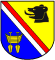
Amlikon Bissegg Blazono.png 213 × 233; 11 KB
-
Amlikon Thurbrücke über die Thur, Amlikon-Bissegg TG 20190801-jag9889.jpg 4,608 × 3,456; 12.02 MB
-
Amlikon Thurbrücke über die Thur, Amlikon-Bissegg TG Skulptur 20190801-jag9889.jpg 4,608 × 3,456; 10.17 MB
-
AmlikonBissegg-blazon.svg 209 × 245; 17 KB
-
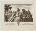
CH-NB - Grafiken Orts- und Landschaftsansichten - GS-GRAF-ANSI-TG-6.tif 5,366 × 4,589, 2 pages; 70.52 MB
-
CHE Amlikon-Bissegg Flag.svg 800 × 800; 2.2 MB
-
CHE Griesenberg COA.svg 520 × 585; 2 KB
-
CHE Griesenberg Flag.svg 800 × 800; 2.18 MB
-
Eschikofer Brücke über die Thur, Bonau TG – Amlikon-Bissegg TG 20190801-jag9889.jpg 4,608 × 3,456; 10.75 MB
-
Eschikofer Brücke über die Thur, Bonau TG – Amlikon-Bissegg TG Tafel 20190801-jag9889.jpg 3,297 × 4,121; 7.43 MB
-
Eschikoferbrücke-1010993.jpg 4,000 × 3,000; 3.6 MB
-
Flag of Amlikon-Bissegg.jpg 560 × 560; 32 KB
-
Gemeindeverwaltung Amlikon-Bissegg.jpg 3,840 × 2,400; 6.4 MB
-
Karte Gemeinde Amlikon-Bissegg 2007.png 1,181 × 944; 260 KB
-
Karte Gemeinde Amlikon-Bissegg 2011.png 1,476 × 1,219; 502 KB
-
Karte Gemeinde Amlikon-Bissegg.png 1,181 × 874; 192 KB
-
Karte Gemeinde Griesenberg 1994.png 1,476 × 1,180; 462 KB
-
Karte Gemeinde Strohwilen 1994.png 1,476 × 1,180; 461 KB
-
Neu-Griesenberg.jpg 1,000 × 766; 197 KB


