Category:American Samoa
Jump to navigation
Jump to search
States of the United States: Alabama · Alaska · Arizona · Arkansas · California · Colorado · Connecticut · Delaware · Florida · Georgia · Hawaii · Idaho · Illinois · Indiana · Iowa · Kansas · Kentucky · Louisiana · Maine · Maryland · Massachusetts · Michigan · Minnesota · Mississippi · Missouri · Montana · Nebraska · Nevada · New Hampshire · New Jersey · New Mexico · New York · North Carolina · North Dakota · Ohio · Oklahoma · Oregon · Pennsylvania · Rhode Island · South Carolina · South Dakota · Tennessee · Texas · Utah · Vermont · Virginia · Washington · West Virginia · Wisconsin · Wyoming – District of Columbia: Washington, D.C.
insular area of the United States: American Samoa · Guam · Northern Mariana Islands · Puerto Rico · United States Virgin Islands – United States Minor Outlying Islands: Bajo Nuevo Bank · Baker Island · Howland Island · Jarvis Island · Johnston Atoll · Kingman Reef · Midway Atoll · Navassa Island · Palmyra Atoll · Serranilla Bank · Wake Island
insular area of the United States: American Samoa · Guam · Northern Mariana Islands · Puerto Rico · United States Virgin Islands – United States Minor Outlying Islands: Bajo Nuevo Bank · Baker Island · Howland Island · Jarvis Island · Johnston Atoll · Kingman Reef · Midway Atoll · Navassa Island · Palmyra Atoll · Serranilla Bank · Wake Island
| Category American Samoa on sister projects: | |||||||||
|---|---|---|---|---|---|---|---|---|---|
Wikinews |
Commons |
Wikivoyage | |||||||
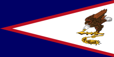
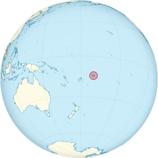
American Samoa is a self-governing insular area and unincorporated unorganized territory of the United States. It is located in the South Pacific Ocean (southeast of the Independent State of Samoa, formerly known as Western Samoa).
United States territory in the Pacific Ocean | |||||
| Upload media | |||||
| Pronunciation audio | |||||
|---|---|---|---|---|---|
| Instance of |
| ||||
| Part of | |||||
| Named after | |||||
| Location |
| ||||
| Located in or next to body of water | |||||
| Capital | |||||
| Legislative body |
| ||||
| Executive body | |||||
| Highest judicial authority |
| ||||
| Official language | |||||
| Anthem | |||||
| Currency | |||||
| Head of government | |||||
| Has part(s) |
| ||||
| Inception |
| ||||
| Highest point |
| ||||
| Population |
| ||||
| Area |
| ||||
| Elevation above sea level |
| ||||
| Top-level Internet domain | |||||
| Different from | |||||
| Maximum temperature record |
| ||||
| Minimum temperature record |
| ||||
| official website | |||||
 | |||||
Subcategories
This category has the following 11 subcategories, out of 11 total.
!
2
C
E
G
H
~
Media in category "American Samoa"
The following 46 files are in this category, out of 46 total.
-
Ale Speaking.jpg 2,048 × 1,365; 649 KB
-
American Samoa Entry Stamp.tif 209 × 136; 81 KB
-
American Samoa Exit stamp.tif 209 × 171; 106 KB
-
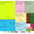
American Samoa Exports Treemap 2017.svg 900 × 900; 168 KB
-
American Samoa tramway remains.jpg 3,264 × 1,836; 2.39 MB
-
Coastline of American Samoa.jpg 1,024 × 669; 133 KB
-
De-Amerikanisch-Samoa.ogg 2.7 s; 26 KB
-
De-Ostsamoa.ogg 2.2 s; 21 KB
-
Divers install monitoring instruments on coral reef.jpg 1,230 × 1,500; 607 KB
-
DotAS-Bahnschrift Condensed.svg 355 × 278; 2 KB
-
FEMA - 42520 - Region IX Administrator Visits Amanave Village in American Samoa.jpg 3,002 × 1,994; 2.55 MB
-
Flag-map of American Samoa.png 1,170 × 272; 28 KB
-
FMIB 41410 Fungasa, or Massacre Bay.jpeg 806 × 567; 127 KB
-
HMNZ Otago visiting American Samoa - 190805-G-IA651-9852.jpg 3,024 × 4,032; 3.17 MB
-
Jean p haydon museum.png 1,724 × 1,140; 2.7 MB
-
Kvzk-color-logo-QSvBjGL.png 1,000 × 500; 26 KB
-
Lemanu Peleti Mauga (cropped).png 546 × 711; 522 KB
-
Leone monument.jpg 2,738 × 3,388; 5.8 MB
-
Manaia Fruean 2022 Cropped.jpg 762 × 1,017; 97 KB
-
Manaia Fruean 2022.jpg 2,048 × 1,365; 1.22 MB
-
MARFORPAC Band in American Samoa 160418-M-CP369-006.jpg 5,760 × 3,840; 6.73 MB
-
MARFORPAC Band in American Samoa 160418-M-CP369-035.jpg 5,760 × 3,840; 5.55 MB
-
MARFORPAC Band in American Samoa 160418-M-CP369-145.jpg 5,760 × 3,840; 7.47 MB
-
Mouth-watering tuna sashimi and a beer at Pago Pago harbour mouth - panoramio.jpg 2,816 × 2,112; 2.07 MB
-
Pago Pago harbor - 190803-G-IA651-2014.jpg 1,280 × 960; 1.73 MB
-
Pago pago post office.jpg 3,650 × 2,183; 7.38 MB
-
Panorama from A'oloau.jpg 7,136 × 3,200; 8.69 MB
-
Panorama of Fagasa.jpg 7,520 × 3,120; 8.85 MB
-
Part of a Full Samoan Tattoo - takes 15 sessions of up to eight hours - panoramio.jpg 2,112 × 2,816; 3.44 MB
-
Porites and Acropora corals in American Samoa.jpg 1,500 × 1,125; 448 KB
-
Samoan Memorial.JPG 1,568 × 1,158; 909 KB
-
Severe Drought (6831021618).jpg 4,000 × 3,000; 4.29 MB
-
Some thousands of white-painted and purple planted used tyres - panoramio.jpg 2,816 × 2,112; 3.38 MB
-
South pacific games.jpg 1,529 × 2,545; 3.39 MB
-
Succulent papaya and swordfish kebab on a banana leaf plate - panoramio.jpg 2,112 × 2,816; 3.22 MB
-
The Rainmaker from near the former Rainmaker Hotel - panoramio.jpg 2,816 × 2,112; 3.25 MB
-
Tisa's Barefoot Bar - panoramio.jpg 2,112 × 2,816; 3.76 MB
-
Tuna long-liner heading out of Pago - panoramio.jpg 2,112 × 2,816; 1.56 MB
-
United States Pacific change 1911-07-17.png 2,046 × 1,321; 230 KB
-
Vatia from the National Park of American Samoa.jpg 3,264 × 1,836; 1.9 MB
-
View from Pago Yacht Club - panoramio.jpg 2,816 × 2,112; 2.65 MB
-
World War II encampments on American Samoa.jpg 3,264 × 1,836; 2.61 MB
-
Woven coconut baskets - panoramio.jpg 2,816 × 2,112; 3.5 MB
-
WW II fortification hidden above harbour mouth - panoramio.jpg 2,112 × 2,816; 3.51 MB
-
Половозрастная пирамида Американского Самоа 2016.jpg 491 × 333; 31 KB


