Category:Alverstoke
Jump to navigation
Jump to search
village in Hampshire, UK  | |||||
| Upload media | |||||
| Instance of | |||||
|---|---|---|---|---|---|
| Location | Gosport, Hampshire, South East England, England | ||||
 | |||||
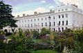
English: Alverstoke is a village, now within the boundaries of Gosport, Hampshire, England, that encompasses land stretching from Haslar to Stokes Bay. The village lies within half a mile of the shore of Stokes Bay and near the head of a creek which extends a mile westward from Portsmouth Harbour. Fort Gilkicker, a nineteenth century coastal battery fort, is located just to the south of Alverstoke, on the west end of Stokes Bay.
Subcategories
This category has the following 12 subcategories, out of 12 total.
A
C
- Church Road, Alverstoke (5 F)
- The Crescent, Alverstoke (14 F)
G
- Green Road, Alverstoke (5 F)
J
- Jellicoe Avenue, Alverstoke (12 F)
L
M
S
- St Francis' Church, Gosport (14 F)
T
- Tebourba Drive, Alverstoke (9 F)
V
- Village Road, Alverstoke (17 F)
Media in category "Alverstoke"
The following 82 files are in this category, out of 82 total.
-
 19, Church Road.jpg 4,032 × 3,024; 2.7 MB
-
 2020 New Year's Day Swim at Stokes Bay - geograph.org.uk - 6357717.jpg 3,872 × 2,592; 4.25 MB
-
 6 and 6A, Church Road.jpg 4,032 × 3,024; 2.83 MB
-
 Alverbank House 2.jpg 4,032 × 3,024; 1.86 MB
-
 Alverbank House 3.jpg 4,032 × 3,024; 3.1 MB
-
 Alverbank House.jpg 3,024 × 4,032; 1.23 MB
-
 Bottom end of Bury Crescent - geograph.org.uk - 1374555.jpg 640 × 480; 56 KB
-
 Alverstoke Church of England Aided Junior School.jpg 4,032 × 3,024; 3.86 MB
-
 Alverstoke Junior School - geograph.org.uk - 1426055.jpg 640 × 480; 89 KB
-
 Alverstoke Post Office - geograph.org.uk - 1425976.jpg 640 × 480; 66 KB
-
 Alverstoke Service Station - geograph.org.uk - 1426018.jpg 640 × 480; 69 KB
-
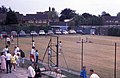
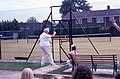
 Alverstoke Tennis Club open day (1) - geograph.org.uk - 1599706.jpg 640 × 418; 76 KB
-
 Alverstoke Tennis Club open day (2) - geograph.org.uk - 1599712.jpg 640 × 418; 79 KB
-
 Alverstoke Tennis Club open day (3) - geograph.org.uk - 1599720.jpg 640 × 418; 89 KB
-
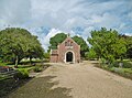 Alverstoke, chapel - geograph.org.uk - 5531868.jpg 1,024 × 756; 190 KB
-
-
 Alverstoke, village centre - geograph.org.uk - 615249.jpg 640 × 480; 53 KB
-
 Anglesey Court - geograph.org.uk - 1387285.jpg 640 × 480; 79 KB
-
 Any land in SZ5997^ - geograph.org.uk - 1144999.jpg 640 × 427; 74 KB
-
 Anyone for tennis^ - geograph.org.uk - 1599694.jpg 1,798 × 1,177; 2.39 MB
-

-

-

-

-
-
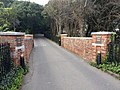 Bridge 30 Yards South Of Alverbank.jpg 4,032 × 3,024; 4.13 MB
-
 Bury Road Surgery - geograph.org.uk - 1426257.jpg 640 × 480; 88 KB
-
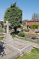
 Cemetery - Alverstoke - geograph.org.uk - 1093292.jpg 640 × 480; 94 KB
-

-

-

-
-
 Civil Defence Control Centre (Former Air Raid Precautions Report Centre) 2.jpg 4,032 × 3,024; 4.84 MB
-
 Civil Defence Control Centre (Former Air Raid Precautions Report Centre) 3.jpg 4,032 × 3,024; 3.88 MB
-
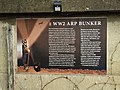 Civil Defence Control Centre (Former Air Raid Precautions Report Centre).jpg 4,032 × 3,024; 1.97 MB
-
 Delightful cottage in Village Road - geograph.org.uk - 1425991.jpg 480 × 640; 99 KB
-
 Fish and chip shop in the village - geograph.org.uk - 1396958.jpg 640 × 480; 81 KB
-
 GAFIRS New Year Day Swim 2013 - geograph.org.uk - 3277749.jpg 3,872 × 2,592; 4.03 MB
-
 GAFIRS sea rescue demonstration (1) - geograph.org.uk - 3799178.jpg 3,872 × 2,592; 3.46 MB
-
 GAFIRS sea rescue demonstration (2) - geograph.org.uk - 3799189.jpg 3,872 × 2,592; 3.18 MB
-
 GAFIRS sea rescue demonstration (3) - geograph.org.uk - 3799210.jpg 3,872 × 2,592; 3.76 MB
-
 Gilkicker Point at sunset - geograph.org.uk - 4124553.jpg 4,000 × 3,000; 2.35 MB
-
 IRB station at Stokes Bay - geograph.org.uk - 1145009.jpg 640 × 427; 118 KB
-
 Junction of The Avenue and Beatty Drive - geograph.org.uk - 1426024.jpg 640 × 480; 104 KB
-

-

-
-

-

-

-
 Old Lodge Hotel.jpg 4,032 × 3,024; 2.97 MB
-
 Post Office - Alverstoke - geograph.org.uk - 1093225.jpg 640 × 480; 59 KB
-
 Reed beds at Browndown - geograph.org.uk - 385340.jpg 640 × 480; 157 KB
-
 Spur of Ashburton Road - geograph.org.uk - 1425558.jpg 640 × 480; 68 KB
-
 Stoke Lake - Gosport - geograph.org.uk - 913016.jpg 640 × 480; 62 KB
-
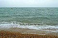
 Stokes Bay - geograph.org.uk - 2103388.jpg 1,800 × 1,200; 343 KB
-

-
 Thatched cottage in the village - geograph.org.uk - 1396982.jpg 640 × 480; 82 KB
-
 The Crescent, Angleseyville.jpg 990 × 627; 107 KB
-
 The Old Rectory, Anglesey Road, Alverstoke, Gosport (NHLE Code 1276935) (April 2019).JPG 2,400 × 1,600; 2.14 MB
-
 The Redan (1) - geograph.org.uk - 3185585.jpg 3,872 × 2,592; 4.76 MB
-
 The Redan (2) - geograph.org.uk - 3185588.jpg 3,872 × 2,592; 4.62 MB
-
 The Redan (3) - geograph.org.uk - 3185592.jpg 3,872 × 2,592; 4.6 MB
-
 The Redan (4) - geograph.org.uk - 3185596.jpg 3,872 × 2,592; 4.36 MB
-
 The Redan (5) - geograph.org.uk - 3185603.jpg 3,872 × 2,592; 4.63 MB
-
 The Redan (6) - geograph.org.uk - 3185607.jpg 3,872 × 2,592; 4.5 MB
-
 The Redan (7) - geograph.org.uk - 3185614.jpg 3,872 × 2,592; 4.46 MB
-
 The Redan (8) - geograph.org.uk - 3185619.jpg 3,872 × 2,592; 4.52 MB
-
 The Redan (9) - geograph.org.uk - 3185625.jpg 3,872 × 2,592; 4.51 MB
-
 The Solent , Hampshire Coastline - geograph.org.uk - 2880088.jpg 4,174 × 2,664; 3.01 MB
-
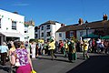
 Trafalgar 200 Celebrations - geograph.org.uk - 358933.jpg 640 × 480; 69 KB
-
 Tree in the village centre - geograph.org.uk - 1396997.jpg 640 × 480; 96 KB
-
 Turkish graves near to Alverstoke, Hampshire, Great Britain.jpg 640 × 480; 96 KB
-

-
 Village Pub - Alverstoke - geograph.org.uk - 1093216.jpg 640 × 480; 65 KB
-
 Any land in SZ5997^ - geograph.org.uk - 1145026.jpg 640 × 427; 88 KB
-
 Bend in Westland Drive - geograph.org.uk - 1426034.jpg 640 × 480; 79 KB
-
 Bottom end of Gordon Road - geograph.org.uk - 1426276.jpg 640 × 439; 63 KB
-
 Gorse bushes at Browndown, Gosport - geograph.org.uk - 385351.jpg 640 × 480; 136 KB
-
 Privett Road Gosport - geograph.org.uk - 389245.jpg 640 × 480; 114 KB
-
 Privett Road, Gosport - geograph.org.uk - 389254.jpg 640 × 480; 76 KB
-
 Privett Road, Gosport - geograph.org.uk - 389263.jpg 640 × 480; 78 KB


_-_geograph.org.uk_-_1599706.jpg)
_-_geograph.org.uk_-_1599712.jpg)
_-_geograph.org.uk_-_1599720.jpg)


_(1).JPG)
_(2).JPG)
_(3).JPG)
_(4).JPG)
_2.jpg)
_3.jpg)
.jpg)


_-_geograph.org.uk_-_3799178.jpg)
_-_geograph.org.uk_-_3799189.jpg)
_-_geograph.org.uk_-_3799210.jpg)


_-_geograph.org.uk_-_1518807.jpg)
_-_geograph.org.uk_-_1518814.jpg)
_-_geograph.org.uk_-_1518821.jpg)
_-_geograph.org.uk_-_1518834.jpg)


_(April_2019).JPG)
_-_geograph.org.uk_-_3185585.jpg)
_-_geograph.org.uk_-_3185588.jpg)
_-_geograph.org.uk_-_3185592.jpg)
_-_geograph.org.uk_-_3185596.jpg)
_-_geograph.org.uk_-_3185603.jpg)
_-_geograph.org.uk_-_3185607.jpg)
_-_geograph.org.uk_-_3185614.jpg)
_-_geograph.org.uk_-_3185619.jpg)
_-_geograph.org.uk_-_3185625.jpg)


