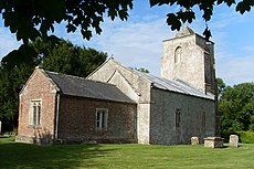
Category:Alton Priors
Jump to navigation
Jump to search
village in Wiltshire, UK | |||||
| Upload media | |||||
| Instance of |
| ||||
|---|---|---|---|---|---|
| Location | Alton, Wiltshire, South West England, England | ||||
 | |||||
Subcategories
This category has only the following subcategory.
A
Media in category "Alton Priors"
The following 46 files are in this category, out of 46 total.
-
Alton Priors and farmland beyond - geograph.org.uk - 1393142.jpg 640 × 488; 103 KB
-
Between two barns near Alton Priors - geograph.org.uk - 1411614.jpg 640 × 467; 115 KB
-
Bridleway, Alton Priors - geograph.org.uk - 1428756.jpg 480 × 640; 185 KB
-
Cattle grazing near Alton Priors - geograph.org.uk - 1393165.jpg 640 × 497; 156 KB
-
Downland, Alton Barnes - geograph.org.uk - 844438.jpg 640 × 480; 152 KB
-
Downland, Alton Barnes - geograph.org.uk - 844447.jpg 640 × 480; 143 KB
-
Downland, Alton Barnes - geograph.org.uk - 844516.jpg 640 × 480; 140 KB
-
Downland, Alton Barnes - geograph.org.uk - 844532.jpg 640 × 480; 133 KB
-
Downland, Alton Barnes - geograph.org.uk - 844683.jpg 640 × 480; 111 KB
-
Downland, Alton Barnes - geograph.org.uk - 844755.jpg 640 × 480; 131 KB
-
Downs, Alton Priors - geograph.org.uk - 282656.jpg 640 × 480; 101 KB
-
Farmland below Woodborough Hill - geograph.org.uk - 843837.jpg 640 × 480; 125 KB
-
Farmland, Alton Priors - geograph.org.uk - 282657.jpg 640 × 480; 88 KB
-
Farmland, Alton Priors - geograph.org.uk - 419380.jpg 640 × 480; 127 KB
-
Heifer and caravans, near Alton Priors - geograph.org.uk - 834276.jpg 640 × 480; 139 KB
-
Knap Hill - panoramio (1).jpg 2,144 × 1,424; 734 KB
-
Knap Hill, Pewsey Downs - geograph.org.uk - 38366.jpg 640 × 264; 71 KB
-
Landform near Alton Priors - geograph.org.uk - 834272.jpg 640 × 480; 169 KB
-
Looking east along the Vale of Pewsey - geograph.org.uk - 1393120.jpg 640 × 491; 129 KB
-
Minor road east of Alton Priors - geograph.org.uk - 1411717.jpg 640 × 427; 135 KB
-
Oats at the bottom of Woodborough Hill - geograph.org.uk - 1412886.jpg 640 × 477; 114 KB
-
Oxnamere, Dewpond - geograph.org.uk - 1093147.jpg 640 × 512; 80 KB
-
Picked Hill - geograph.org.uk - 837122.jpg 640 × 480; 140 KB
-
Picked Hill - geograph.org.uk - 842639.jpg 640 × 480; 158 KB
-
Picked Hill - geograph.org.uk - 842671.jpg 640 × 480; 175 KB
-
Picked Hill - geograph.org.uk - 842679.jpg 640 × 480; 165 KB
-
Picked Hill - geograph.org.uk - 842690.jpg 640 × 480; 148 KB
-
Ripening wheat near Alton Priors - geograph.org.uk - 1411725.jpg 640 × 452; 122 KB
-
Telephone box, Alton Priors - geograph.org.uk - 1428744.jpg 640 × 480; 187 KB
-
The Alton White Horse - geograph.org.uk - 85928.jpg 640 × 469; 46 KB
-
The Wansdyke, East of Tan Hill. - geograph.org.uk - 185572.jpg 640 × 370; 101 KB
-
The Wansdyke, North of Milk Hill. - geograph.org.uk - 185562.jpg 640 × 438; 135 KB
-
Vale Of Pewsey - panoramio (1).jpg 2,144 × 1,424; 680 KB
-
Vale Of Pewsey - panoramio (2).jpg 2,144 × 1,424; 750 KB
-
Vale Of Pewsey - panoramio.jpg 2,144 × 1,424; 889 KB
-
View to the downs, Alton Barnes - geograph.org.uk - 844387.jpg 640 × 480; 172 KB
-
Walkers Hill, Pewsey Downs - geograph.org.uk - 38372.jpg 640 × 480; 117 KB
-
Wheatfield near Alton Priors - geograph.org.uk - 1411688.jpg 640 × 472; 130 KB
-
Wheatfield near Alton Priors - geograph.org.uk - 834287.jpg 640 × 480; 101 KB
-
Wheatfield near Alton Priors - geograph.org.uk - 834298.jpg 640 × 480; 206 KB
-
Wheatfield near Alton Priors - geograph.org.uk - 834299.jpg 640 × 480; 168 KB
-
Wheatfield near Alton Priors - geograph.org.uk - 834300.jpg 640 × 480; 197 KB
-
Wiltshire downs. - geograph.org.uk - 1770515.jpg 3,264 × 2,448; 1.69 MB


