Category:Aldford
Jump to navigation
Jump to search
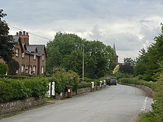
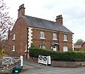
English: Aldford is a village and former civil parish, now in Aldford and Saighton civil parish, in the county of Cheshire, England, south of Chester . Most of the building stock was constructed as a designed village in the middle of the 19th century by Sir Richard Grosvenor, in almost rectangular form.
village in Cheshire West and Chester, Cheshire, UK | |||||
| Upload media | |||||
| Instance of |
| ||||
|---|---|---|---|---|---|
| Location | Aldford and Saighton, Cheshire West and Chester, Cheshire, North West England, England | ||||
 | |||||
Subcategories
This category has the following 6 subcategories, out of 6 total.
A
- Aldford Bridge (14 F)
- Aldford Castle (10 F)
- Aldford Lodge (3 F)
- Aldford Stocks (7 F)
Media in category "Aldford"
The following 112 files are in this category, out of 112 total.
-
600 Year Old Oak tree near Aldford Castle - geograph.org.uk - 2401033.jpg 2,592 × 3,888; 2.93 MB
-
A field near Aldford - August 2009 - geograph.org.uk - 1613691.jpg 640 × 480; 172 KB
-
Aldford - Lea Manor Farm - geograph.org.uk - 220733.jpg 512 × 388; 145 KB
-
Aldford Brook - geograph.org.uk - 3918166.jpg 4,608 × 3,456; 4.28 MB
-
Aldford Brook - geograph.org.uk - 3981163.jpg 640 × 480; 422 KB
-
Aldford Brook in Flood - geograph.org.uk - 3801901.jpg 4,000 × 3,000; 2.57 MB
-
Aldford Brook in Flood - geograph.org.uk - 3801905.jpg 4,000 × 3,000; 2.78 MB
-
Aldford Post Box - geograph.org.uk - 1350468.jpg 468 × 640; 122 KB
-
Aldford Post Office and Village Store - geograph.org.uk - 5303809.jpg 3,392 × 2,256; 1.63 MB
-
Aldford School - geograph.org.uk - 1350449.jpg 640 × 479; 81 KB
-
Aldford Tug of War, May Day 1979 - geograph.org.uk - 5211262.jpg 3,456 × 2,256; 1.63 MB
-
Aldford Tug of War, May Day 1979 - geograph.org.uk - 5211273.jpg 3,448 × 2,232; 1.58 MB
-
Aldford Tug of War, May Day 1979 - geograph.org.uk - 5211283.jpg 3,724 × 2,445; 1.19 MB
-
Aldford Village - geograph.org.uk - 58474.jpg 640 × 480; 174 KB
-
Aldford Village car park - geograph.org.uk - 2440685.jpg 3,888 × 2,592; 3.74 MB
-
Aldford Village Hall - geograph.org.uk - 3922630.jpg 4,000 × 3,000; 2.62 MB
-
Aldford Village Hall - geograph.org.uk - 3922635.jpg 4,000 × 3,000; 2.97 MB
-
Aldford, B5130 - geograph.org.uk - 3981167.jpg 640 × 480; 310 KB
-
Aldford, Grosvenor Arms - geograph.org.uk - 3981141.jpg 640 × 480; 255 KB
-
Aldford, the recreation ground - geograph.org.uk - 1350528.jpg 640 × 479; 77 KB
-
Aldford.jpg 640 × 479; 87 KB
-
Approaching Aldford Bridge - geograph.org.uk - 1614593.jpg 640 × 480; 165 KB
-
Bank Farm, Aldford 01.jpg 2,427 × 2,128; 614 KB
-
Bank Farm, Aldford 02.jpg 4,000 × 3,000; 954 KB
-
Barn on Church Lane - geograph.org.uk - 1350487.jpg 640 × 479; 112 KB
-
Brook View and Stocks View, Aldford 01.jpg 4,000 × 3,000; 1.09 MB
-
Brook View and Stocks View, Aldford 02.jpg 4,000 × 3,000; 1.07 MB
-
Bus Stop near Aldford Bridge - geograph.org.uk - 3981140.jpg 640 × 480; 388 KB
-
Church House near Aldford - geograph.org.uk - 2443383.jpg 3,072 × 2,304; 1.26 MB
-
Church Lane, Aldford - geograph.org.uk - 2440667.jpg 3,888 × 2,592; 2.55 MB
-
Clematis Cottages, Aldford 01.jpg 4,000 × 3,000; 5.19 MB
-
Clematis Cottages, Aldford 02.jpg 4,000 × 3,000; 1.01 MB
-
Cottage in School Lane, Aldford.jpg 4,000 × 3,000; 982 KB
-
Cottages and village store - geograph.org.uk - 1350462.jpg 640 × 479; 68 KB
-
Cottages at Aldford - geograph.org.uk - 1350426.jpg 640 × 479; 84 KB
-
Cottages in Aldford village - geograph.org.uk - 2440703.jpg 3,888 × 2,592; 5.64 MB
-
Cottages on School Lane - geograph.org.uk - 1350453.jpg 640 × 479; 95 KB
-
Cruck Framed Barn on Aldford Village Green - geograph.org.uk - 3922852.jpg 4,000 × 3,000; 2.88 MB
-
Cruck Framed Barn on Aldford Village Green - geograph.org.uk - 3922878.jpg 4,000 × 3,000; 2.58 MB
-
Cruck Framed Barn on Aldford Village Green - geograph.org.uk - 3922912.jpg 4,000 × 3,000; 2.33 MB
-
Cruck Framed Barn on Aldford Village Green - geograph.org.uk - 3922922.jpg 4,000 × 3,000; 2.45 MB
-
Drive to Eaton Hall - geograph.org.uk - 1349067.jpg 640 × 479; 123 KB
-
Entering Aldford from the north - geograph.org.uk - 1615466.jpg 640 × 480; 171 KB
-
Farmland and Pond - geograph.org.uk - 330261.jpg 640 × 480; 197 KB
-
Gate entrance to the Grosvenor estate.jpg 3,084 × 1,398; 1.86 MB
-
Green Lake Lane, Aldford - geograph.org.uk - 1613793.jpg 640 × 480; 119 KB
-
Heywood Woodhouse Farm, Aldford, Cheshire (1533560).jpg 1,828 × 1,200; 317 KB
-
Heywood Woodhouse Farm, Aldford, Cheshire (1533561).jpg 1,828 × 1,200; 279 KB
-
Heywood Woodhouse Farm, Aldford, Cheshire (1533562).jpg 1,828 × 1,200; 281 KB
-
Heywood Woodhouse Farm, Aldford, Cheshire (1533563).jpg 1,828 × 1,200; 350 KB
-
Heywood Woodhouse Farm, Aldford, Cheshire (1533564).jpg 1,828 × 1,200; 369 KB
-
Heywood Woodhouse Farm, Aldford, Cheshire (1533565).jpg 1,828 × 1,200; 179 KB
-
Heywood Woodhouse Farm, Aldford, Cheshire (1533566).jpg 1,200 × 1,828; 179 KB
-
Heywood Woodhouse Farm, Aldford, Cheshire (1533568).jpg 1,828 × 1,200; 215 KB
-
Heywood Woodhouse Farm, Aldford, Cheshire (1533569).jpg 1,828 × 1,200; 216 KB
-
Heywood Woodhouse Farm, Aldford, Cheshire (1533570).jpg 1,828 × 1,200; 226 KB
-
Heywood Woodhouse Farm, Aldford, Cheshire (1533571).jpg 1,828 × 1,200; 210 KB
-
Heywood Woodhouse Farm, Aldford, Cheshire (1533572).jpg 1,200 × 1,828; 210 KB
-
Heywood Woodhouse Farm, Aldford, Cheshire (1533573).jpg 1,200 × 1,828; 196 KB
-
Heywood Woodhouse Farm, Aldford, Cheshire (1533574).jpg 1,200 × 1,828; 211 KB
-
Heywood Woodhouse Farm, Aldford, Cheshire (1533575).jpg 1,200 × 1,828; 220 KB
-
Heywood Woodhouse Farm, Aldford, Cheshire (1533576).jpg 1,200 × 1,828; 213 KB
-
Heywood Woodhouse Farm, Aldford, Cheshire (1533577).jpg 1,828 × 1,200; 239 KB
-
Heywood Woodhouse Farm, Aldford, Cheshire (1533578).jpg 1,828 × 1,200; 264 KB
-
Houses on School Lane - geograph.org.uk - 1350433.jpg 640 × 479; 84 KB
-
Large House at Aldford - geograph.org.uk - 3981172.jpg 640 × 480; 333 KB
-
Middle Lane, Aldford - geograph.org.uk - 2401201.jpg 3,888 × 2,592; 1.92 MB
-
Nos.l (formerly Evelyn Cottage) and 2 Church Lane, Aldford.jpg 1,800 × 1,350; 305 KB
-
Not Flush Bracket G3151 - geograph.org.uk - 1612532.jpg 479 × 640; 188 KB
-
Old houses at Aldford - geograph.org.uk - 1350443.jpg 640 × 479; 114 KB
-
Old School, Aldford 01.jpg 4,000 × 3,000; 875 KB
-
Old School, Aldford 02.jpg 4,000 × 3,000; 1.08 MB
-
Old stone stile alongside the B5130 - geograph.org.uk - 1613821.jpg 640 × 480; 170 KB
-
Pancake ice on the River Dee - geograph.org.uk - 1659151.jpg 640 × 480; 175 KB
-
Road Junction in Aldford - geograph.org.uk - 2788179.jpg 5,184 × 3,456; 3.78 MB
-
Road Junction next to Aldford Bridge - geograph.org.uk - 2788193.jpg 5,184 × 3,456; 3.31 MB
-
Rose Cottage and West View, Aldford 01.jpg 4,052 × 3,070; 1.35 MB
-
Rushmere View, Aldford 01.jpg 4,000 × 3,000; 1.07 MB
-
Rushmere View, Aldford 02.jpg 4,000 × 3,000; 5.31 MB
-
Shop window - geograph.org.uk - 1350475.jpg 640 × 479; 125 KB
-
Telephone kiosk, Aldford.jpg 3,456 × 5,184; 2.96 MB
-
The B5130 and a stone stile - geograph.org.uk - 1613827.jpg 640 × 480; 150 KB
-
The B5130 going north through Aldford - geograph.org.uk - 1613814.jpg 640 × 480; 157 KB
-
The Grosvenor Arms - geograph.org.uk - 1350516.jpg 640 × 479; 68 KB
-
The Grosvenor Arms, Aldford (detail) - geograph.org.uk - 1350521.jpg 467 × 640; 105 KB
-
The Institute, Aldford - geograph.org.uk - 1350478.jpg 640 × 479; 109 KB
-
The Old Rectory, Aldford (from the southeast).jpg 4,000 × 3,000; 4.98 MB
-
The Old Rectory, Aldford.jpg 1,800 × 1,350; 1.07 MB
-
The River Dee at Aldford - geograph.org.uk - 2440769.jpg 3,888 × 2,592; 6.1 MB
-
The River Dee near Aldford - geograph.org.uk - 2440807.jpg 7,888 × 5,260; 5.24 MB
-
The River Dee near Aldford - geograph.org.uk - 2440823.jpg 3,888 × 2,592; 6.25 MB
-
The River Dee near Aldford - geograph.org.uk - 2440836.jpg 5,888 × 3,925; 3.63 MB
-
The River Dee near Aldford - geograph.org.uk - 2441106.jpg 4,888 × 3,259; 4.36 MB
-
Trees near Aldford Castle - geograph.org.uk - 2401020.jpg 3,888 × 2,592; 2.57 MB
-
Trees on Banks of The Dee - geograph.org.uk - 2399200.jpg 788 × 1,123; 799 KB
-
View from the River Dee path - geograph.org.uk - 2441114.jpg 3,888 × 2,592; 5.9 MB
-
Village store, Aldford - geograph.org.uk - 202889.jpg 527 × 640; 130 KB
-
Vine Cottage and Smithy Cottage, Aldford 01.jpg 4,000 × 3,000; 5.15 MB
-
Vine Cottage and Smithy Cottage, Aldford 02.jpg 4,000 × 3,000; 5.08 MB
-
Vine Cottage and Smithy Cottage, Aldford 03.jpg 4,000 × 3,000; 972 KB
-
Woodhouse Farm - geograph.org.uk - 1349059.jpg 640 × 479; 103 KB
-
Woodhouse Farm - geograph.org.uk - 1350424.jpg 640 × 479; 64 KB
-
Woodhouse Farm - geograph.org.uk - 1350456.jpg 640 × 479; 74 KB
-
Access road to Grange Farm - geograph.org.uk - 302612.jpg 640 × 480; 51 KB
-
At the Crossroads - geograph.org.uk - 327056.jpg 640 × 480; 164 KB
-
Church House - geograph.org.uk - 302619.jpg 640 × 480; 77 KB
-
Pumping Station on the River Dee - geograph.org.uk - 378454.jpg 640 × 480; 122 KB
-
Re-instated Footpath - geograph.org.uk - 326956.jpg 640 × 480; 214 KB
-
Townfield Lands - geograph.org.uk - 58476.jpg 640 × 480; 140 KB


