Category:Al-Tall, Acre
Jump to navigation
Jump to search
village in Palestine depopulated during the 1948 war | |||||
| Upload media | |||||
| Instance of | |||||
|---|---|---|---|---|---|
| Location | Acre Subdistrict, Mandatory Palestine, Palestine, West Asia | ||||
| Dissolved, abolished or demolished date |
| ||||
| Population |
| ||||
| Area |
| ||||
| Elevation above sea level |
| ||||
| Different from | |||||
| official website | |||||
 | |||||
Media in category "Al-Tall, Acre"
The following 4 files are in this category, out of 4 total.
-
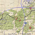
Historical map series for the area of al-Tall, Acre (1870s).jpg 748 × 752; 235 KB
-
Historical map series for the area of al-Tall, Acre (1940s).jpg 748 × 752; 245 KB
-
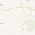
Historical map series for the area of al-Tall, Acre (modern).jpg 748 × 752; 81 KB


