Category:Airport diagrams of airports in Alabama
Jump to navigation
Jump to search
States of the United States: Alabama · Alaska · Arizona · Arkansas · California · Colorado · Connecticut · Delaware · Florida · Georgia · Hawaii · Idaho · Illinois · Indiana · Iowa · Kansas · Kentucky · Louisiana · Maine · Maryland · Massachusetts · Michigan · Minnesota · Mississippi · Missouri · Montana · Nebraska · Nevada · New Hampshire · New Jersey · New Mexico · New York · North Carolina · North Dakota · Ohio · Oklahoma · Oregon · Pennsylvania · Rhode Island · South Carolina · South Dakota · Tennessee · Texas · Utah · Vermont · Virginia · Washington · West Virginia · Wisconsin · Wyoming

Media in category "Airport diagrams of airports in Alabama"
The following 7 files are in this category, out of 7 total.
-
 Airport diagram Dothan Regio 123.pdf 806 × 1,237; 112 KB
-
 Cairns Army Airfield.png 1,570 × 2,276; 444 KB
-
 Dothan Regional Airport diagram.png 1,570 × 2,285; 330 KB
-
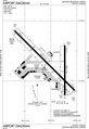
 HSV - FAA airport diagram.png 651 × 1,000; 121 KB
-
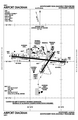 MGM - FAA airport diagram.png 651 × 1,000; 142 KB
-
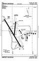
 MOB - FAA airport diagram.png 651 × 1,000; 131 KB
-
 MXF - FAA airport diagram.png 651 × 1,000; 129 KB


