Category:Aire and Calder Navigation, Normanton
Jump to navigation
Jump to search
Subcategories
This category has the following 7 subcategories, out of 7 total.
B
- Birkwood Lock (14 F)
F
- Foxholes Bridge, Altofts (3 F)
K
- King's Road Lock (17 F)
S
- Stanley Ferry Aqueduct (33 F)
W
- Woodnook Lock (11 F)
Media in category "Aire and Calder Navigation, Normanton"
The following 5 files are in this category, out of 5 total.
-
 Blot on the landscape - geograph.org.uk - 2790729.jpg 1,024 × 768; 565 KB
-
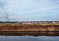 Bottom Boat and power lines - geograph.org.uk - 5701980.jpg 3,529 × 2,480; 1.63 MB
-
 Foxholes Bridge - geograph.org.uk - 3278130.jpg 4,288 × 3,216; 6.12 MB
-
 Shoe factory, Bottomboat - geograph.org.uk - 1848482.jpg 640 × 480; 261 KB
-
 St Peter’s (viewed from the Aire ^ Calder canal) - geograph.org.uk - 2272991.jpg 1,024 × 768; 712 KB


_-_geograph.org.uk_-_2272991.jpg)