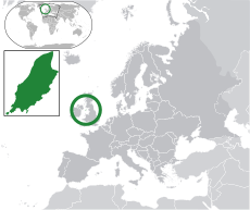
Category:Agriculture in the Isle of Man
Jump to navigation
Jump to search
Wikimedia category | |||||
| Upload media | |||||
| Instance of | |||||
|---|---|---|---|---|---|
| Category combines topics | |||||
| Isle of Man | |||||
historic nation and a self-governing British Crown dependency | |||||
| Instance of | |||||
| Part of |
| ||||
| Location | Irish Sea | ||||
| Capital | |||||
| Legislative body | |||||
| Executive body | |||||
| Official language | |||||
| Anthem | |||||
| Currency | |||||
| Head of state |
| ||||
| Head of government |
| ||||
| Inception |
| ||||
| Highest point | |||||
| Population |
| ||||
| Area |
| ||||
| Top-level Internet domain | |||||
| Different from | |||||
| official website | |||||
 | |||||
Subcategories
This category has the following 5 subcategories, out of 5 total.
F
- Fields in the Isle of Man (34 F)
Media in category "Agriculture in the Isle of Man"
The following 14 files are in this category, out of 14 total.
-
Ballig Plantation north of St.John's - geograph.org.uk - 491534.jpg 640 × 480; 114 KB
-
Farming machinery, Billown, Isle of Man - geograph.org.uk - 170863.jpg 640 × 480; 300 KB
-
In Glion Gill Plantation - geograph.org.uk - 602401.jpg 640 × 427; 131 KB
-
Manx Loaghtan Sheep, Cregneash, Isle Of Man..jpg 4,000 × 3,000; 2.89 MB
-
Pastures above Lamode - geograph.org.uk - 113197.jpg 640 × 427; 88 KB
-
The Experimental Plantation - geograph.org.uk - 37629.jpg 640 × 419; 113 KB
-
Earystane plantation, Isle of Man - geograph.org.uk - 118029.jpg 640 × 480; 63 KB
-
Gateway to the Ohio Plantation - geograph.org.uk - 475162.jpg 640 × 480; 144 KB
-
Kerroodhoo plantation - geograph.org.uk - 117385.jpg 640 × 480; 85 KB
-
Stoney Mountain - geograph.org.uk - 106097.jpg 640 × 363; 106 KB
-
Stoney Mountain Plantation - geograph.org.uk - 122423.jpg 640 × 480; 89 KB
-
The Mount and Chibbanagh Plantation - geograph.org.uk - 42860.jpg 640 × 480; 90 KB
-
Thurot Cottage Isle of Man. - geograph.org.uk - 33930.jpg 640 × 480; 165 KB


